

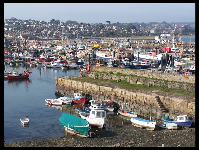
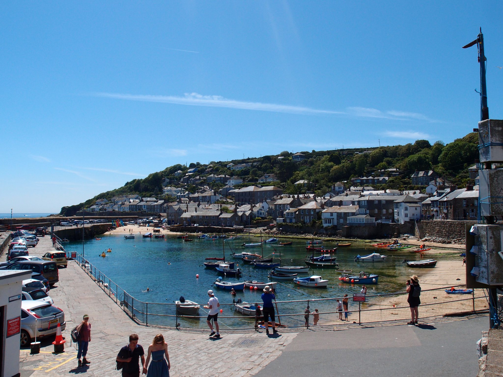
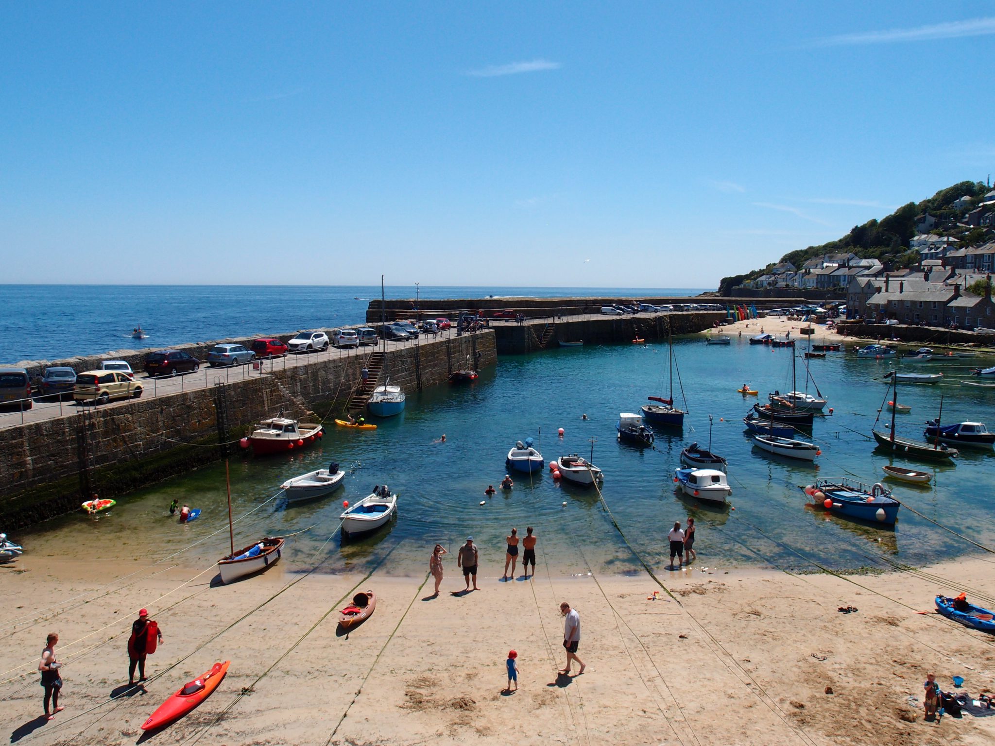
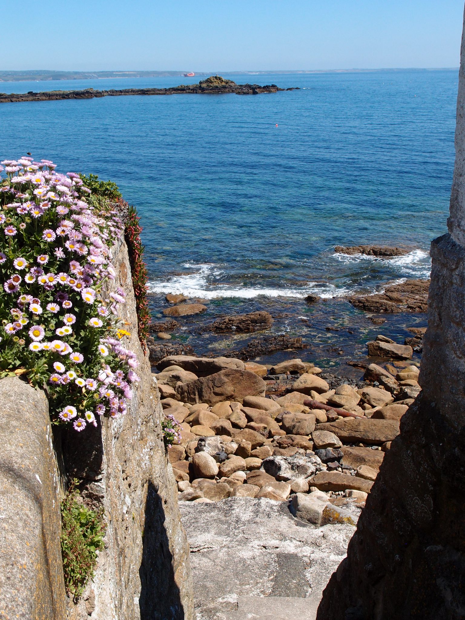
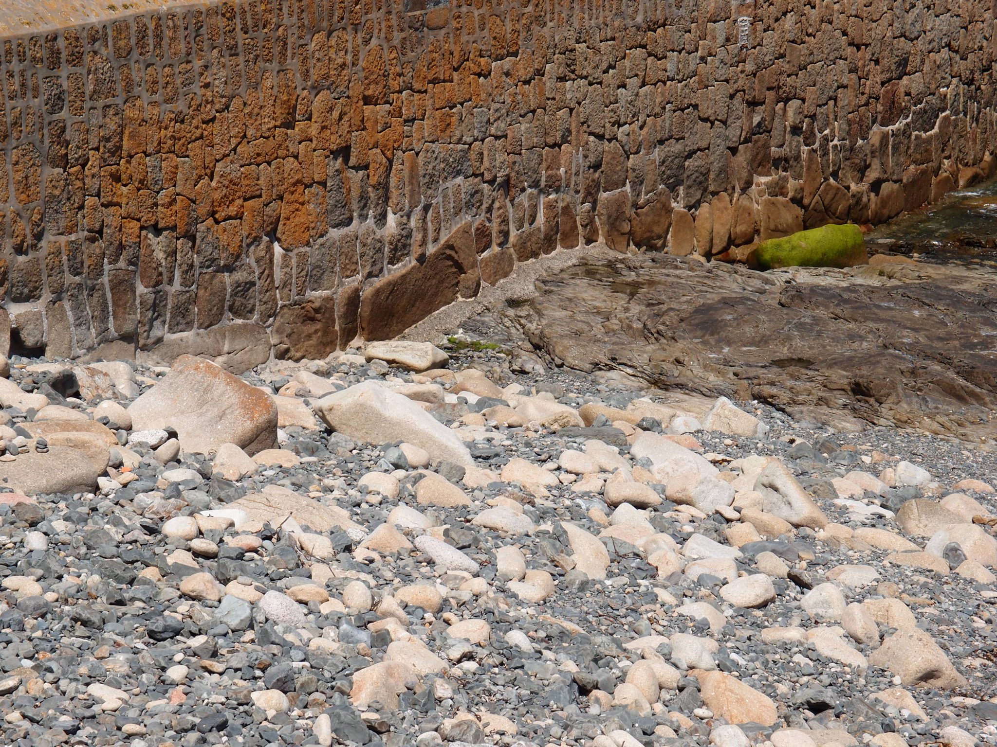
The Sheltered Harbor at Mousehole
(pronounced “MOW-zul.”) opens onto Mount’s Bay, and is just three miles south of Penzance. Mousehole, which Dylan Thomas described as “the loveliest village in England,” has existed since at least 1266 (when it was listed as a major fishing port). Two granite quays—the North Quay, dating from the 17th century, and the South Quay, from the 19th—protect the working harbor, where boats unload their catches of fish and shellfish. In this photo, the
opening in the Harbor Wall reveals St. Michael’s Mount, in the distance.
Autumn 2018
Journeys towards Cornwall are not usually entertaining.
When traveling by car from almost anywhere else in England, the drive will likely be tedious, and delay-prone: Britain’s motorways are becoming overwhelmed by ever-increasing volumes of passenger cars, white van men, lorries, coaches, and caravans. Or, assuming that England’s various rail operators aren’t indulging in yet another of their service slowdowns or stoppages, when setting out from London via train, one must expect the ride to be slow, and apt to run behind schedule. The remoteness of Cornwall demands patience of the traveler; but Cornwall then rewards such patience with experiences and sights so varied and so beautiful that even the most optimistic traveler’s expectations will be exceeded.
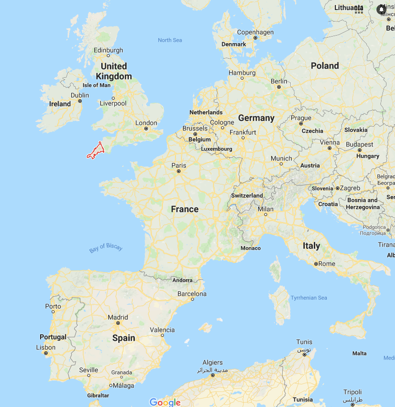
Cornwall — outlined in Red — in relation to Europe.
The County of Cornwall is outlined in Red. The River Tamar separates Cornwall from Devon, which is directly to the east. The English Channel is south of Cornwall, and the Celtic Sea is west and north of Cornwall.
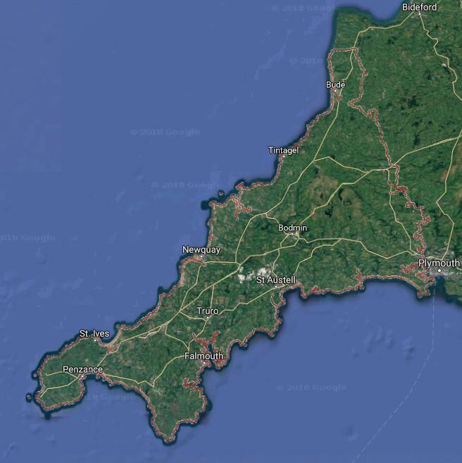
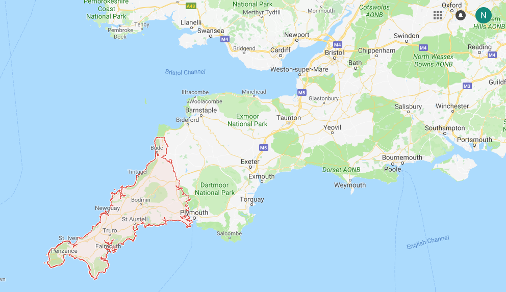
Satellite View of Cornwall. Penzance, Cornwall’s western-most town, is 250 miles from central London.
I globe-trot: nimbly, and alertly. In crowded places, I fasten my purse strap across my body, and keep my single piece of luggage close … and I never fixate upon a computer screen or an iPhone when surrounded by humanity. Instead, if I must cool my heels as I endure long hours en route, I clear my brain, and settle into quiet observation of my surroundings. Time after time, when I’ve created this serene-eye-of-hurricane-space for myself, interesting people then cross my path.
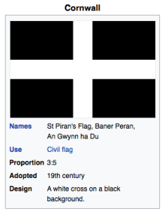
Saint Piran’s Flag is the flag of Cornwall. Image courtesy of Wikipedia.
My most recent visit to England’s southwestern peninsula began in the most propitious way. On a Friday, in late-morning, in mid-June, I’d arrived at London’s Paddington Station ( early, of course, as is my habit ) where I planned to board the Great Western Railway’s Noontime train, bound for Cornwall’s end-of-the-line town of Penzance ( on a good day, this journey, without glitches, will consume more than 5 hours).
Coat-of-arms of the Great Western Railway
As seems always to be the case at the start of a summer weekend, much of London—residents and tourists alike—had felt compelled to flee the city, and Paddington was a madhouse. I found myself a seat, and settled in for an hour-long wait. A bench-spot next to mine opened up, and a handsome, silver-haired man — who was wearing a rumpled-linen suit of an improbable turquoise hue, and a crisply-starched blue and white striped shirt — plopped down next to me.
On a leash: his gorgeous golden retriever.
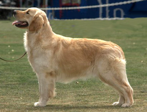
Without preamble, the man turned to me and asked: “Do you mind if my dog sits her bum on your feet? It makes her feel more secure to do that.” Since the dog was very well-behaved, I hesitated for only a split second: “OK.” Understanding me, Fido immediately settled her warm hindquarters down onto my boots (which actually made ME feel more secure, too), as she gazed up into her master’s eyes. The man explained further: “If she can see my face, everything will be fine.” Turned out the gentleman’s an architect, and so we had plenty of design-world-fads-and-follies to discuss as we killed time, before we boarded the same train, to Penzance. But the architect and his retriever were only the first of my several travel-entertainments, that day.

The Friday-train to Penzance was overflowing: standing room only.
Happily, I’d made a seat reservation, months beforehand (always secure your seat in advance, if you’re planning long-distance rail travel, in England). Because I like to avoid being held hostage
by a chatty seat-mate, I’d booked a free-standing seat, in the First Class carriage. From this private perch I could tune out—or eavesdrop upon—the conversations of those around me. The murmurings of overlapping voices, combined with the clacking of train wheels over metal rails became white-noise, and soothing, and I relaxed into something close to sleep.
A couple of hours into the journey, fatigue had been repaired, and my awareness of my fellow travelers sharpened. Opposite me, a couple from London were quietly reviewing their agenda for the next week, their sentences morphing seamlessly from English into German and back again into English: they were on their way to the Isles of Scilly, where they’d scuba dive and do underwater photography. Behind me, a young man with the refined erudition of an Oxfordian was expounding at length to an elegant lady about his thankless job as a tutor to the “brat son” of a Russian oligarch. Ahead of me, a gentleman farmer began to lecture everyone within earshot about the finer points of dog-breeding. The train’s sole conductor, passing by to do a much-delayed ticket-scan, stopped, enthusiastically whipped out an iPhone, and showed multiple pictures of the litter that HIS prize female had just birthed. Diagonally across the aisle, an exuberant American couple from Florida who were speculating about their soon-to-be-first-time stay in a Cornish village, paused, and, with double yelps presented THEIR phones to the conductor and the farmer: all of these folks owned the same breed of dog. Much hilarious (to dog owners) canine talk ensued. By this time, the train was crossing the River Tamar, and passing from Devon into Cornwall.
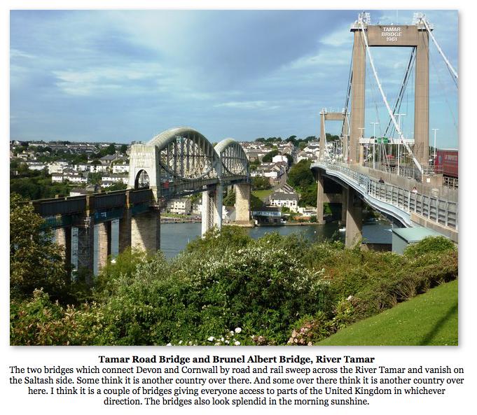
Image & Caption courtesy of Tom Jolliffe
Several miles down the track, the train lurched to a stop: the conductor forgot all about dogs, and then rushed forward, to consult with his engineer. Our train idled, and then idled some more: we had reached Cornwall, but were only in its Eastern-most parts. Penzance was still nearly 2 hours away.
A crackly-announcement came over the train’s speakers: Ahead of us, a car had driven into one of the supports of a train bridge…we’d have to remain where we were, until Great Western personnel
could be certain of the bridge’s structural integrity. People grumbled a bit, and then a sour silence descended.
His iPad muted, the posh Oxfordian had been watching the 2018 World Cup Playoffs. Either dispirited or bored by the soccer, he began humming, and then to sing, but very quietly. The German-English Londoner swallowed a mouthful of sushi that his wife had been feeding him, and, looking across at the Oxfordian, also began to sing, making a harmony with the young man. These strangers
( who I later learned partake regularly in the Cornish tradition of spontaneous pub-singing ) — both of them having been blessed with beautiful vocal chords — then sang, in the most offhand but accomplished way, a ditty which has become a Cornish anthem (lyrics follow) :
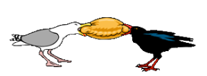
A seagull and a chough play tug-of-war with a Cornish Pasty. Image courtesy of Stamp-and-Go
CORNWALL MY HOME
I’ve stood on Cape Cornwall in the sun’s evening glow,
On Chywoone Hill at Newlyn to watch the fishing fleets go,
Watched the sheave wheels at Geevor as they spun around
And heard the men singing as they go underground.
And no one will ever move me from this land
Until the Lord calls me to sit at his hand.
For this is my Eden, and I’m not alone.
For this is my Cornwall and this is my home.
I’ve left childish footsteps in the soft Sennen sand,
I’ve chased the maids there, all giggly and tanned.
I’ve stood on the cliff top in a westerly blow
And heard the wave thunder on the rocks far below.
First thing in the morning, on Chapel Carn Brea
And gaze at the Scillies in the blue far away.
For this is my Cornwall, and I’ll tell you why
Because I was born here and here I shall die.
By Harry Glasson (singer/songwriter: born in Cornwall, in 1951)
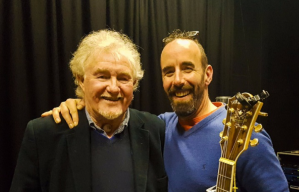
Songwriter Harry Glasson, with
Singer Will Keating. Image courtesy of Will Keating
Their duet finished, each man nodded at the other, and, respectively, soccer-watching and sushi-eating were resumed.This song had charmed me, and everyone in our carriage; our delay
was forgotten. Then, with nearly poetically-perfect timing, the train soon grunted, and came back to life, and began to move in its proper direction; no serious damage had been done to the railway’s bridge, and so we could proceed, on towards Penzance.
More and more, as I toddle around in the World, I’m convinced that Serendipity is Real, and that Truth is Stranger Than Fiction. Cornwall has always considered itself a Place Apart from
England, and the oddities of my journey that day—as I left London and headed toward Cornwall —had made it very clear to me that I was transitioning from one World into Another.
And so now I begin for you a multi-chapter, region-by-region guide to those places along the Cornish coastline which have most enchanted me.
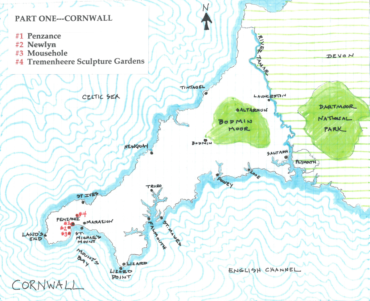
The Destinations in Part One of our Tour
PENZANCE
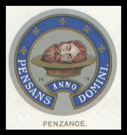
The Mayoral Seal of Penzance
Until the 1930s, the severed head of St. John the Baptist was the chosen symbol of Penzance. Not at all macabre, or even particularly religious, this Symbol reflects typically Cornish wit. Over 1000 years ago, a chapel was said to have stood on the hill which overlooks Penzance Harbor. In the Cornish language, “Pennsans,” means “Holy Headland.” And thus the holiest head of them all, belonging to the unfortunate St.John, became the Town’s emblem.
What’s not to love? Cornwall wears its peculiarities proudly.
At Penzance my recent train journey ended, and therefore this is where our Cornwall explorations must begin.
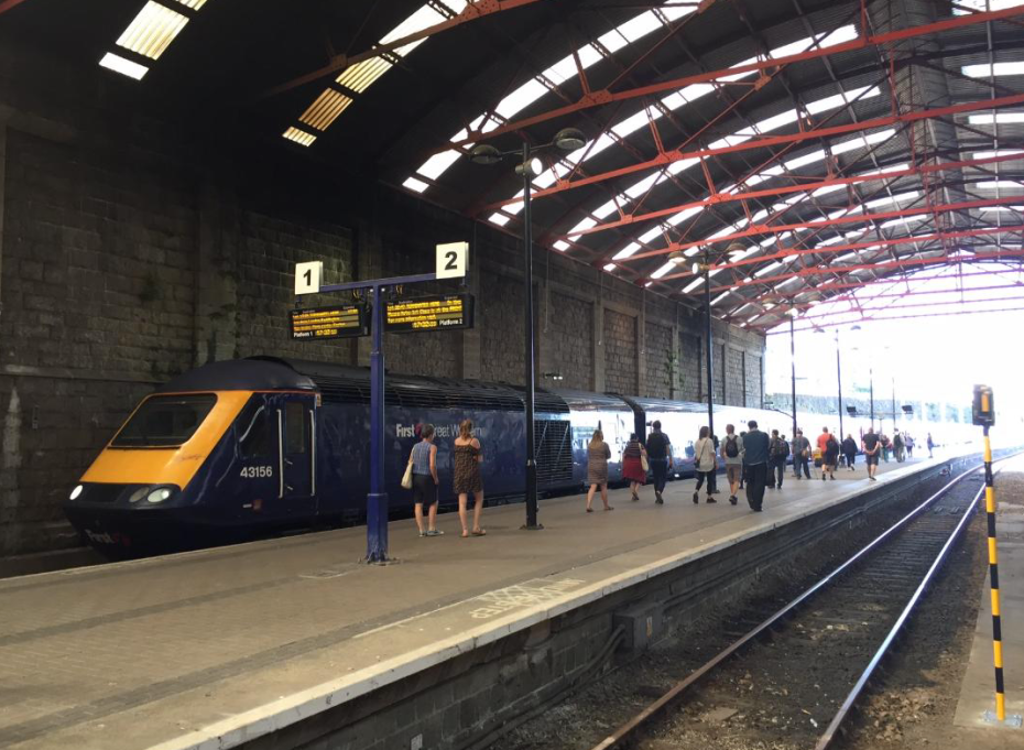
This is my train, just arrived in Penzance, where my dear friends Anne & David Guy awaited me. Over the course of two extended, summertime stays, the Guys led me to all of the places which we’ll discover, in my Cornwall Diaries; were it not for their natives’ knowledge of the area, I would have missed many Cornish Treasures. I take full blame, however, for ALL observations, opinions, and syntheses, contained herein.
Photo courtesy of Anne Guy
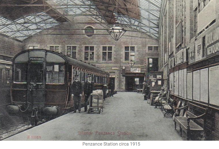
Apart from the rolling stock and conductors’ uniforms, not much at the Train Station (which was built in 1879) has changed since this photo was taken in 1915.
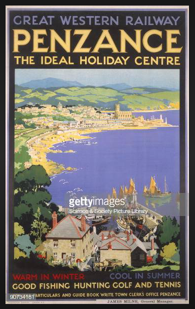
During the 1930s, in what has since been declared to be the Golden Age of British Railway Posters, each of England’s four largest regional rail companies developed a distinct, graphic style for their advertisements. The work of the Great Western Railway’s artists, who publicized destinations in Cornwall and Devon, was refined and seductive: what holiday-maker would NOT wish to be spirited away to places such as those illustrated on GWR’s Posters … into (as Hopkins & Cole have described, in their History of the Railway Poster in Britain) “a world of sunshine, sandy beaches, and endless fun!”
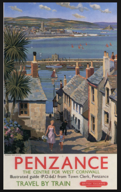
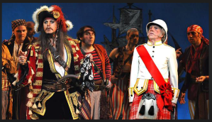
But long before the advertising department of the Great Western Railway had begun to paint their rosy pictures of the Cornish coast, the notion of Penzance as a merry place had already become well-established in the popular imagination. In 1879, when W.S.Gilbert & Arthur Sullivan — those Mad-Geniuses of Operetta — first presented “The Pirates of Penzance,” the name of this remote town in Cornwall instantly became well-known, across the World. It’s no stretch to say that, in the 139 years since the debut of this musical confection, during every single month, on yet another stage, somewhere upon Earth, a baritone has belted out “I am the very model of a modern Major-General.” “Pirates” has always been one of G&S’s most crowd-pleasing creations, and, so, in our familiarity with the name “Penzance,” it has been easy for us to imagine that the fantasyland concocted by Gilbert & Sullivan bears some resemblance to the actual Town.
Penzance, as envisioned by Gilbert & Sullivan
I’ll get right to it. Accurate reporting demands this caution: of all the places you’ll visit in my multi-part survey of Cornwall, Penzance will be far and away the least charming, at least upon first glance.
Much like Hastings or Brighton — other end-of-the-train-line seaside towns in England — Penzance, with its melange of fine but often ill-tended Regency and Victorian era buildings, and unfortunate 20th century “improvements,” has the forlorn air of past prosperity and faded glory. The Town is much in need of some sensitive, 21st century rejuvenation.
As described in Historic Cornwall’s survey:
“Penzance lies in the Penwith District, in the extreme west of Cornwall, 10 miles from Land’s End. It is the most south-westerly town not only of Cornwall, but of Britain as a whole. It sits on the north-west shore of the spectacular sweep of Mount’s Bay. With the most temperate climate in Britain, the town is particularly noted for its sub-tropical trees and plants. Penzance is a port, rail and coach route terminus. Sea links with the Isles Of Scilly operate from Penzance harbor and air routes from the nearby Land’s End airport.” [Note: A new Heliport is currently being built, near to the Penzance Train Station.] “The harbor is the most westerly major port in the English Channel, the first reached from the Atlantic, and the principal commercial port west of Falmouth. These connections give Penzance a strategic importance that outweighs its remote location.”
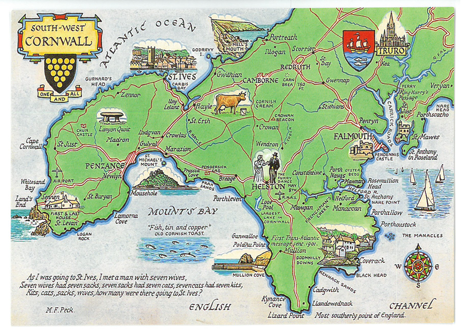
My favorite Postcard Map of South-West Cornwall
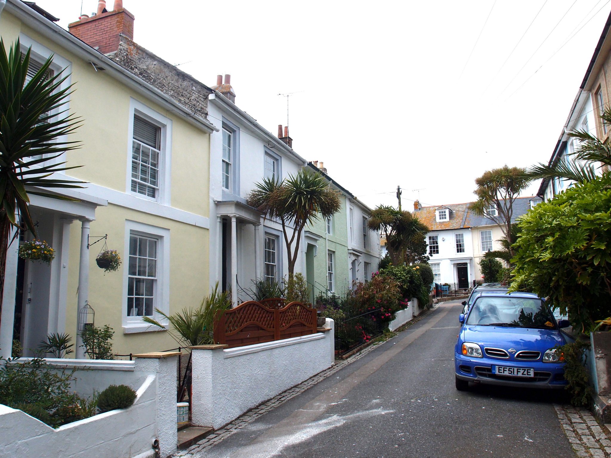
And so, although Penzance does not possess the same loveliness as that which draws visitors to her sister towns of Mousehole and Marazion, Penzance is nevertheless an historically significant and worthwhile and USEFUL place: its population of over 21,000 souls allows the businesses ( the likes of which are often harder to find in Cornwall’s less populated and more picturesque regions ) which provide Life’s Necessities, to prosper.
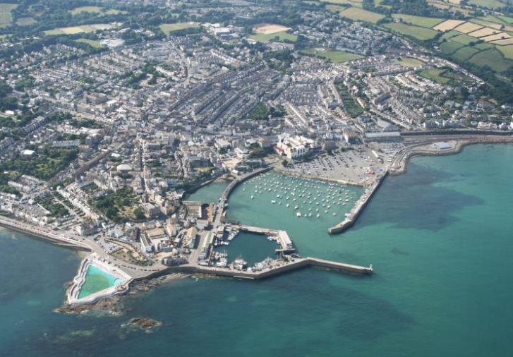
Aerial view of Penzance
We can stock up on the essentials at Sainsbury’s, an enormous and first-rate grocery store; they’ve also got a terrace Café, serving up coffee AND beautiful views of the English Channel (which is just beyond the not-so-lovely A30 road).
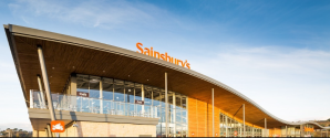
Sainsbury’s, in Penzance. Image courtesy of Norclad.
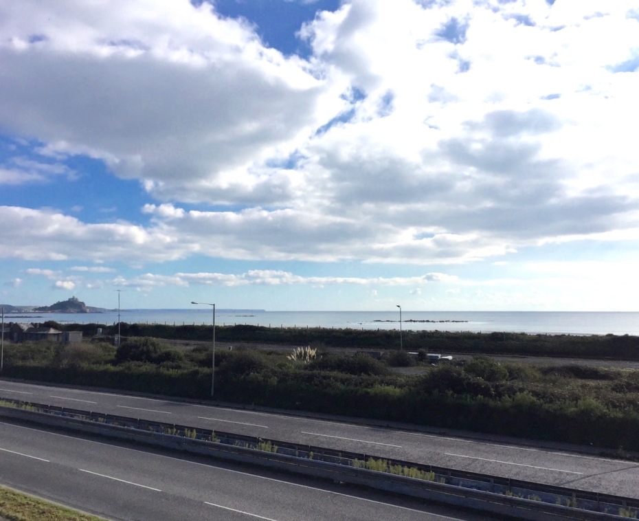
From the 2nd floor Café at Sainsburys: our view across the lanes of the A30, toward St.Michael’s Mount, in Mount’s Bay.
Image courtesy of Anne Guy.
We can shop for high-quality, made-in-Cornwall clothing and soft goods, which are sold at Seasalt’s flagship store, at 1-3 Adelaide Street.
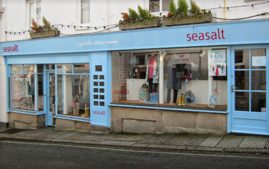
www.seasaltcornwall.co.uk
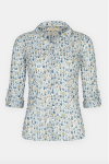
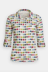
Seasalt was established in 1981 by Don Chadwick, whose studio designs all of their products. I’m addicted to their blouses: each season, unique new prints are introduced to adorn the 100% cotton fabric, which is meant to be twisted and dried after washing…perfect clothing for a Traveling Lady. These are just some of the blouses I’ve collected:


We can browse Barton Books’ impeccably-curated shelves,at 45 Causewayhead.
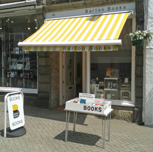
www.bartonbooks.co.uk
And in just a few hours of wandering through the Town Centre, we can view a bricks-and-mortar stylebook of architectural fashions from the past 200 years. Unlike many other regions in England, where centuries-old structures are commonplace, most of the buildings we now see in Penzance are relatively new, and date from the early 1800s, and onward into the present day.
Although archaeologists know that humans have been knocking about in Penzance since the Bronze Age, the first documented mention of “Pennsans” is dated 1284. By the early 1300s, market days were being held in the area, and tax collection records indicate that by 1322 Penzance was considered to be a Town. With the granting of its Royal Market status in 1404, Penzance began an extended period of relative prosperity, which continued for five centuries, despite the area being regularly sacked by various, seafaring aggressors. During the Middle Ages, Barbary Pirates made frequent raids. In 1595, four Spanish galleons landed, sacked Penzance and the surrounding villages (including Mousehole), and then set fires, which reduced nearly all of the area’s structures to ash. Such are the perils of being situated upon England’s southwestern-most peninsula…the first port of call, for belligerent and avaricious sailors.

A Spanish Galleon. Or, as Alfred, Lord Tennyson wrote, in his tale of the ship REVENGE: better to
“Fall into the hands of God, not into the hands of Spain.”
We’ll take a fast stroll now, along some of the Town Centre’s more interesting streets ( most of which are within the earliest-settled areas of Penzance, indicated by the Purple zone, on the following map).
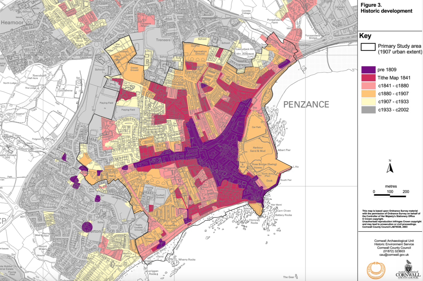
Map of the Historic Development of Penzance. Image courtesy of Historic Cornwall
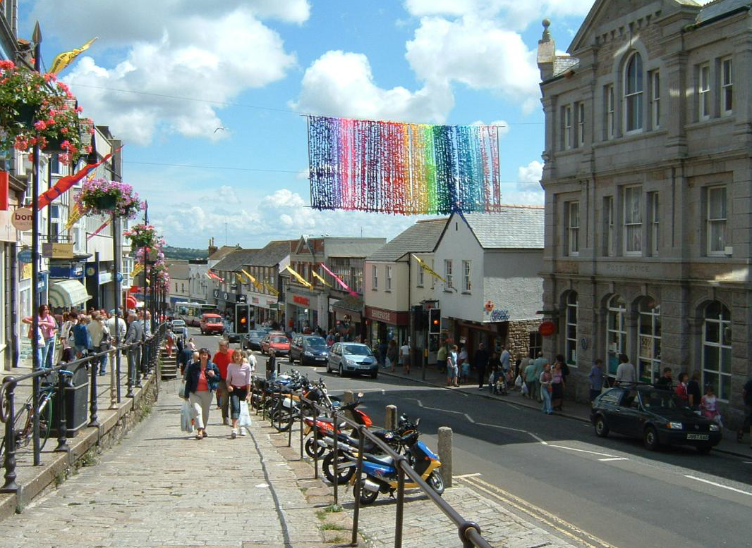
Market Jew Street, during Golowan (the Feast of St.John and a Pagan celebration of midsummer). We’re half way up the Street, which rises with the hill. We pause, turn around, and then look back, in the direction of the Harbor. Image courtesy of Anne Guy
On Market Jew Street we find what has always been Penzance’s main shopping district. Wikipedia’s summary of this thoroughfare explains its name:
“The name ‘Market Jew’ comes from the Cornish language’s
‘Marghas Yow,’ meaning ‘Thursday Market,’ the name of a nearby village now absorbed into Marazion,” towards which Market Jew Street points.
[Note: In Part Two of my Cornwall guide we’ll visit Marazion, the location of St.Michael’s Mount.]
These days, Market Jew Street isn’t particularly distinguished by its vendors. Rather, The Terrace — with its flights of stairs, and dual-level granite walkways which run along the entire length of the steeply-sloping northwestern side of the Street — is the Street’s defining feature. The Victorians built this odd but functional streetscape—which is essentially an extended Stage–when they transformed what had been a narrow, muddy and sewage-tainted lane into a hygienic place for the townsfolk to do some serious promenading.
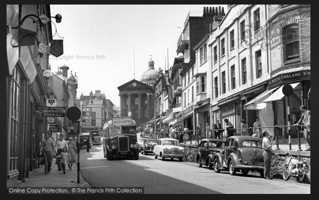
Market Jew Street in 1953. Image courtesy of Francis Firth.
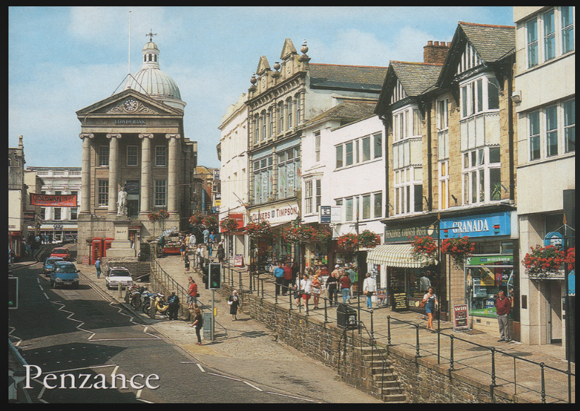
Market Jew Street in 1990. Courtesy of Historic Cornwall.
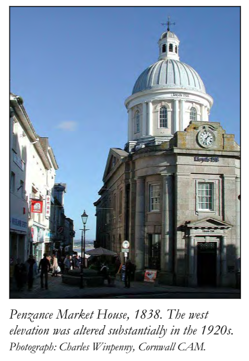
At the top of Market Jew Street is the Market House: Penzance’s little temple of Commerce, which was built in 1838. Until the early 1600s, twice-weekly market days in Penzance had been open-air events. In 1614, James I made Penzance a charter town, and the town fathers, proud of this improved status, saw fit to design a permanent structure to accommodate the Tuesday and Thursday Markets. Considering what additional uses might be made of their new building, the town fathers also added prison cells (which soon became notorious) to the design programme. That building lasted for over two centuries, until it was replaced by the current edifice (which is now a branch of Lloyds Bank).
The West side of the Market House, on Market Place. Image courtesy of Historic Cornwall.
Behind Market Place, we turn left, and connect with Chapel Street ( Penzance Centre’s other, major roadway ) : we’ll follow this route as we continue our gradual ascent through the hilly Town, toward St.Mary’s Church, which is at the top-most point on Chapel Street. Along Chapel Street we’ll pass many of the Town’s most significant buildings, which were constructed between 1750 and 1850. During this 100-year stretch, Chapel Street became the focus of what the folks at Historic Cornwall have described as “Penzance’s First Age of Elegance, when the cultural, leisure and religious life of the Town….of polite society and the luxury trades,” began to flourish. Historic Cornwall further explains: “Penzance was an important naval, postal and victualling station during the long French wars of 1793-1815. As with many other south coast ports, the effective closure of Europe to travellers during this period also stimulated a nascent tourist industry. The mildness of the air, the agreeableness of its inhabitants rendered Penzance particularly inviting to residence.”
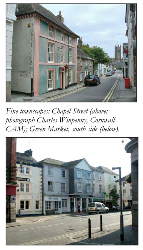
Penzance Streetscapes. Image courtesy of Historic Cornwall
My view up Chapel Street, toward the tower of St.Mary’s Chuch
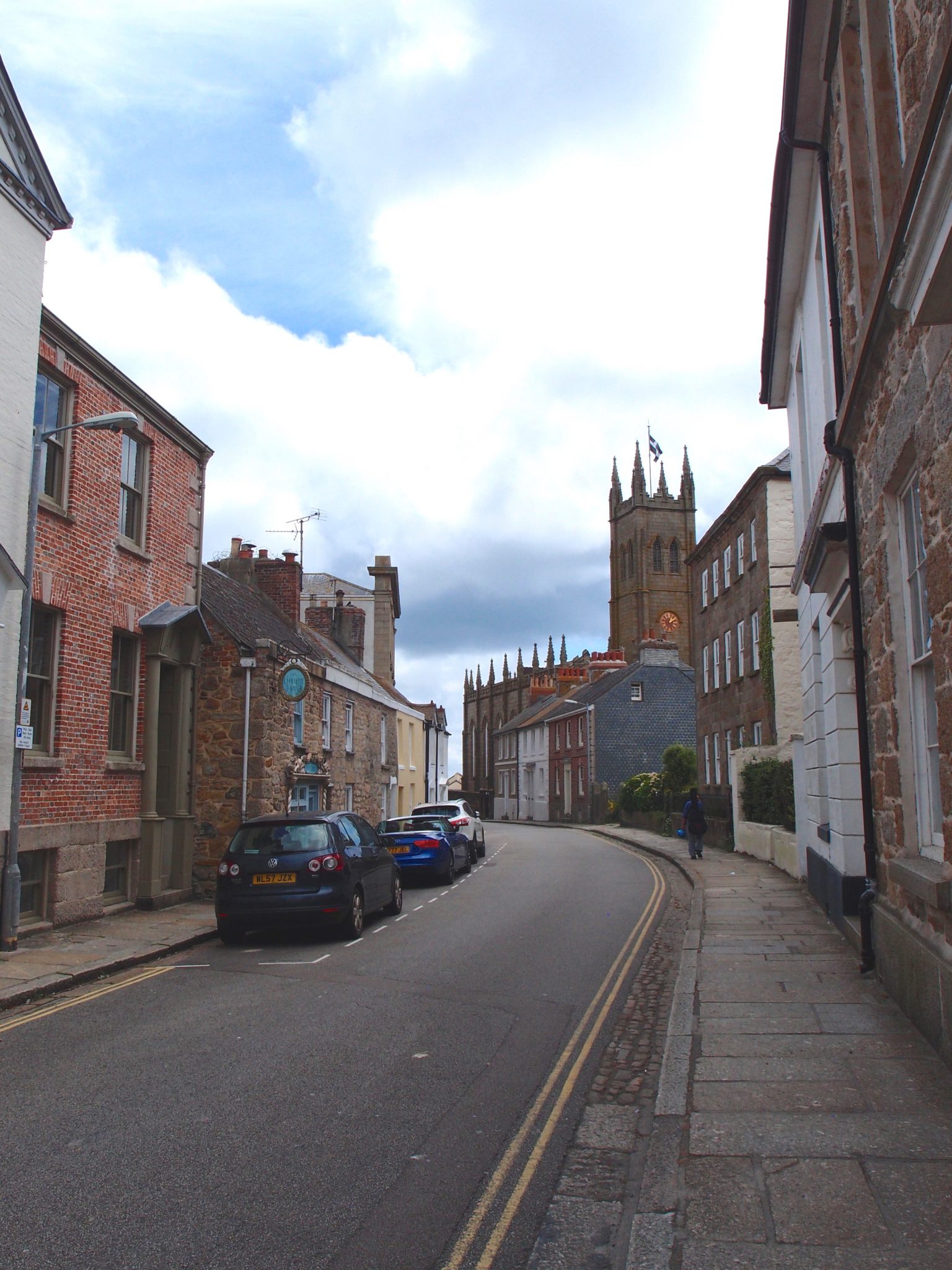
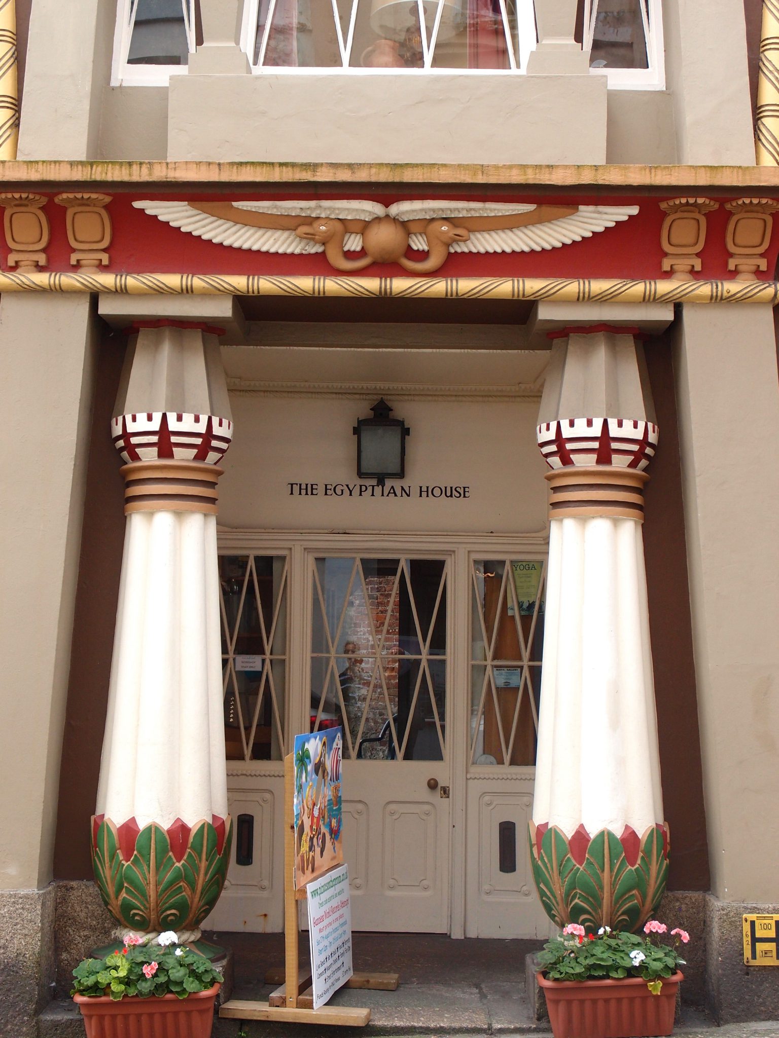
The most eye-catching sight on Chapel Street is The Egyptian House.
The Egyptian House, on Chapel Street
The Landmark Trust acquired The Egyptian House in 1973 and they describe this treasure as “a rare and noble survivor of a style that enjoyed a vogue after Napoleon’s campaign in Egypt in 1798.”
But the exotic appeal of the Egyptian House is only skin deep. In 1800 the building was an unremarkable town house. In 1835, the antiquarian John Lavin purchased the property, and instructed his architect to renovate the façade in an ersatz-Egyptian style, by applying Coade stone, which was then painted in vivid colors. Local reactions to Lavin’s newly-gussied-up street-face weren’t positive: “astonishingly gaudy” seems to have been the most positive verdict.
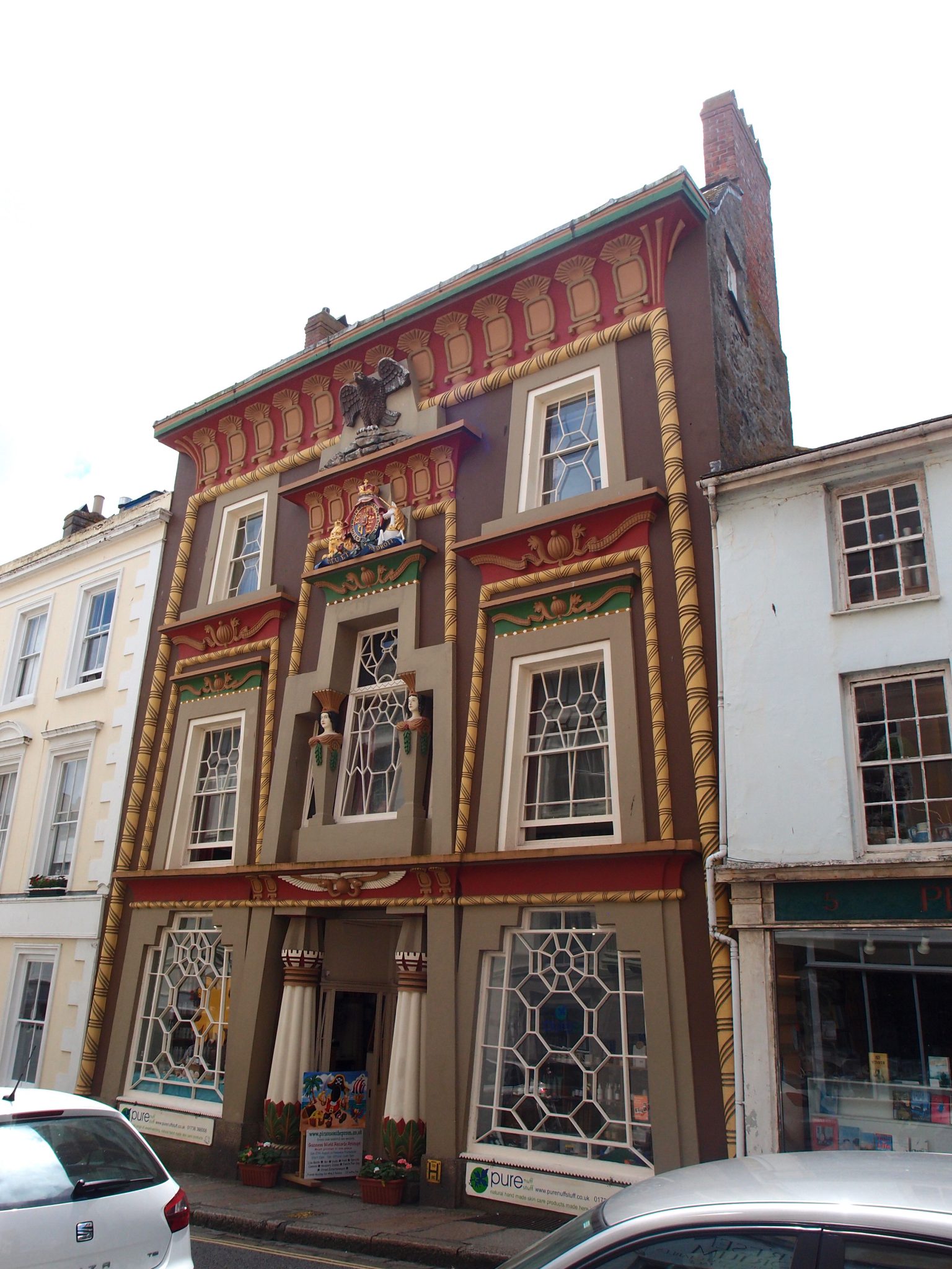
Rooms (which — Alas — look perfectly ordinary) in Penzance’s Egyptian House are available as self-catering, holiday rentals, through the Landmark Trust.
www.landmarktrust.org.uk
Interior of the 1st floor, of The Egyptian House. Image courtesy of The Landmark Trust
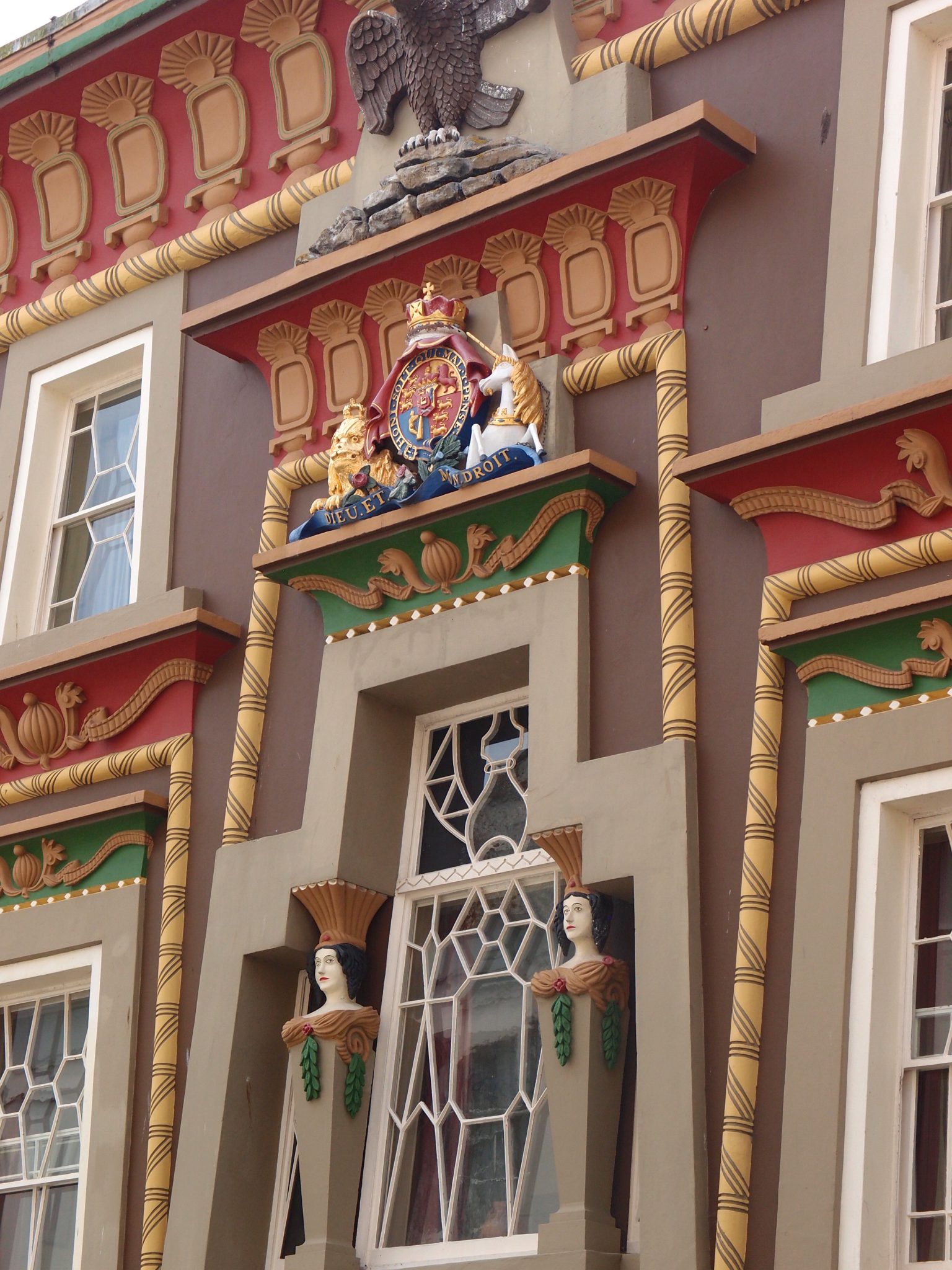
The Egyptian House. Detail of the Fabulous Chapel Street Facade
The Egyptian House. Detail of Coade stone façade. The recipe for Coade stone was developed in the late 18th century. This artificial stone is easily moulded into intricate shapes, is thus particularly suited for making sculptural pieces and architectural decorations, and is tough and nearly impervious to weather.
And still further up Chapel Street we find the Admiral Benbow Pub and Inn, which dates from the 17th century.
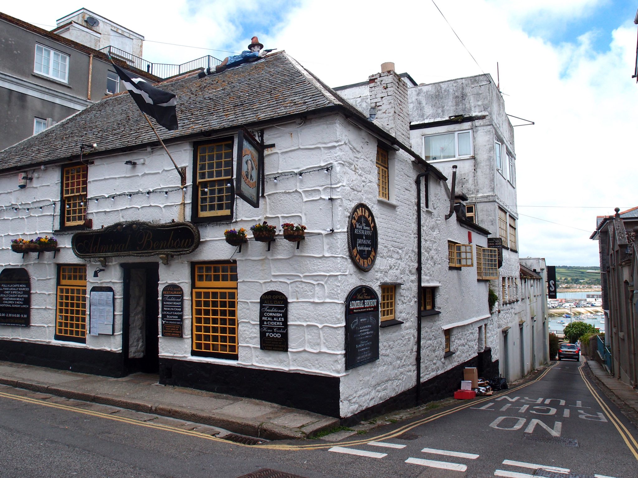
The Admiral Benbow, on Chapel Street
In TREASURE ISLAND, Robert Louis Stevenson’s tale of “buccaneers and buried gold,” the author used the Admiral Benbow as the fictional home of his hero, Jim Hawkins. On the roof, the present owners of the Pub have mounted a figure of smuggler Octavius Lanyon, the ringleader of the Benbow Brandy Men. During the “Golden Age of Smuggling,“ from 1750 until 1830, Cornwall’s impoverished fishermen and laborers turned to smuggling to survive, when the tax burden upon ordinary citizens—levied on a vast range of everyday goods and imposed by a far-away central government to fund foreign wars—became enormous and untenable.
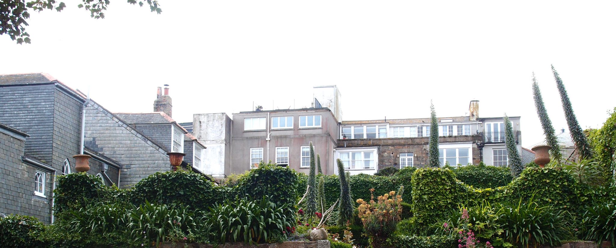
As we draw closer to the end of Chapel Street, we pass Abbey Street, which is worth a little detour. This area, on a bluff overlooking what was Penzance’s original Harbor, is the most long-established section of Town.
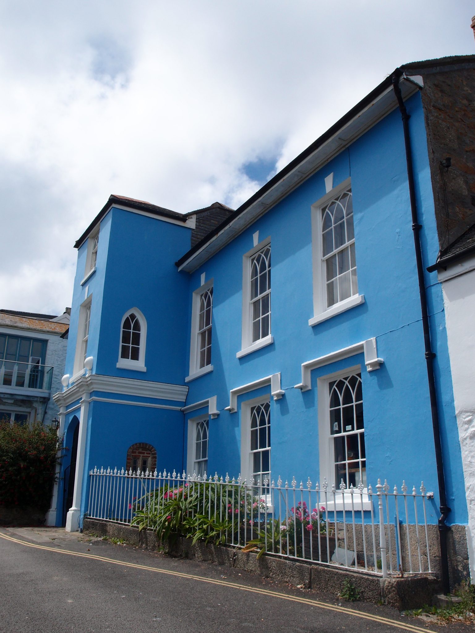
Abbey House, on Abbey Street, overlooking Penzance’s Quay. Until 2016, this was Jean Shrimpton’s Abbey Hotel.
For more than 30 years, Jean Shrimpton, the world’s first supermodel, owned and operated The Abbey Hotel with her husband, Michael Cox. In 2016 they retired, and their son now manages the site as a self-catering holiday rental, which is suitable for groups of up to 14 guests.
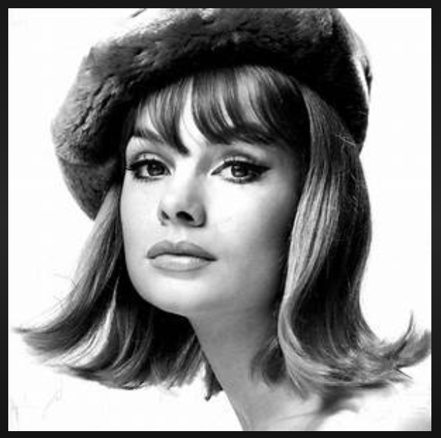
Jean Shrimpton in the 1960s, before she turned her back upon Fame.
In her early 30s, Shrimpton, weary after many years of being one of the World’s most photographed models, first moved from London to southwest Cornwall…to nearby Marazion, where she ran an antiques shop. Soon thereafter, she bought Abbey House, which she completely renovated and then glammed-up into an award-winning Hotel.
My glimpse of the private garden, behind the former Abbey Hotel. The foundations and cellars of the main building date from 1660. In the 1820s the original house was remodeled in the Georgian/Gothic style, which has survived to the present day.
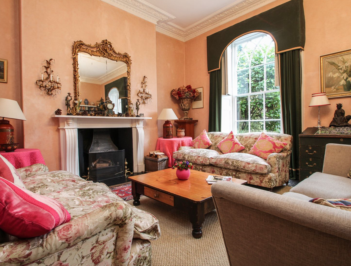
Interior décor at The Abbey was done
by Jean Shrimpton. The Abbey, Self-Catering Holiday Mansion.
7 bedrooms, 6 bathrooms. Property # 918888, available through
www.sykescottages.co.uk

View from New Street (which is just below the former Abbey Hotel) of the Quay.
Chapel Street ends, appropriately, at St.Mary’s: the Mother Church of Penzance. St.Mary’s is situated atop a hill; upon the same “Holy Headland,” with its commanding views across the Bay, where the ancient chapel which inspired the naming of the Town originally stood. The tower of St.Mary’s is Penzance’s dominant landmark, both for townspeople, and for sailors on Mount’s Bay.
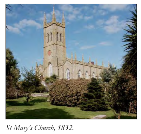
St.Mary’s Church. Image courtesy of Historic Cornwall
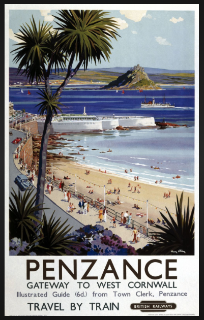
Our final waterside destination in Central Penzance is the Art-Deco era, Jubilee Pool, at the Battery Rocks. If you refer to the second Great Western Railway Poster which appears earlier in this Diary, you’ll see that it features an enormous, glisteningly-white, triangular pool, which extends into Mount’s Bay. GWR’s artists didn’t have to idealize the View: in its heyday, the Jubilee Pool, an open-to-the-elements Lido, was an artistic and engineering Marvel, and a Great Crowd-Puller.
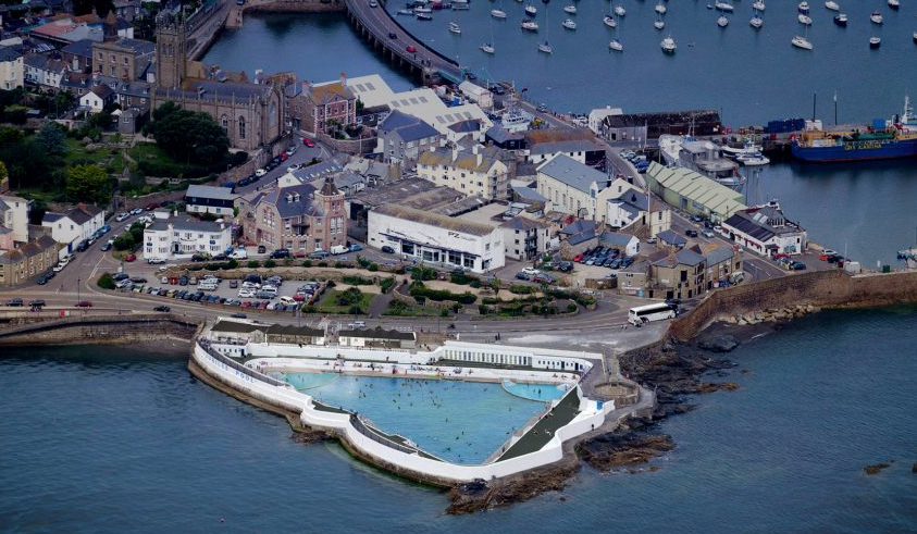
Aerial view of Jubilee Pool, with St.Mary’s Church in the upper left hand portion of the photo. Image courtesy of the Jubilee Pool.
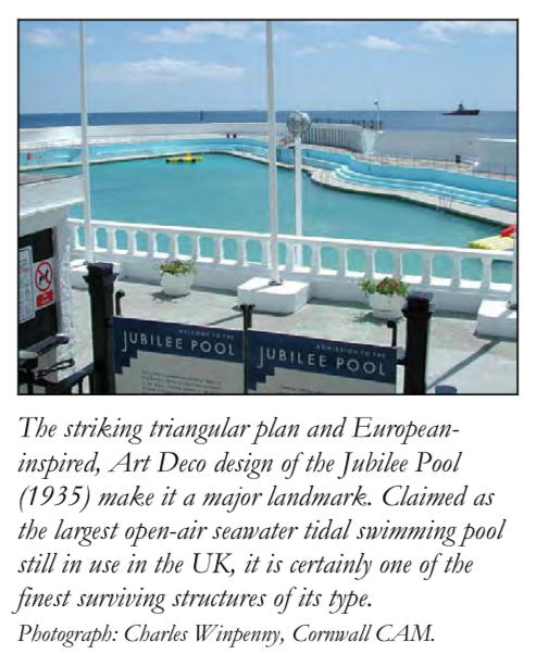
A closer look at the Jubilee Pool.
Image courtesy of Historic Cornwall
Perched between land and sea, the Lido has inevitably been battered by Winter storms, the worst of which came in 2014, when the very underpinnings of the structure were nearly destroyed.
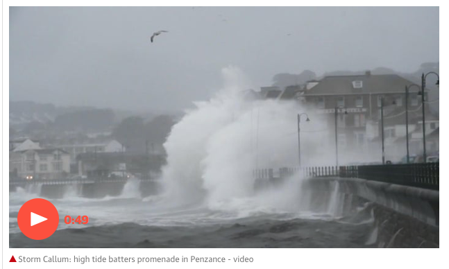
Here’s another illustration of just how vulnerable Penzance’s waterfront is to Mother Nature’s Fury. An Autumn Storm batters the Promenade (which is adjacent to the Lido) in Penzance,
on 13 October 2018.
Photo courtesy of the GUARDIAN.
A nationally-funded campaign allowed for total restoration of 2014’s storm damage, and currently the managers of the Lido report that:
“ work is underway to drill a geothermal well which will provide enough renewable energy to heat a section of the water to 35 degrees C. This will mean that, for the first time, the Pool will
have heated water, transforming it into an all-year-round attraction, which we hope to open in May of 2019.”
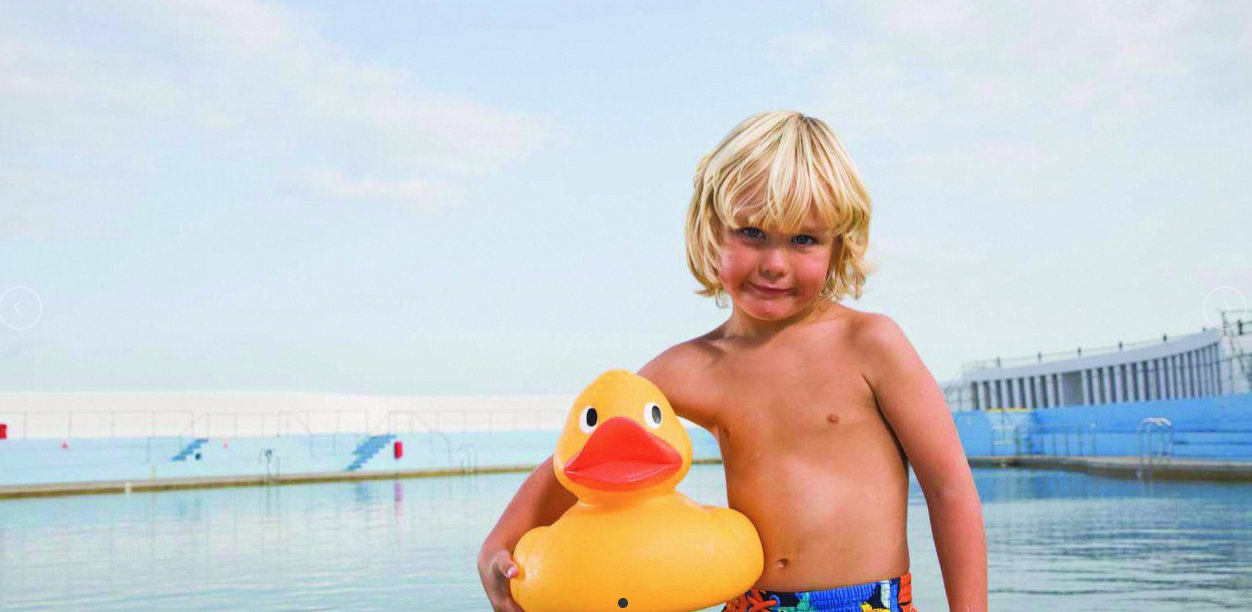
The Future, at the Jubilee Pool. Image courtesy of the Jubilee Pool.
As we wrap up our Penzance-stroll, we’ll head inland, toward Penlee Park. In the early years of the Victorian Age, the fields that lay to the west of Chapel Street provided much-needed expansion space for the Town. Terrace housing to accommodate the growing population of middle-class workers sprang up, and, today, most of those buildings are still residences.
Stuccoed Terraces, and Front Gardens Aplenty, in the Morrab Gardens neighborhood
The Morrab Gardens neighborhood: Pedestrian Friendly, but Parking Hell.
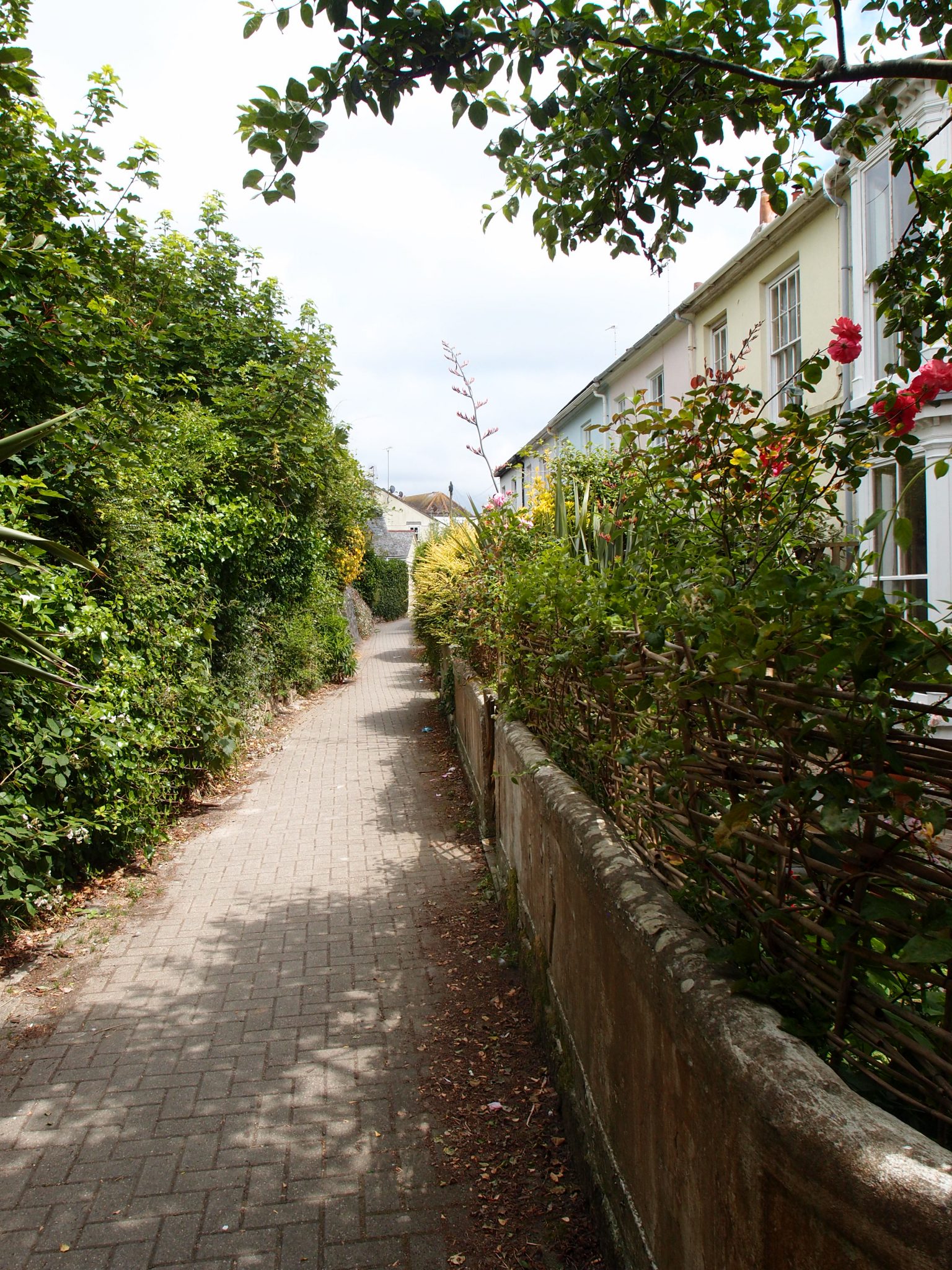
Approaching Penlee Park along a pedestrian lane, with lush greenery cascading over boundary walls.
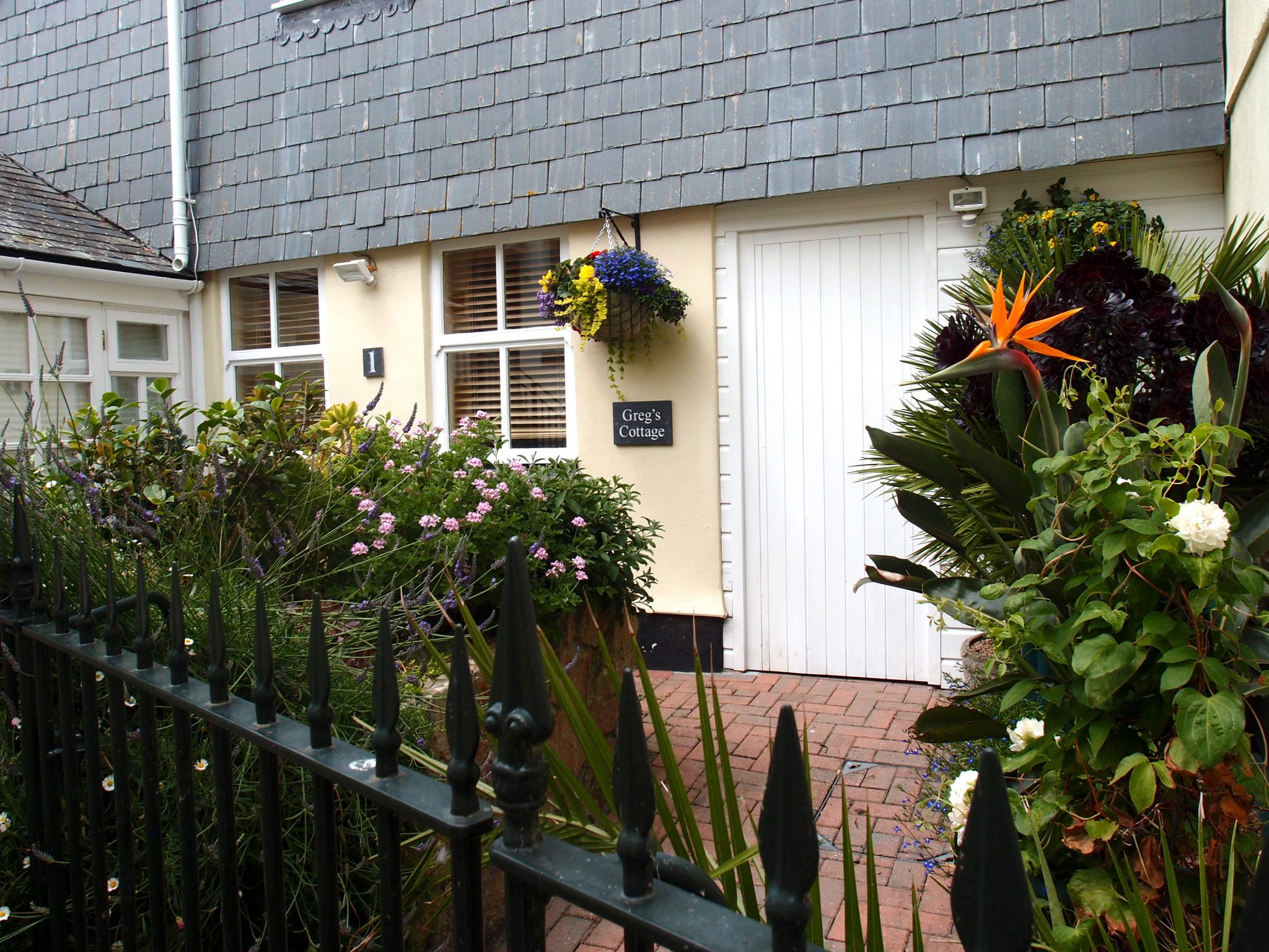
Greg’s Cottage, with a Bird of Paradise: blooming, for the pleasure of all who pass by.
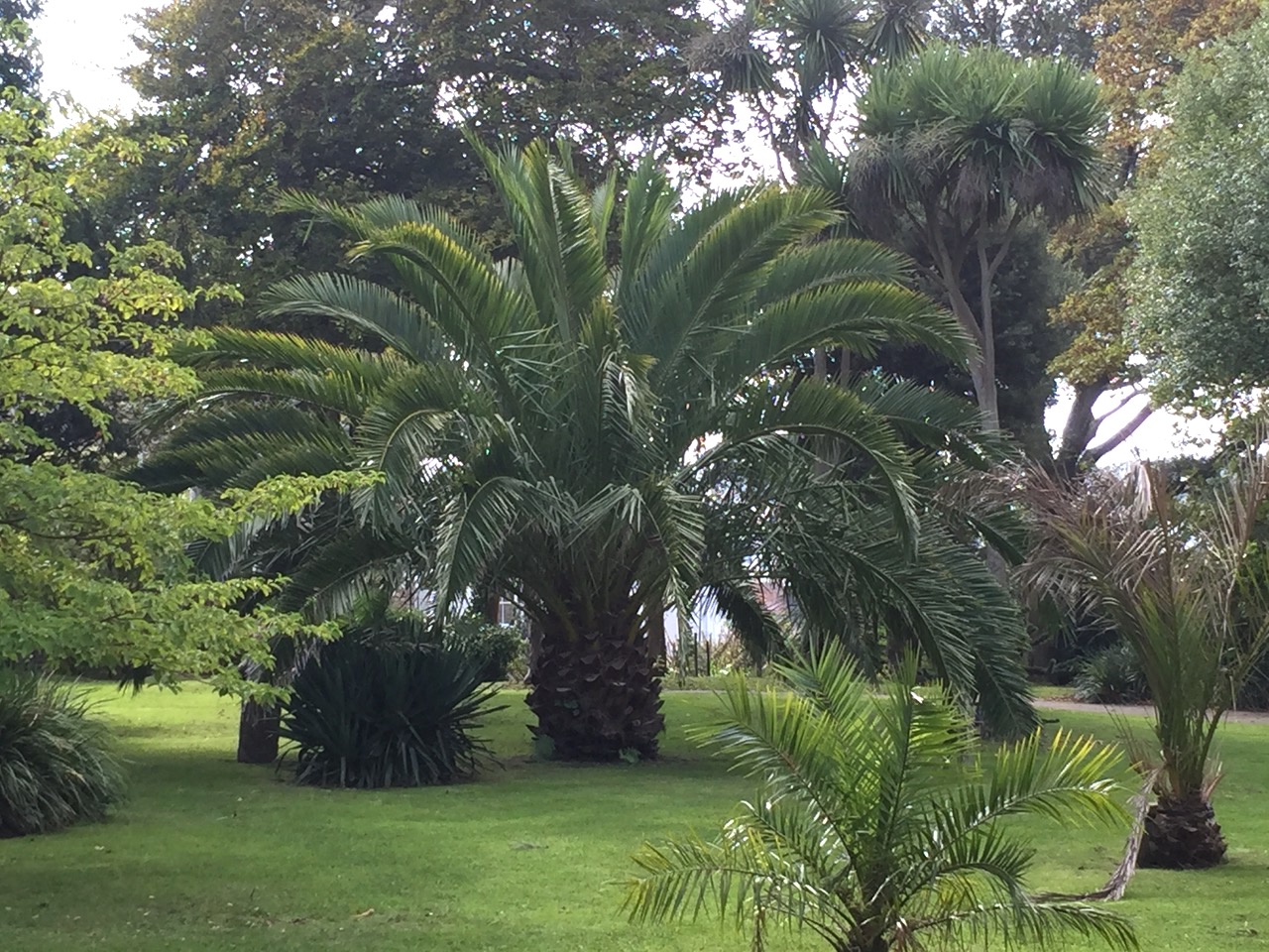
Date palms flourish, in Penlee Park’s semi-tropical gardens. Image courtesy of Anne Guy
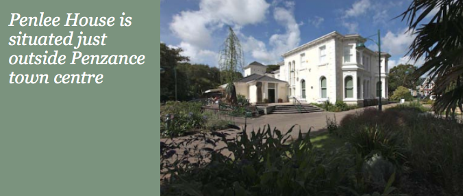
During our day-long walks, Anne and David and I stop frequently for coffee, and food. Our destination: The Orangery Café, at the Penlee House Gallery & Museum. Penlee House was built in 1860 by the Branwells, who were wealthy cousins of the Bronte sisters. In 1946, when the Branwell family line had finally fizzled out, the property was offered to Penzance’s Town Council, who promptly repurposed the estate into a park and a museum. In the Museum you’ll find displays by the Penwith Natural History Society, as well as a selection of the work by painters of the Newlyn School (which I’ll mention, in just a bit).
Penlee House Gallery & Museum.
The Orangery Café. I recommend having lunch on the Cafe’s tented terrace. Be advised, however, that diabolically clever seagulls lurk there, and will swoop through the tent to snatch any unattended food. www.penleehouse.org.uk
Adjacent to the Orangey Café is a recently-installed bronze sculpture, titled “The Broccoli Juggler.” Look closely, and you’ll see that this faceless man is in fact juggling cauliflowers…..yet another instance of a Cornish word meaning something Different from what that word means, Elsewhere.
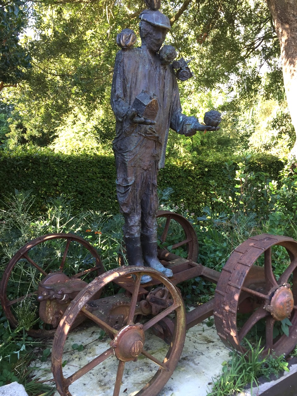
THE BROCCOLI JUGGLER, by Kurt Jackson.
Image courtesy of Anne Guy.
I’ll quote the Artist, Kurt Jackson, in his Statement:
“I live and work within an agricultural community here in the far west of Cornwall; many of my friends and neighbors are farmers. The landscape has been shaped by their activities and by their ancestors before them. In the last few decades their livelihoods have become more tenuous, less certain with market prices falling; labour, transport and production costs rising, and the disruption from extreme weather events more frequent. ‘The Broccoli Juggler’
juggles precariously, throwing up cauliflowers (broccoli in the local dialect), a small tractor and a home whilst perched, balanced on the remains of a cast iron ancient carcass of the ancestors’ farm machinery.”
Kurt Jackson’s sculpture will be a permanent presence on Penlee’s Terrace. That the Town Council chose to acquire this particular work of art — where the sculptor’s serious intent and love for this region is illustrated with a disturbing yet endearingly daft image — seems to sum up the enduring complexities, and humor, of the Cornish people.
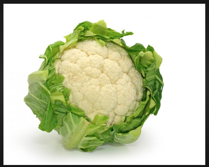
In Cornwall, Cauliflower is called Broccoli
NEWLYN
Having cleared up some questions about the cruciferous vegetables in Penlee Park, we now turn our attention to Fish, and thus to the Harbor at nearby Newlyn.
Newlyn’s 40 acre Harbor is home to one of the largest fishing fleets in the United Kingdom. Image courtesy of
Town of Newlyn.
Newlyn has been a fishing settlement since at least the 13th century, and the vessels which frequent the Harbor now contribute many tens of millions of British Pounds to the Cornish economy, each and every year. But unless you hanker for just-caught-fish, you’ll find few other reasons to visit Newlyn; this is a working-town, and not a place which lends itself to hours of sightseeing. Because the port was sacked and burned by the Spanish in 1595, no vestiges of the medieval town survived. By the late 19th century, Newlyn’s built environment consisted largely of granite or white-painted cottages, and those affordable accommodations attracted a cluster of plein air painters, who called themselves The Newlyn School, an art colony which flourished from the 1880s until the early 20th century. However, a good portion of the remaining charm of the Town was erased by the “slum” clearance which occurred in the 1930s.
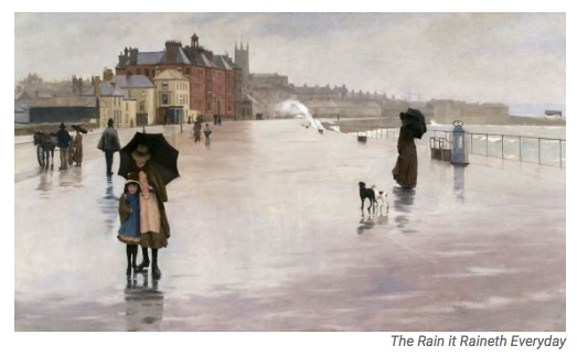
THE RAIN IT RAINETH EVERY DAY, by Norman Garstin, shows the Promenade, in Penzance. Garstin (b.1847, d.1926) was one of the earliest members of the Newlyn art colony. Image courtesy of the Penlee House Museum.
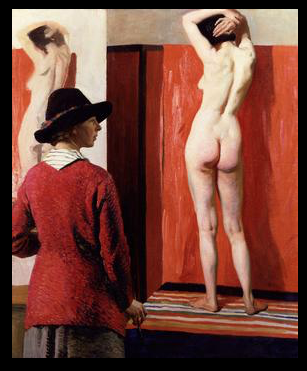
SELF PORTRAIT WITH NUDE–1913, by Dame Laura Knight, is an extraordinarily bold (for its time) and well-done composition. Dame Knight (b.1877, d.1970) was part of the second wave of artists who settled in Newlyn. Image courtesy of the National Portrait Gallery.
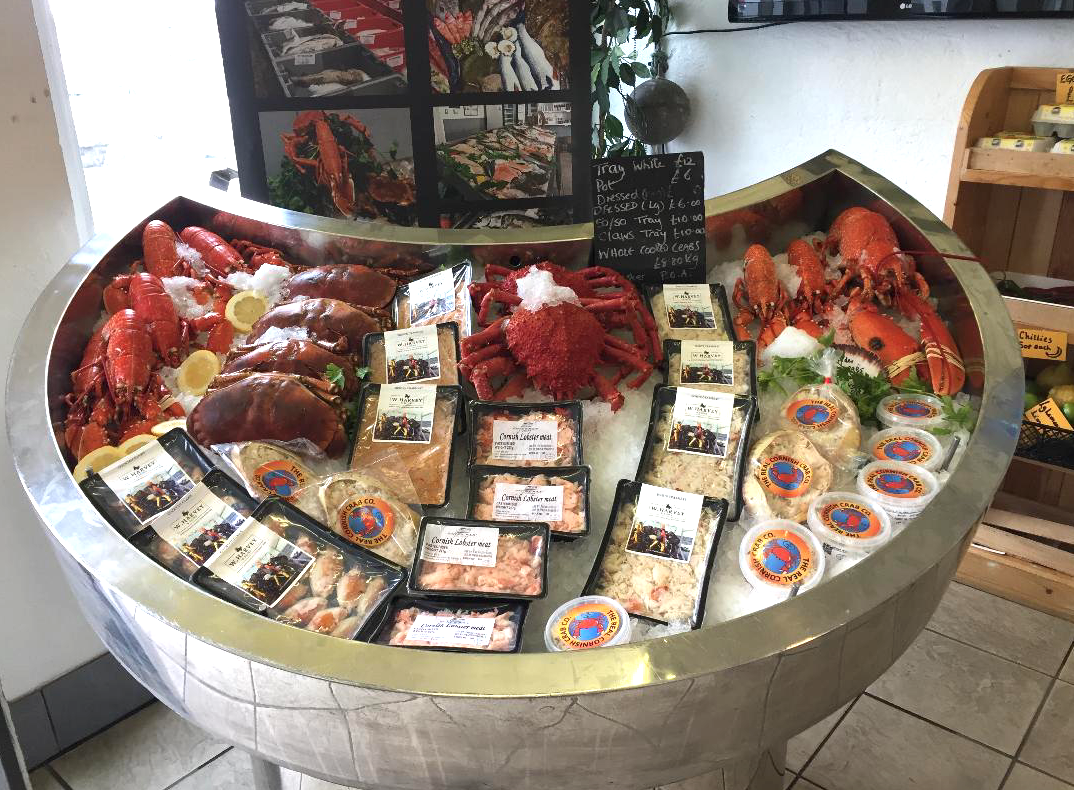
But, back to freshly-caught Fish, and THE reason to make a detour to Newlyn. During my sojourns in Western Cornwall with Anne and David Guy, we have rented a house with first-rate kitchen facilities, and so have regularly bought fish for ourselves at Stevenson Newlyn: these folks are the BEST fishmongers in Town (or perhaps in all of the UK).
Stevenson Newlyn,
The Strand, Newlyn, Cornwall
TR18 5HA
Image courtesy of
Anne Guy
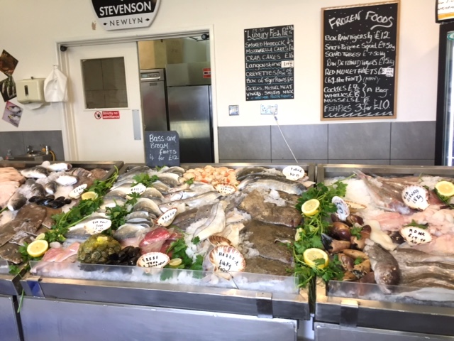
Feel like frying up some fish? Go to Stevenson’s!
www.newlynfreshfish.co.uk
Image courtesy of
Anne Guy
For my Final Newlyn Tip: I’ll let the website of the United Kingdom’s National Tide Gauge Network speak for itself about the importance of the Newlyn Tidal Observatory:
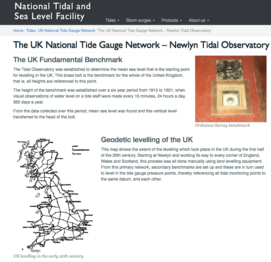
Image courtesy of the Newlyn Tidal Observatory
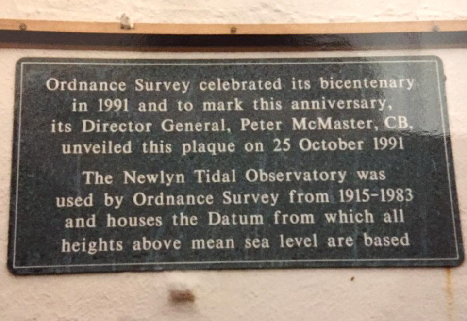
Anne Guy wisely suggested that I include mention of Newlyn’s critically important Tidal Observatory. She took this photo of the plaque, on the Quayside, several years ago.
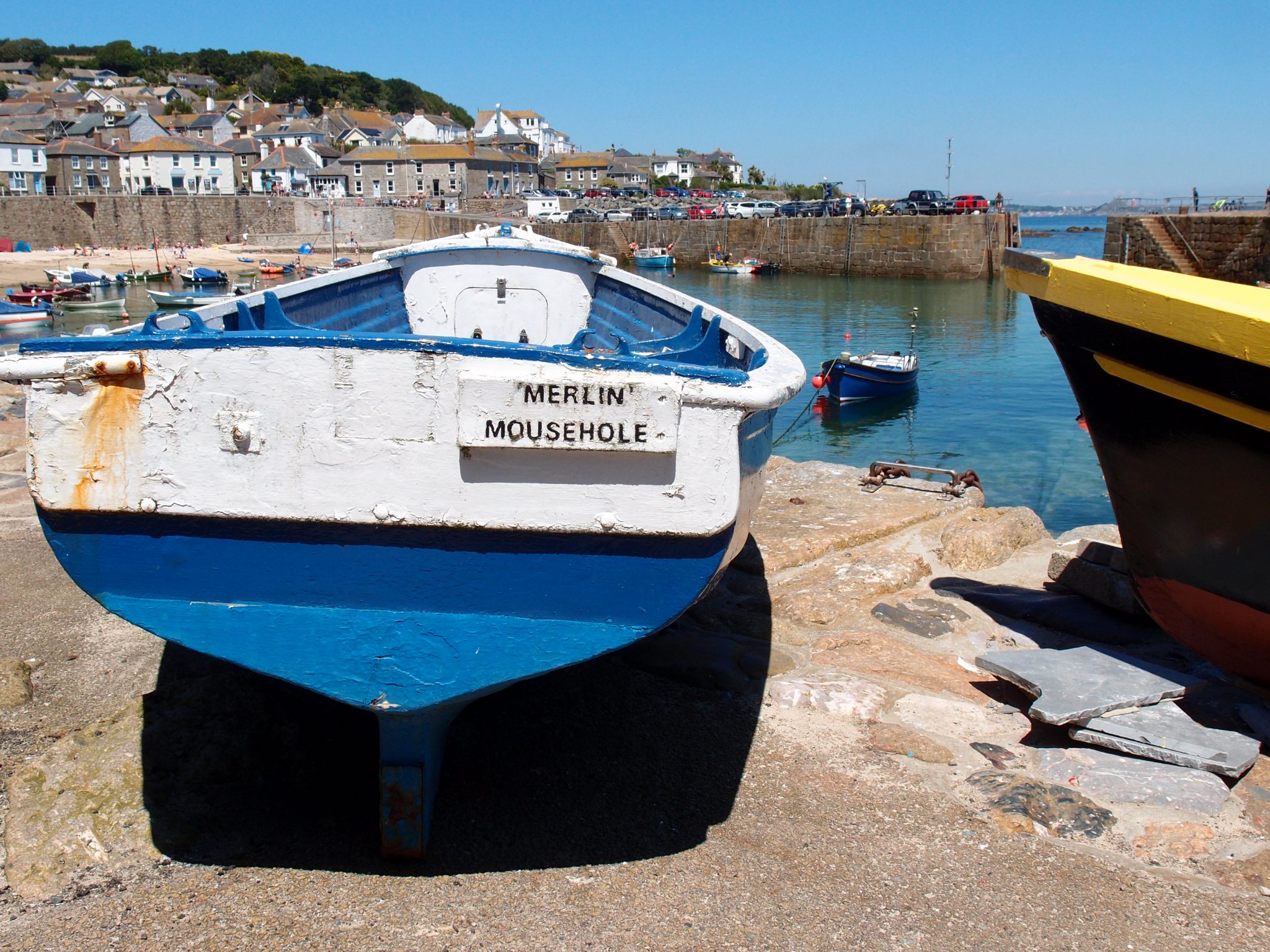
MOUSEHOLE
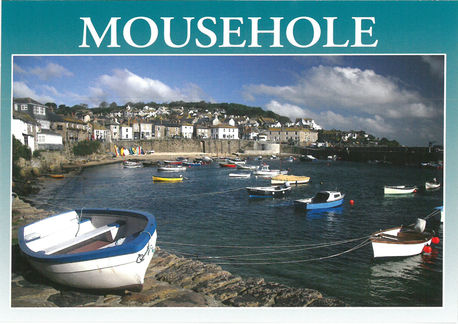
Remember, it’s pronounced MOW-zul
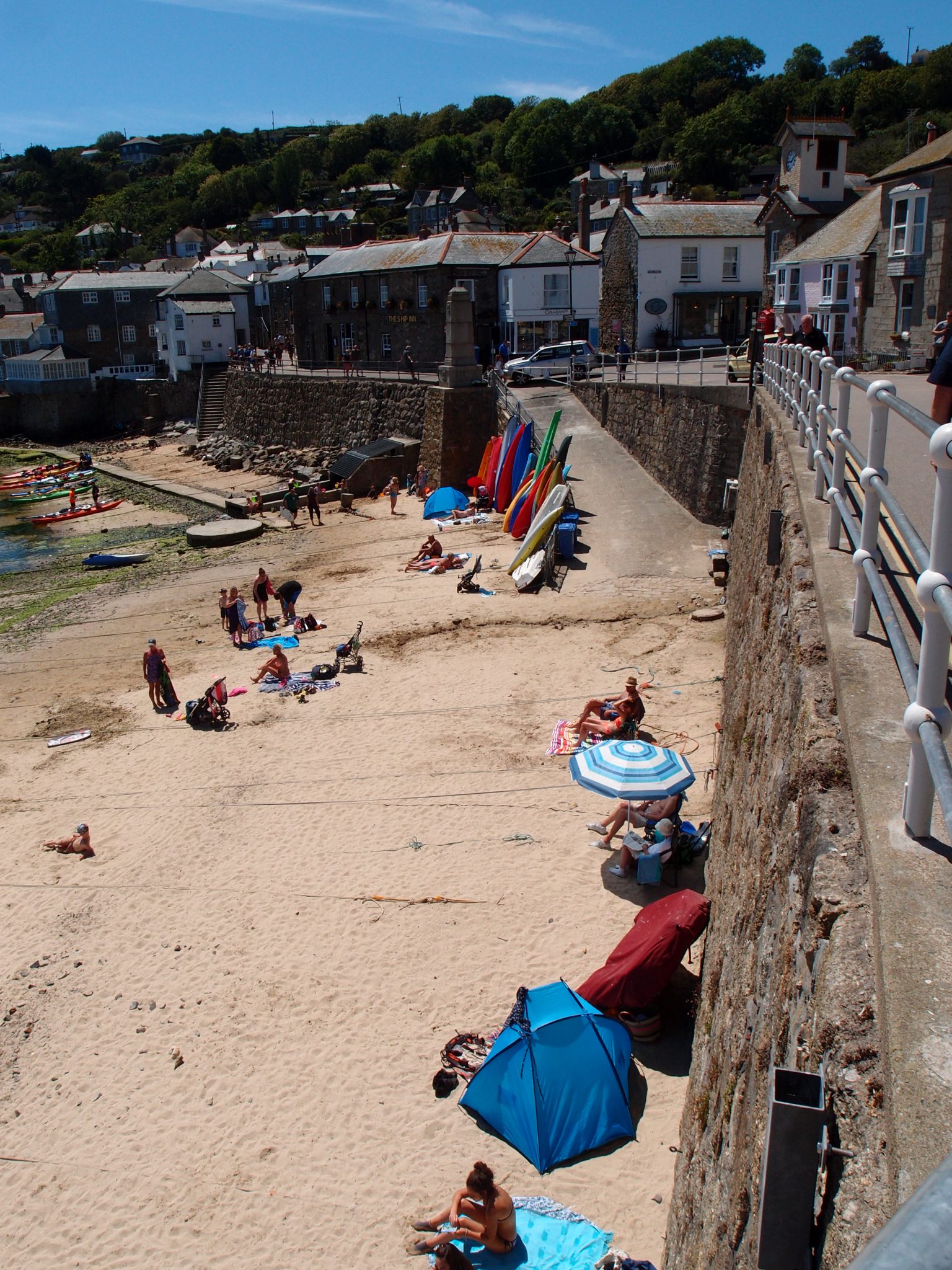
Two and a half miles south of Penzance, on the western shore of Mount’s Bay, is the tiny village and man-made harbor of Mousehole. At the 2011 census, 697 year-round residents were recorded, but on a fine summer’s day—or during the village’s annual festival of Christmas lights— the nose-count in Mousehole is always considerably larger. This community, which until 100 years ago was a bustling fishing port but is now dependent upon day-tripper visitors for its financial survival, has somehow retained an authenticity which is absent in most tourist-magnets.
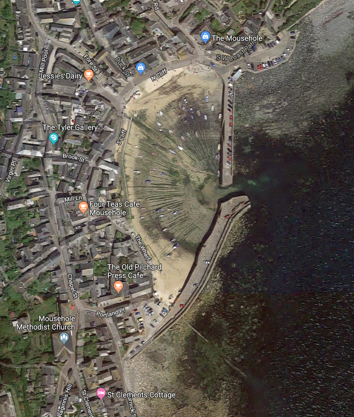
Aerial View of Mousehole, Cornwall
For your visit, don’t even think about driving anywhere near to Mousehole’s Harbor. Instead, as Anne and David and I did, park your car in the municipal lot on the northern edge of the village. A five minute stroll, downhill toward the Bay,
will transport you onto lanes and past cottages which date from the 17th century.
Unsurprisingly, Mousehole’s seaside setting and well-preserved architecture have beguiled some of England’s most discerning honeymooners. As mentioned in my caption which accompanies this Diary’s lead photo, Dylan Thomas, who in 1937 spent his wedding night with Caitlin Macnamara at the now-defunct Lobster Pot guest house, declared Mousehole to be England’s loveliest village. And Winston Graham has written that, in 1939, he and his new wife Jean Williamson “spent the few days of our honeymoon at Mousehole.”
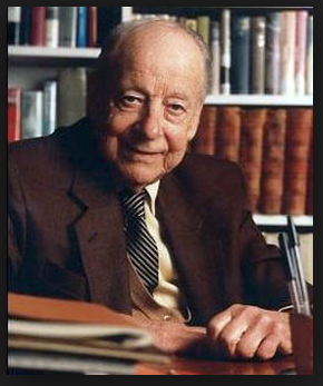
Prolific British Author, Winston Graham
(born-1908 Manchester; died-2003 Sussex)
At this mention of Winston Graham in Mousehole, the whiskers of some of my more alert Readers may have begun to twitch. Graham churned out books about a wide range of subjects, but is today most acclaimed as the author of the Poldark series of 12 historical novels. Graham moved to Cornwall when he was 17, and lived there for the next 34 years of his very long life. He adored Cornwall, and knew it intimately, and his Poldark stories draw upon that emotion and knowledge. As Graham explained: ”Anyway, for better or worse, the Poldark world is one I have myself inhabited over long periods of my life.”
Cornwall’s culture and landscapes have been woven into the novels of many other British authors. Cornwall-loving writers include Daphne du Maurier, Virginia Woolf, John le Carre, Rosamunde Pilcher, and Anyone who has written about the Arthurian Legends.
Many of my Readers, when learning about my plans to write a multi-part Cornwall Diary, have inquired if I’ll be showing sites where the recent BBC adaptations of the Poldark books have been filmed. Yes: in my forthcoming Cornwall Parts 3, 4 and 5, ravishing places — tin mines, rock cliffs, windblown bluffs, churches, hidden coves, and beaches — on Cornwall’s northern, western, and southern coastlines which have served as filming locations will indeed be featured. For those Poldark Fans who’d prefer to forego my broadly-based commentaries about Cornwall, and who’d like, instead, to drill directly down to Poldark-as-seen-on-TV, in future Diaries I’ll bookmark the Poldark sections with the
following thumbnail :
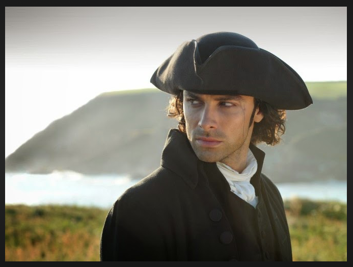
Aidan Turner as Poldark.
Image courtesy of the BBC
But now — back to Mousehole — as I retrace the steps that Anne and David I took, during a balmy afternoon in June.
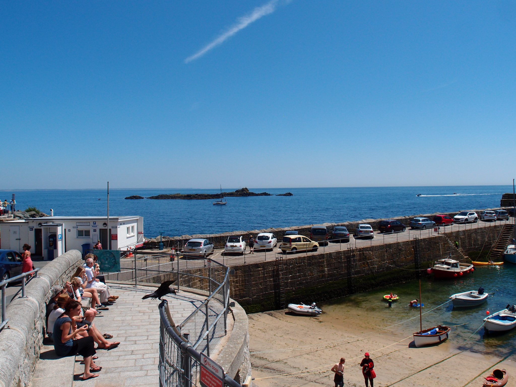
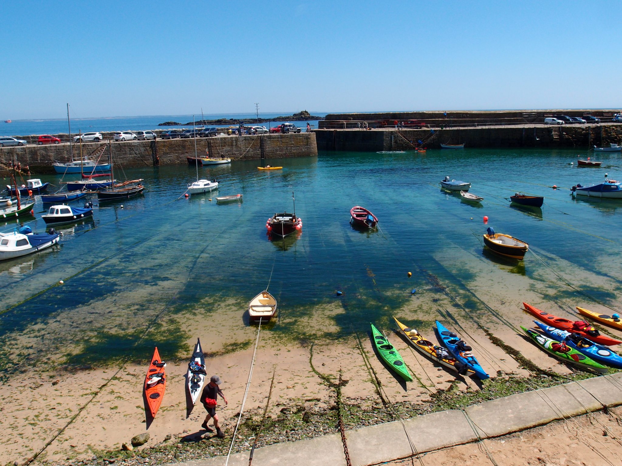
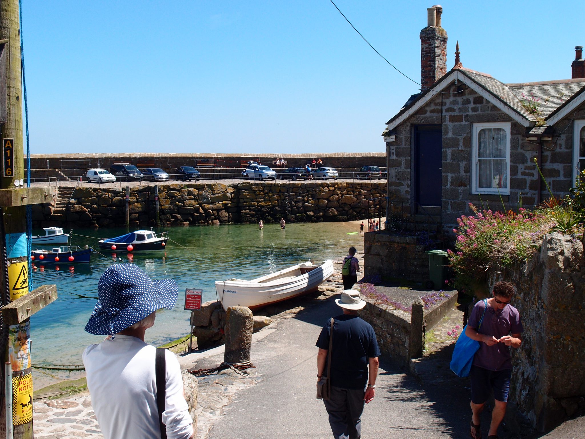
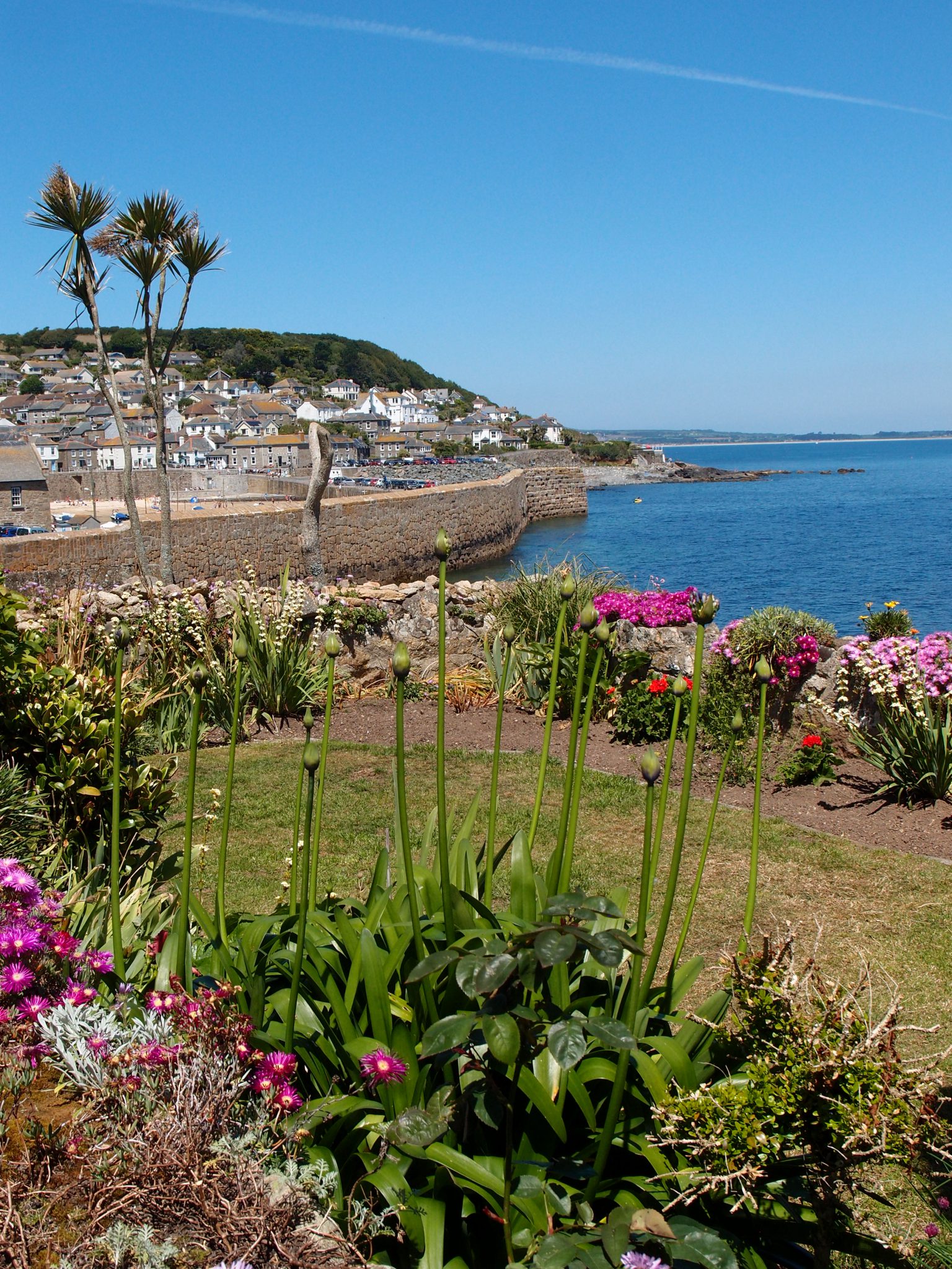
We approach the Harbor. To our left: the North Quay of the Harbor, constructed with granite from nearby quarries in Lamorna, dates from the 17th century.
Mousehole’s manmade Harbor, and its little sandy beach. Straight ahead, out past the Harbor, is
the English Channel.
Just beyond the North Quay, a small cluster of rocks in Mount’s Bay—called St.Clement’s Isle—is said to have been the (very uncomfortable) home of an ancient hermit.
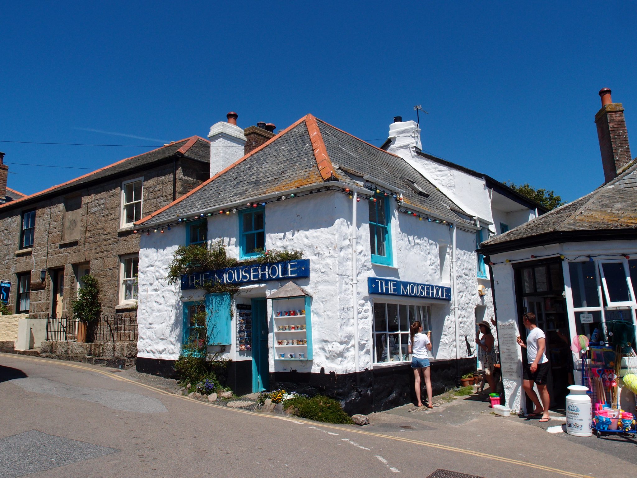
What ELSE could they have named this strategically-located Gift Shop, which is on North Cliff (Mousehole’s Main street)? And just TRY to leave the Village
without a Mousehole mug, tea towel, and postcard!
From North Cliff: our view of the boat ramp and beach
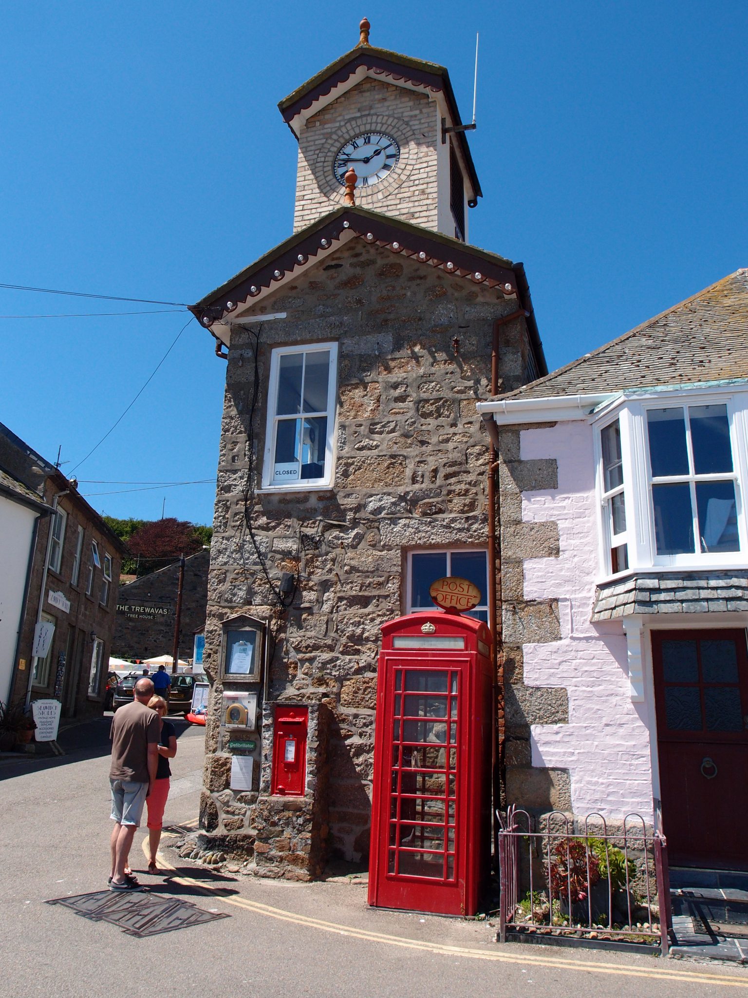
The Essentials:
Town Clock. Post Box.
Phone Booth.
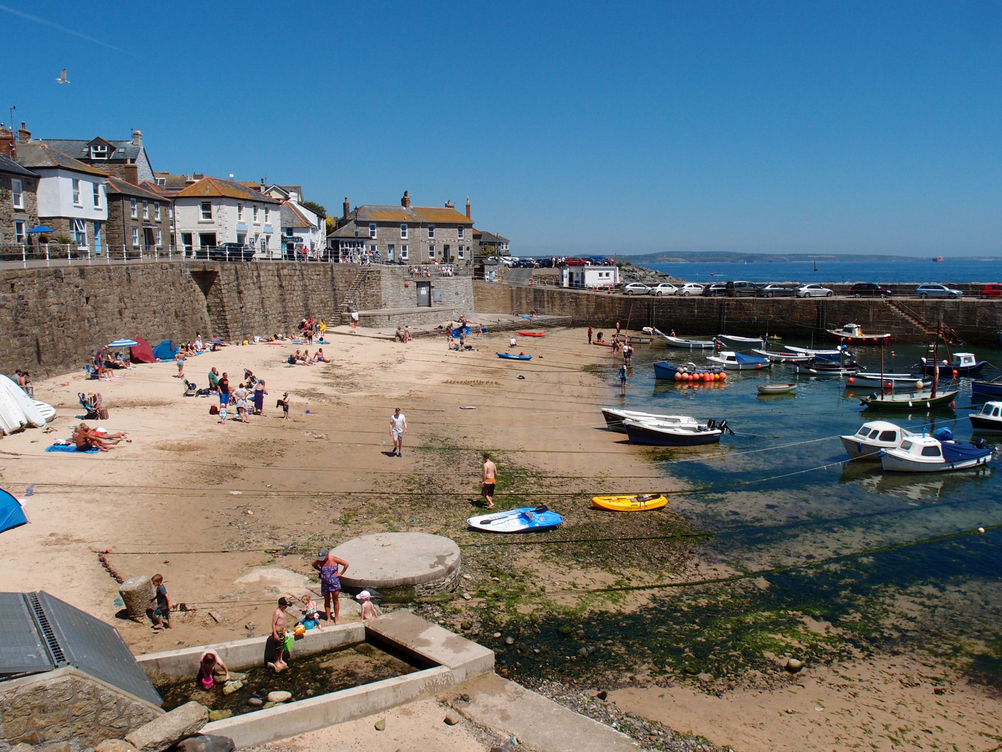
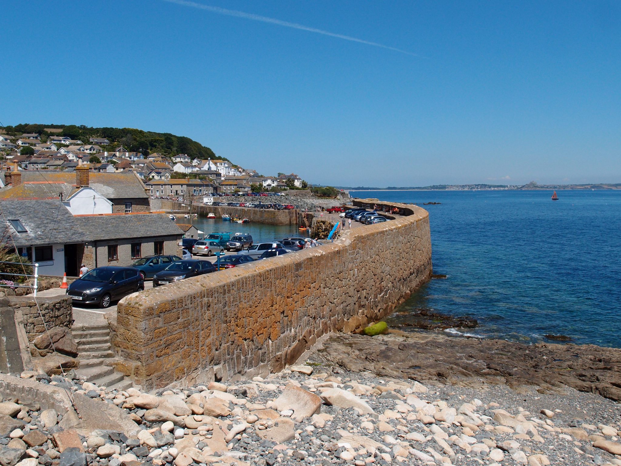
Now on South Cliff, we have a view of both Harbor Quays. The southern Quay (to the right), which is wider and taller than the northern Quay, dates from the 19th century.
St.Clement’s Isle is the mid-distance, and far, far away we can
see just a low sliver of the eastern-most shores of Mount’s Bay
A view of the North Quay, with the mainland in the distance.
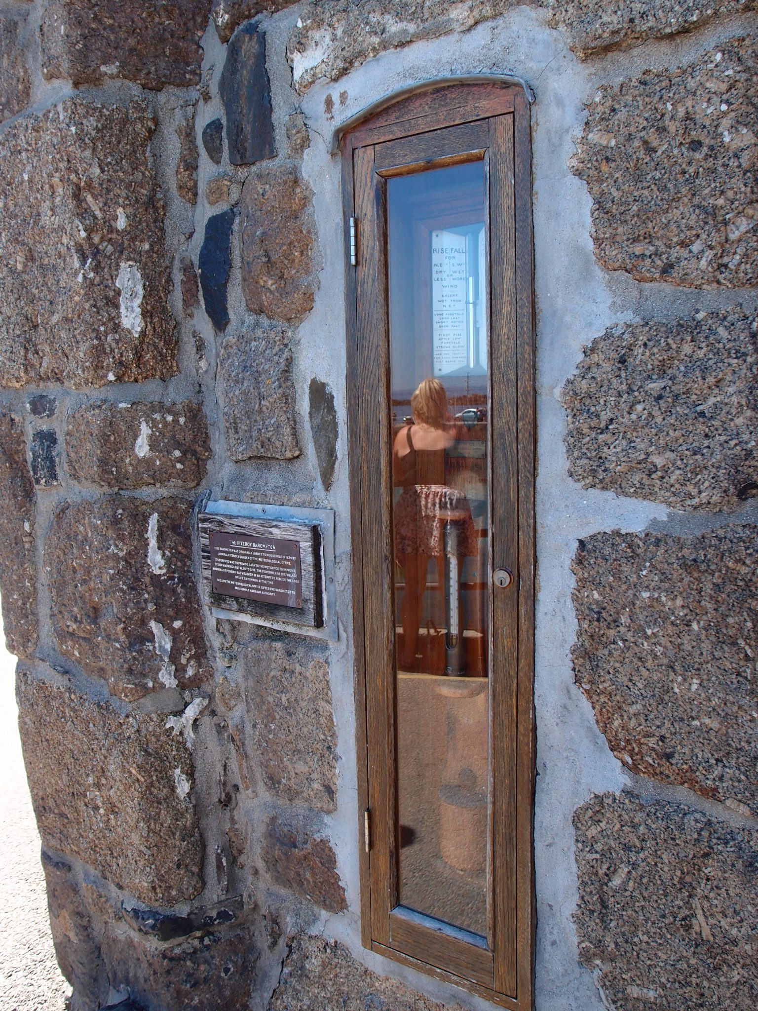
The Fitzroy Barometer
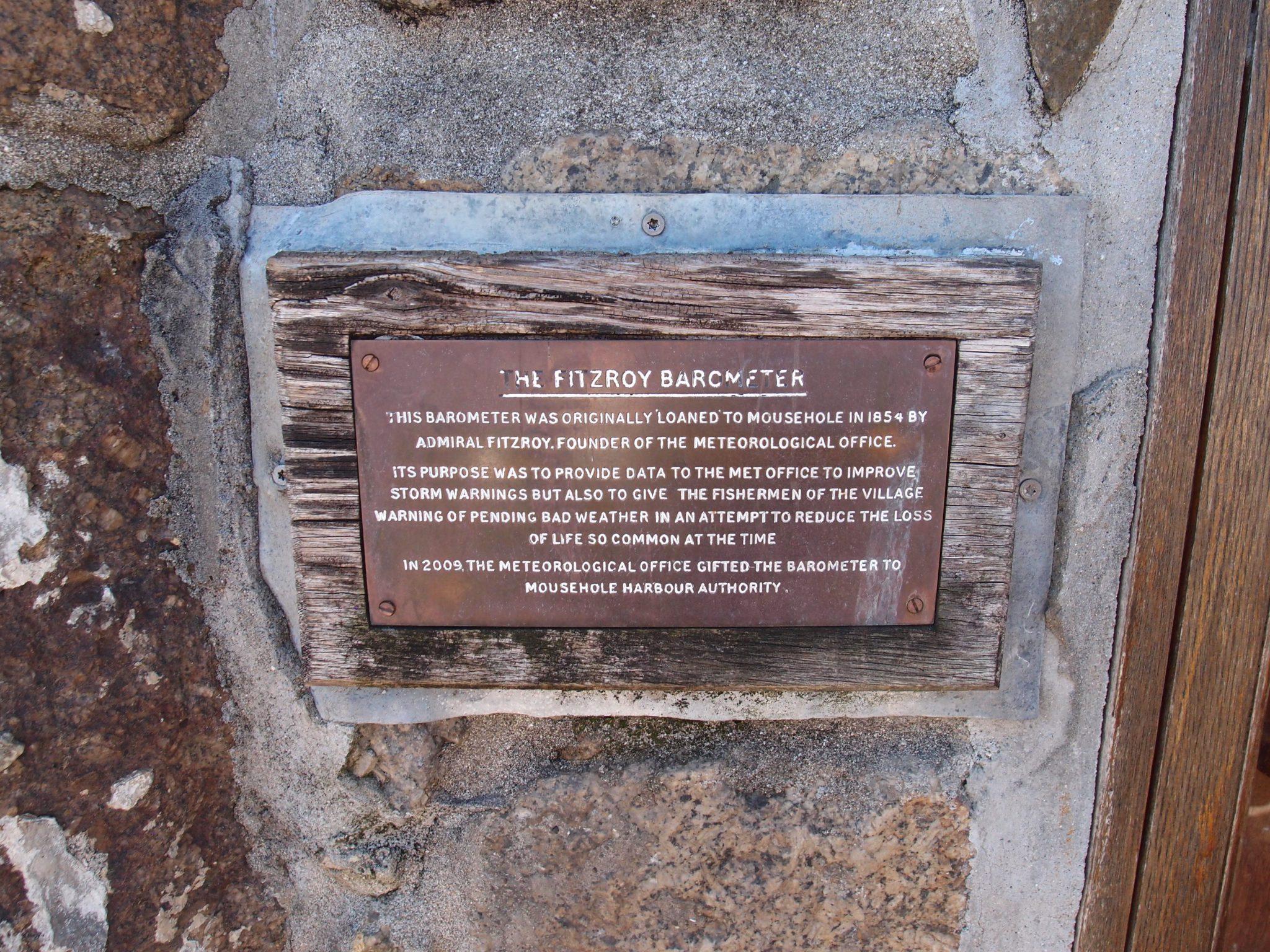
EVERY village ought to have its own Barometer….
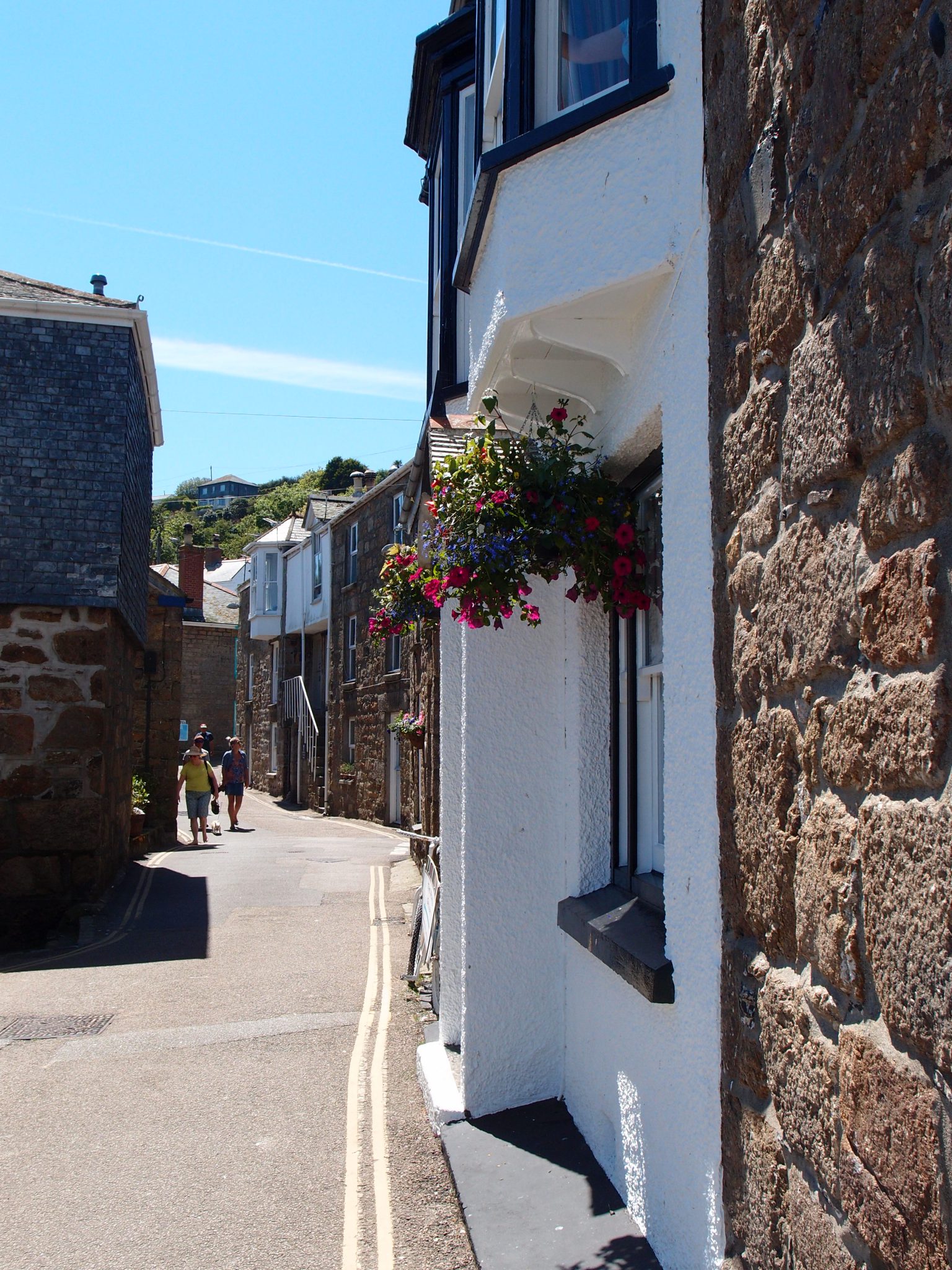
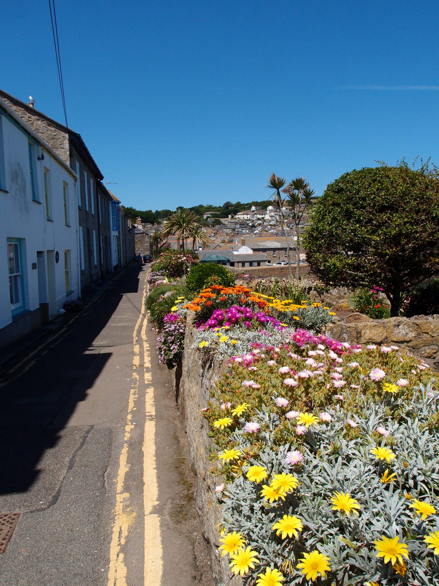
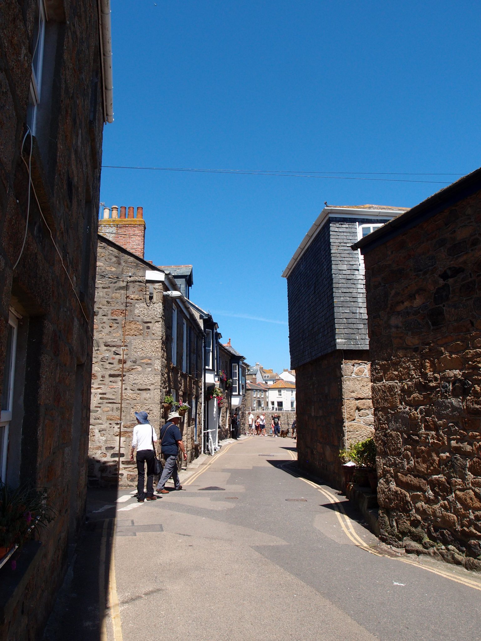
A typical lane in Mousehole
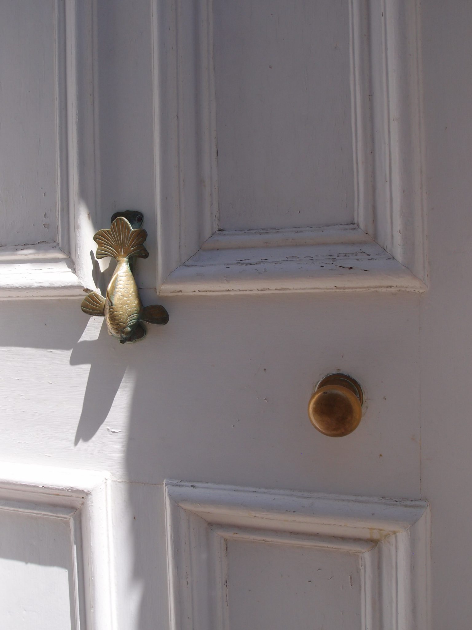
A fine fish, for a door knocker
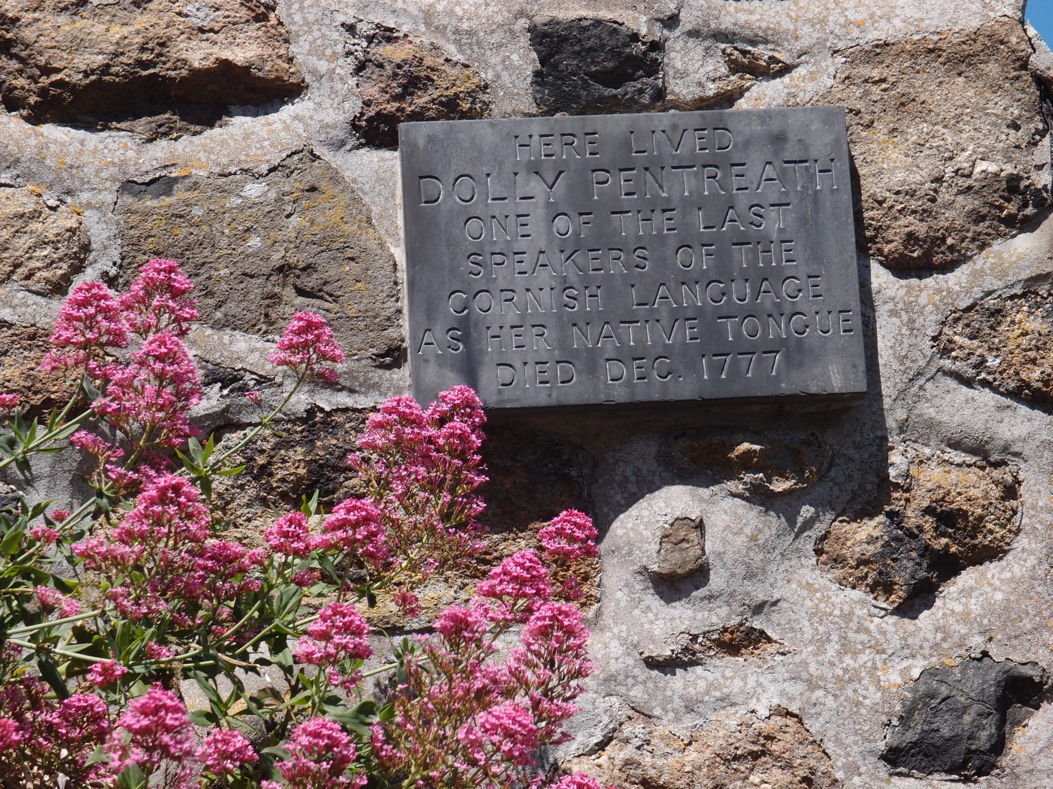
Site of the home of Dolly Pentreath, who was one of the last speakers of the Cornish language.
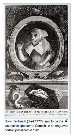
Dolly Pentreath. Image courtesy of Wikipedia
Anne and David (both sensibly be-hatted, on that hot, sunny day) lead me down into the Harbor.
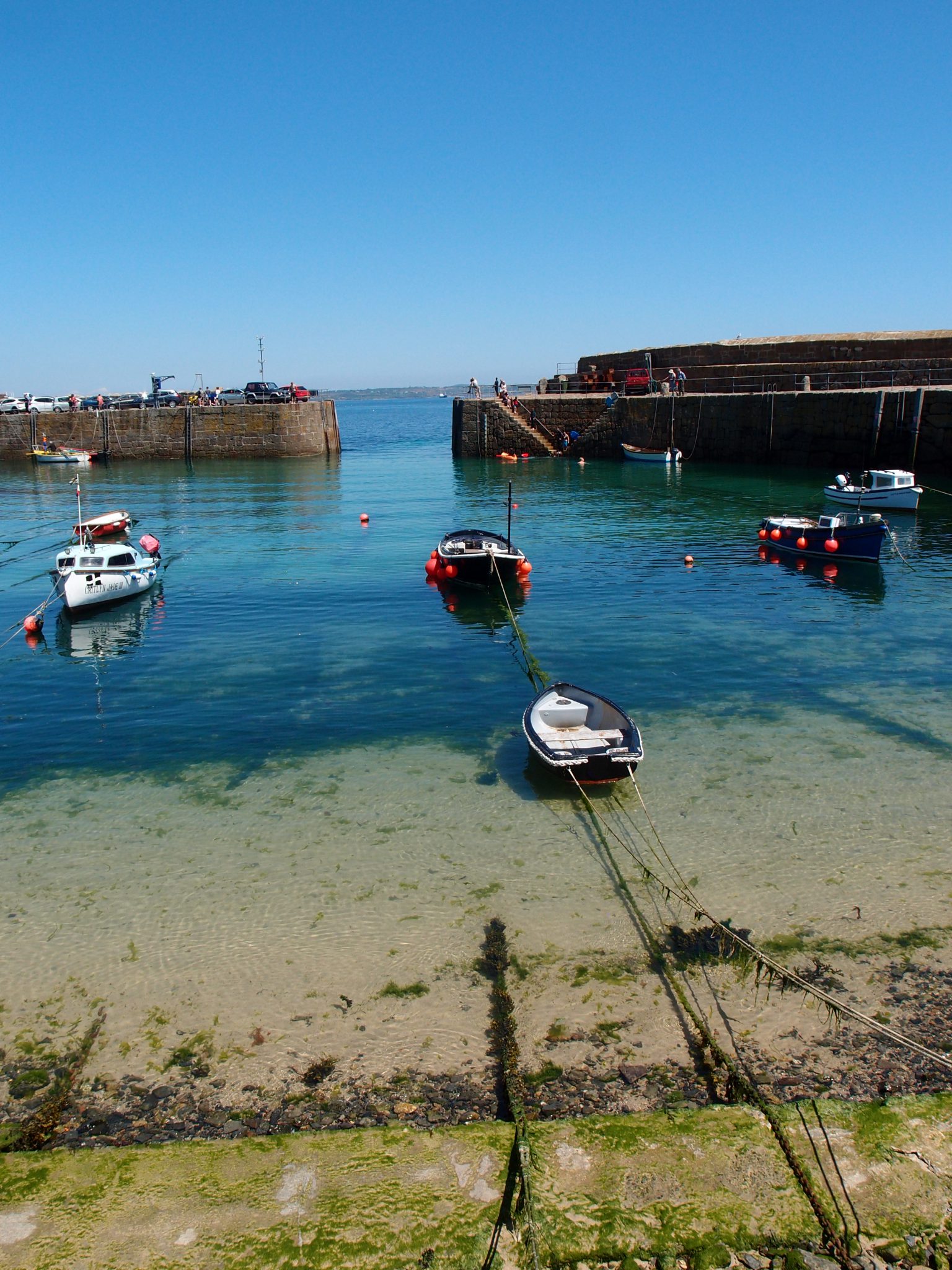
From the beach, we’re able to peer through the central opening in the Quay.
We’ve reached the southernmost end of the Harbor, and are on Gurnick Street. A little boat with a beautiful,
terra-cotta colored sail, is in the distance. Look carefully, past the upper left of the sailboat, and, above the horizon, you’ll see the peaked roofs of St.Michael’s Mount (which we’ll visit in Part Two).
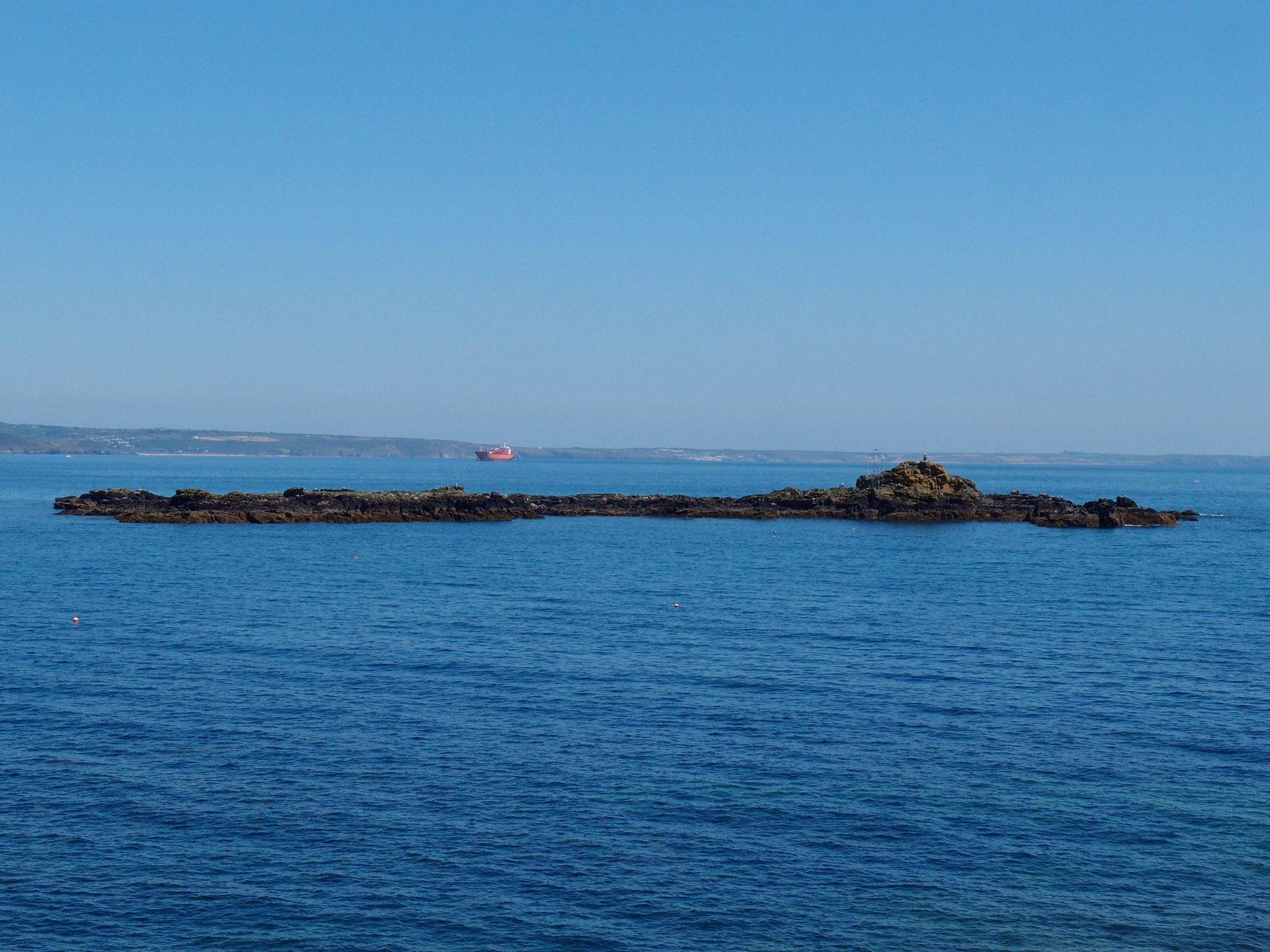
Another view of St.Clement’s Isle. The
red ship is one of the many seagoing vessels which were anchored that day, in the Bay.
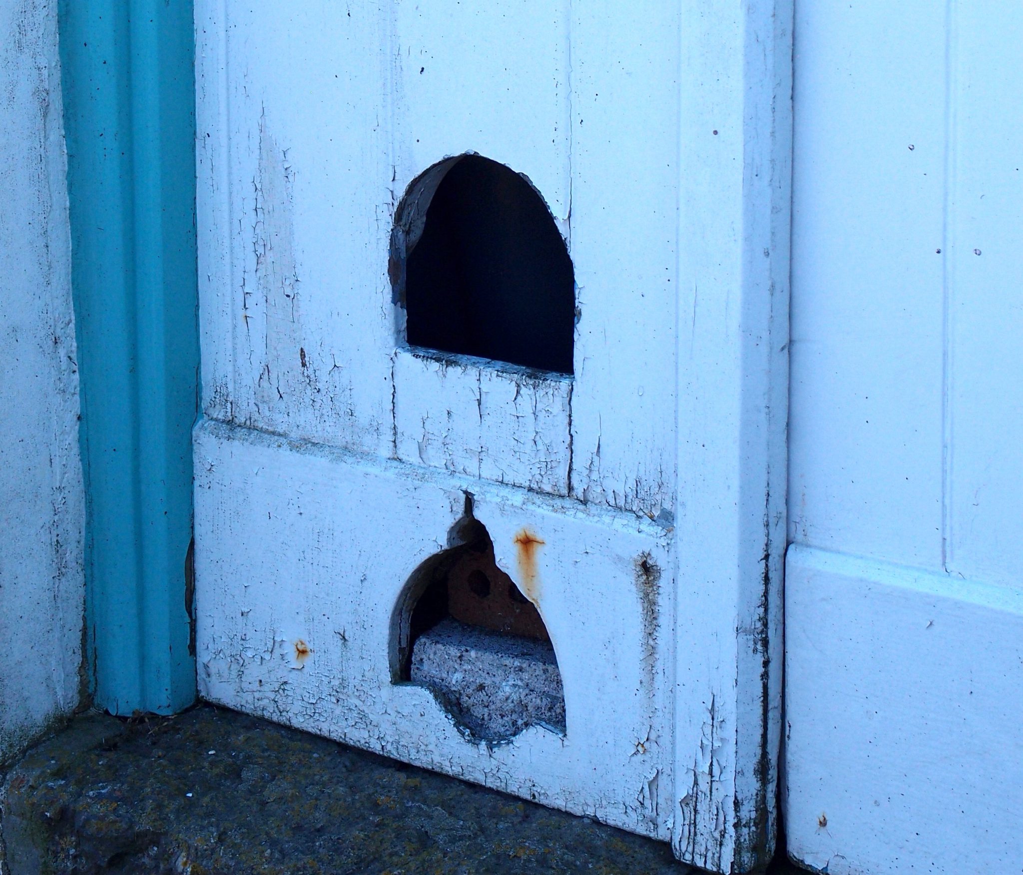
On Gurnick Street: I passed these two animal-doors, and was reminded by Anne that, a couple of years ago, she’d sent me an email reporting HER discovery of these same doors.
As Anne had written to me, in 2016:
“We saw a beautifully tended tiny garden overlooking Mount’s Bay. We met a man coming out of his house to let his pet duck into the garden! His duck was of course called Donald but was lovely even though he thought I had food and pecked my hand! Apparently the man takes Donald to the pub on Tuesdays and Thursdays where the duck eats pork crisps and drinks Guinness! Donald also has his own duck flap as he couldn’t get in the one the man had made for his previous pet rabbit!”
Unfortunately, during MY visit to Mousehole, neither man nor duck appeared. But, without Anne and David — wonderful travel companions, who share my fascination for Distinctly Odd Places — my Cornish explorations would clearly have been far less entertaining.
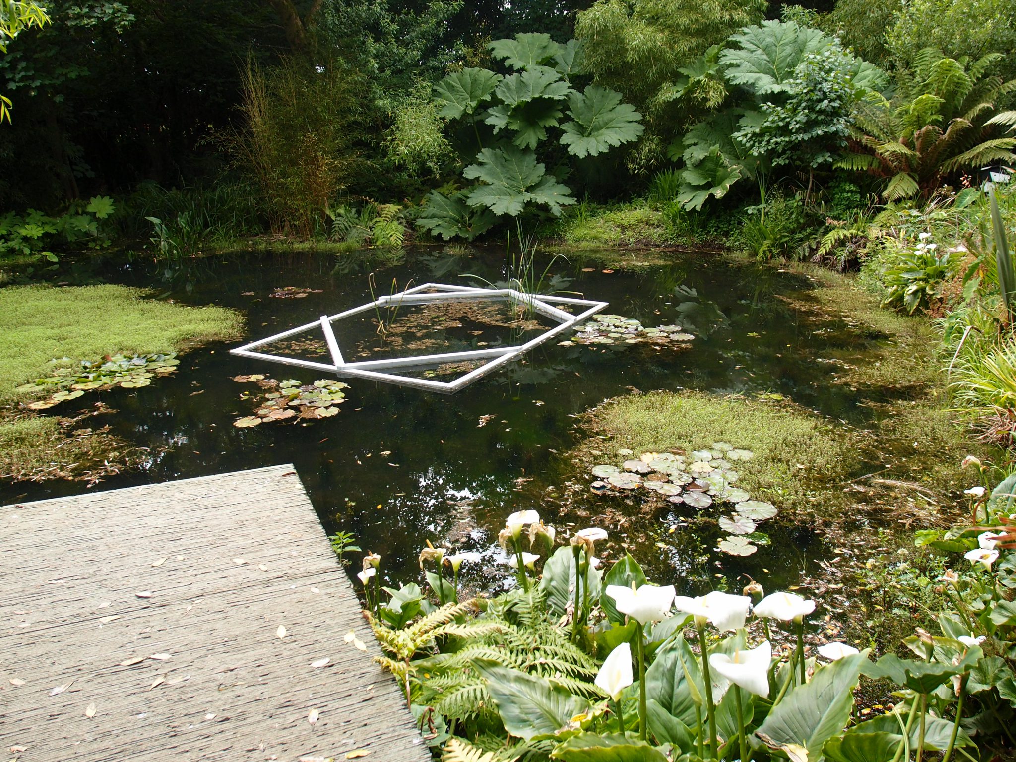
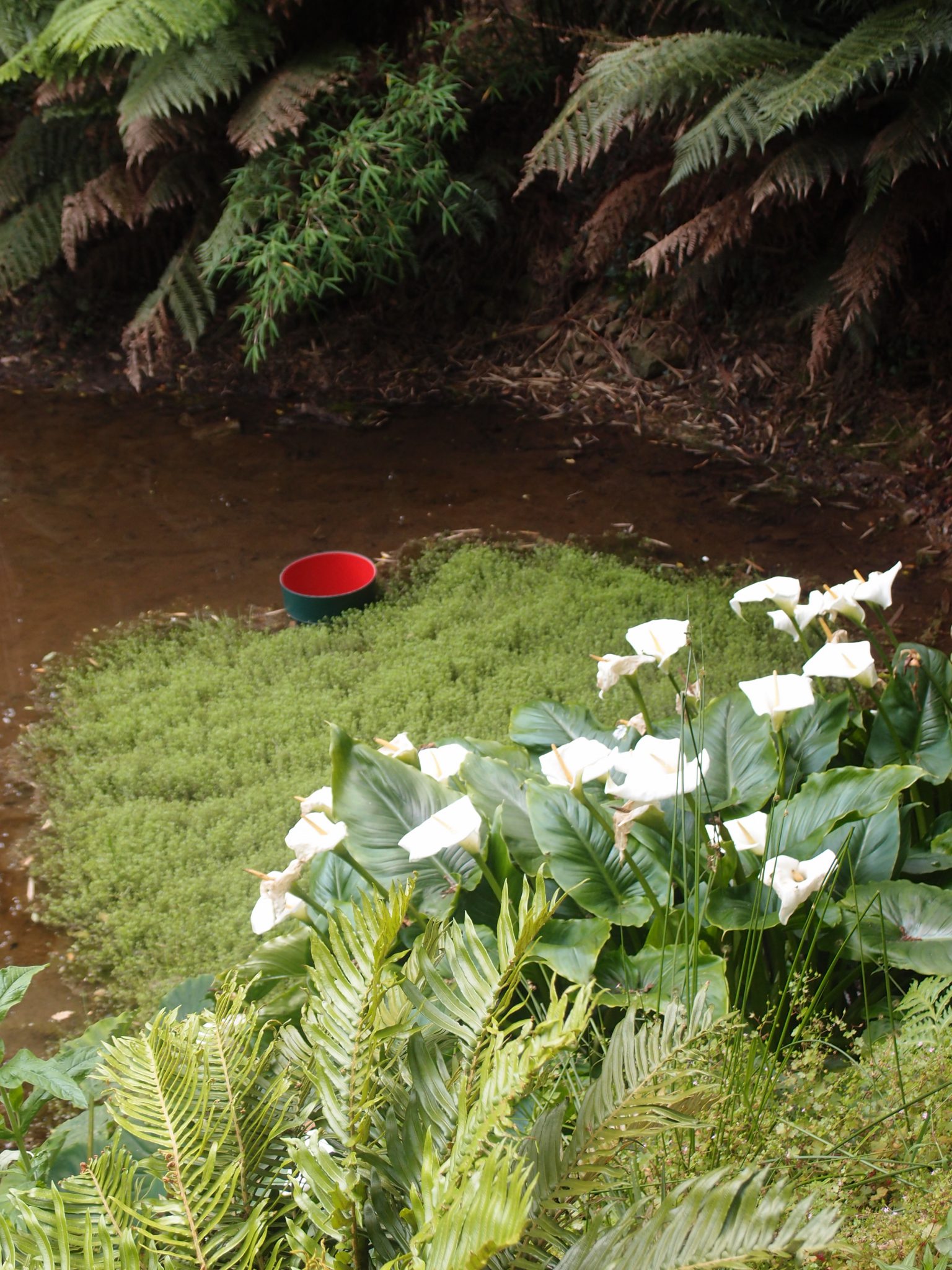
A stretch of Harborside gardens run alongside Gurnick Street. Per Anne Guy (who is also my Horticulture Guru), the rather Dr.Seuss-ish tree to the left is Cordyline australis (or Cabbage Tree, or Cornish Palm). This tree is native to New Zealand.
My view down Gurnick Street, back into Town
Another Bay View, from Gurnick Street. The flowers cascading over the edge of the seawall are Erigeron glaucus (or beach asters). These flowers are native to the coastlines of Oregon and California.
Per Anne: “The orange flowers on the stone wall are Gazanias, and the pink ones Lampranthus.” Both types of flowers are native to South Africa.
As is obvious: British Gardeners are horticultural magpies. They collect odds and ends of plants, from around the entire Planet, and they’re not afraid to then try to get those plants to flourish, on their own northern-hemisphere Island.
A last look at the garden on Gurnick Street
The clear waters of Mount’s Bay
The breakwater, at the base of the Harbor Wall
Another reminder that Cornwall is also the Land of Merlin & King Arthur
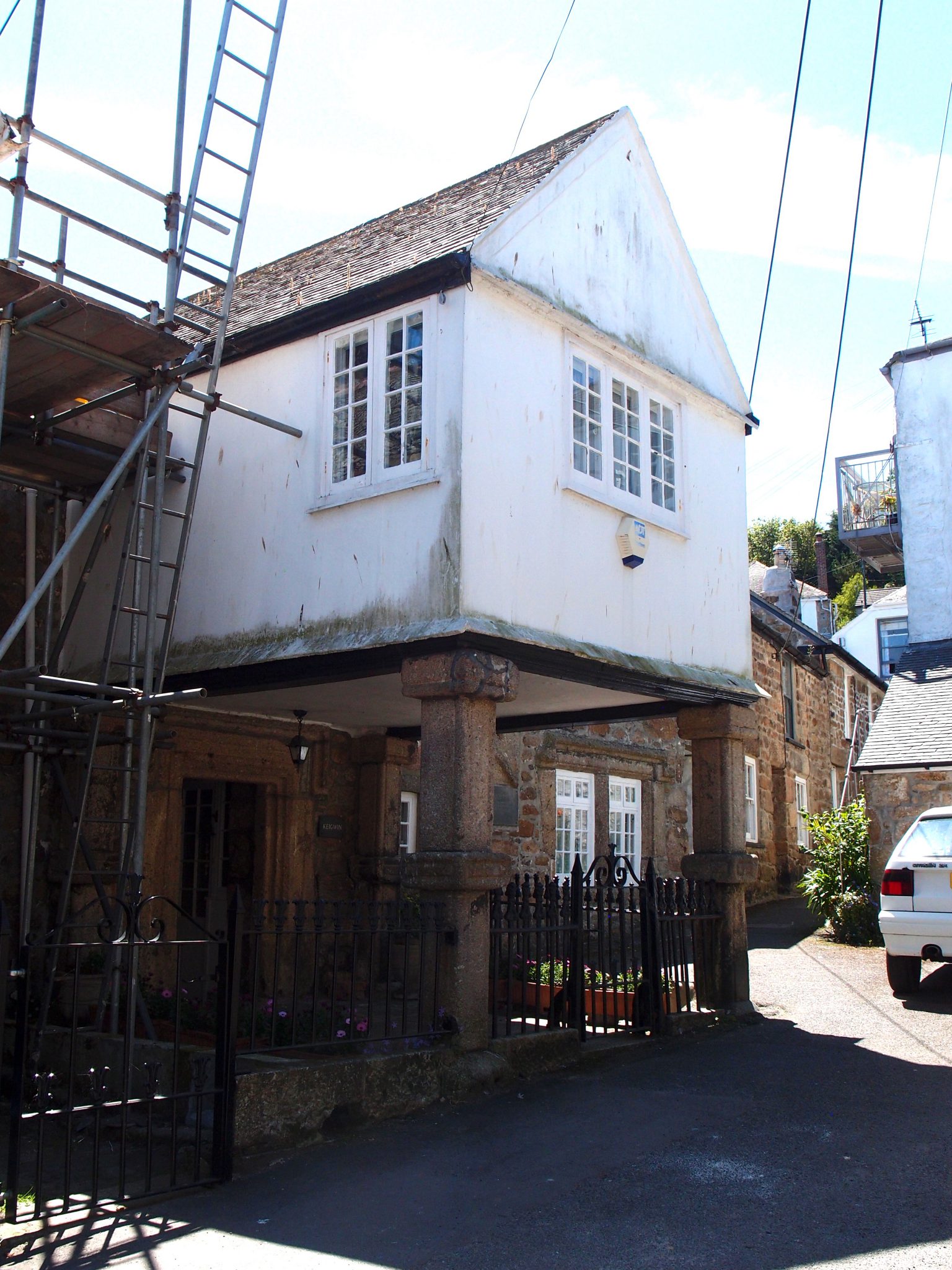
Per Wikipedia: “Mousehole, like Penzance, Newlyn and Paul, was destroyed in the 1595 raid on Mount’s Bay by Spaniard
Carlos de Amesquita. “ This building, which is called the “Keigwin Arms,” is the only building that survived, when the Spaniards set
fire to the Village. The structure is now a private residence.
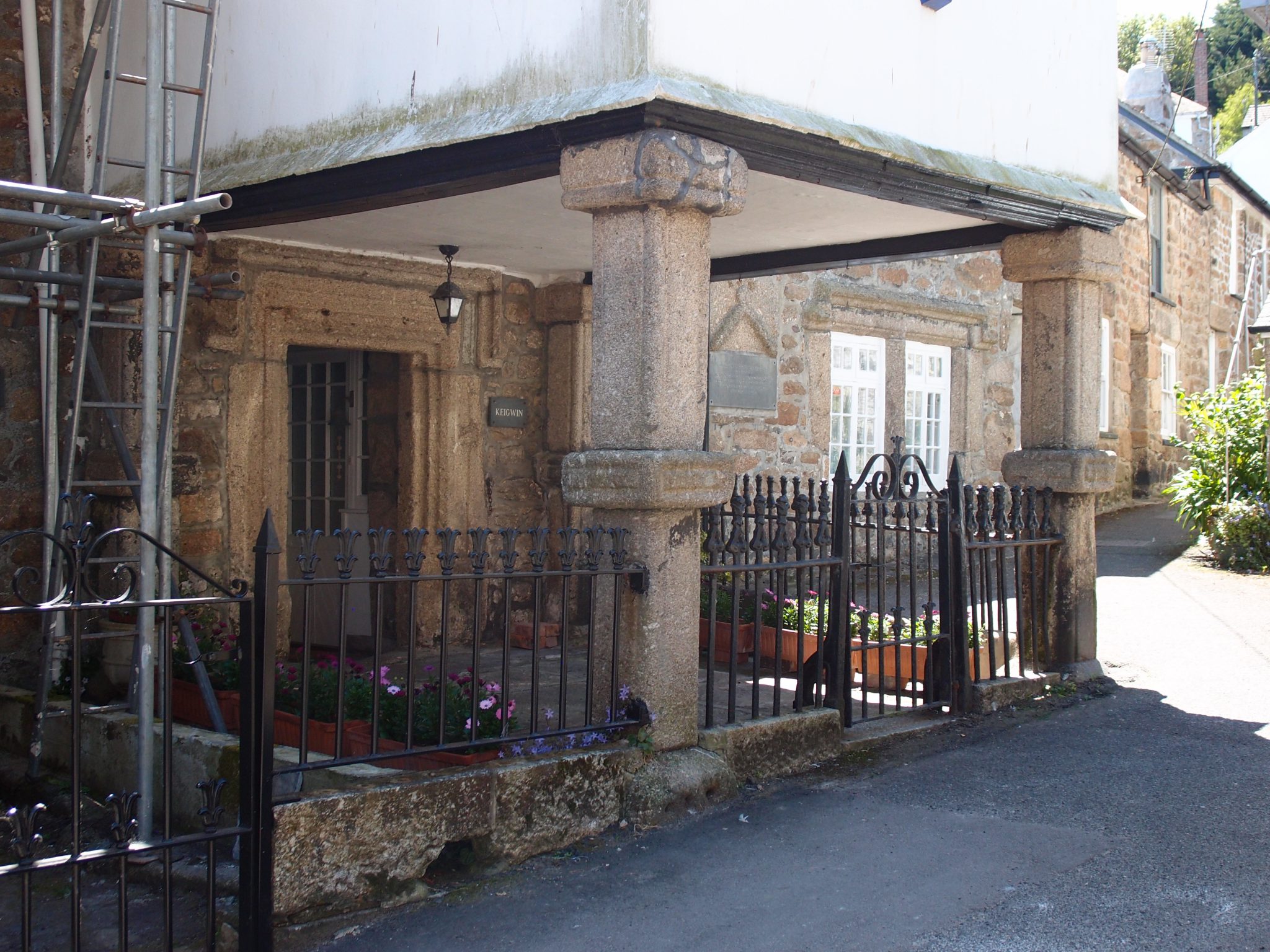
A closer look at the imposing portico of Keigwin Arms
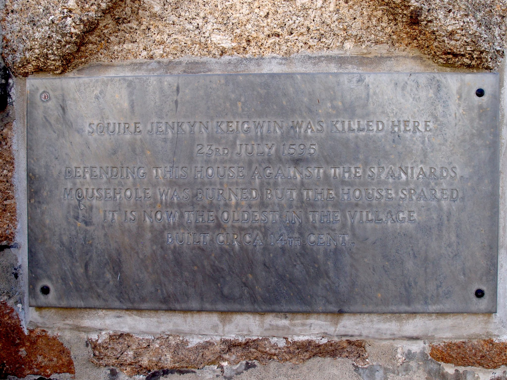
Tragically, although this building survived, the Master of the House did not.
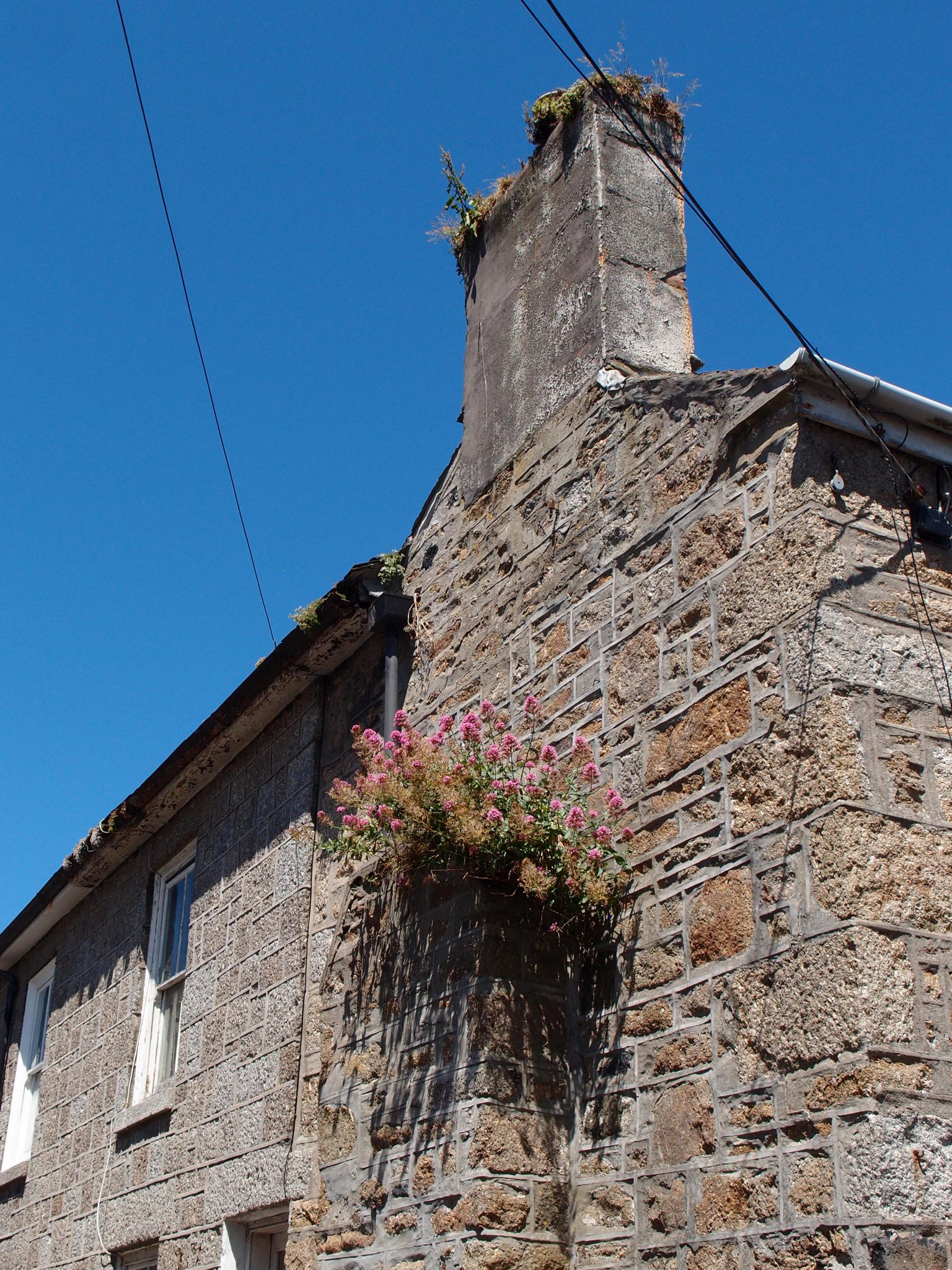
Flowers WILL grow where they want to be. Here, a clump of Centranthus (or Red Valerian) has taken root, high up in the wall of a stone house.
T’was time for Tea, and Anne and David began to search for a watering hole.
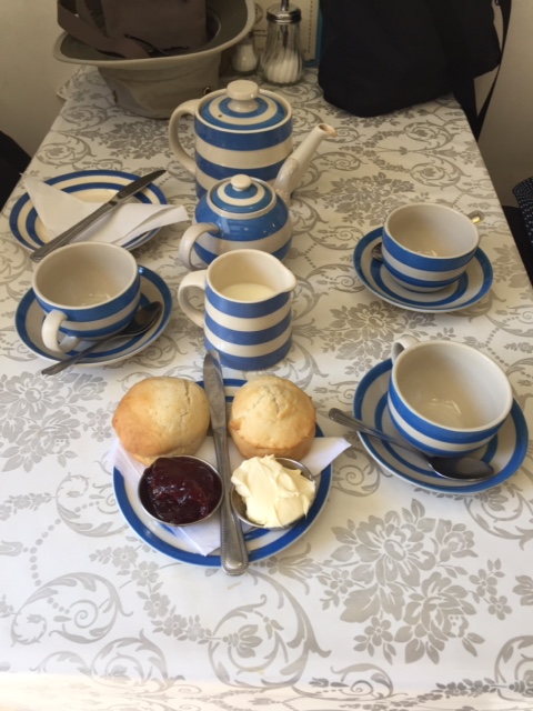
We ended our afternoon in Mousehole with a Proper Tea, at Jessie’s Dairy (11 Fore Street). Image courtesy of David Guy
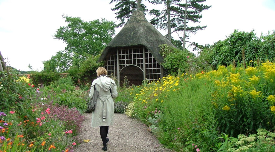
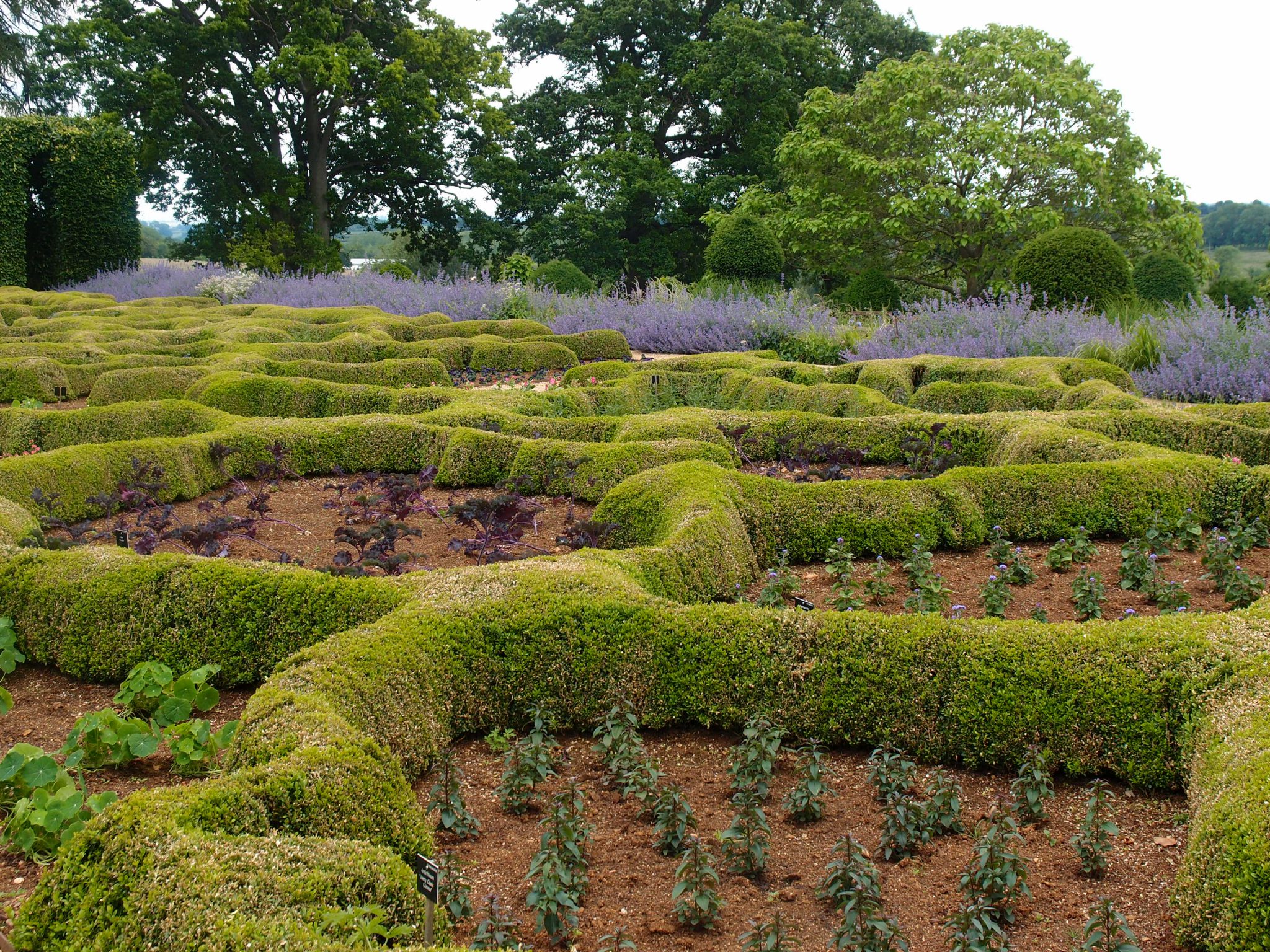
TREMENHEERE SCULPTURE GARDENS
near Gulval, Penzance, Cornwall TR20 8YL
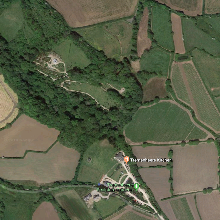
Aerial view of Tremenheere Sculpture Gardens
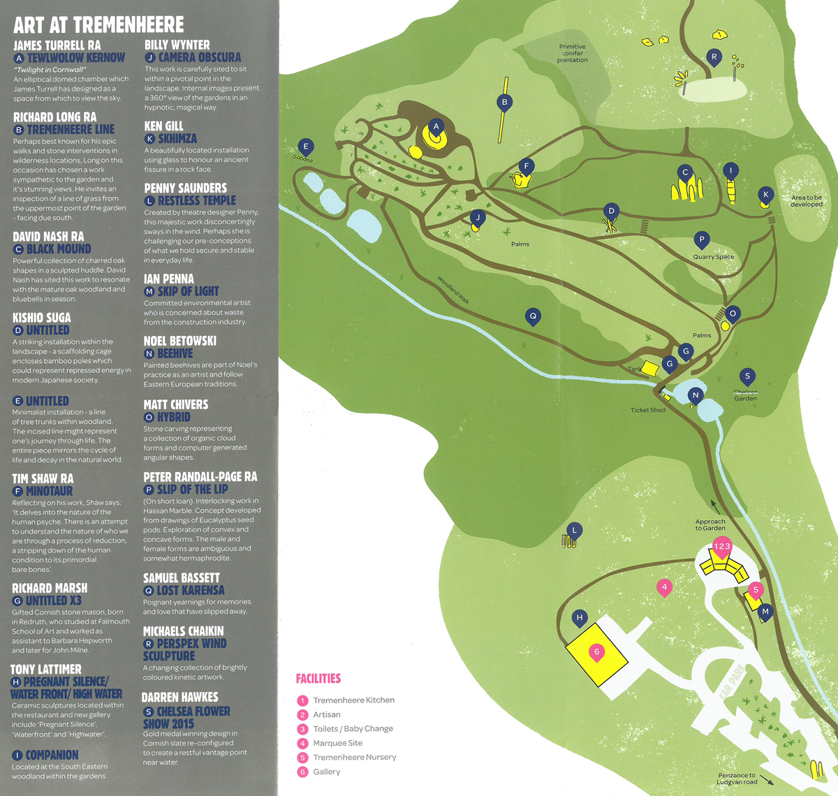
Plan of the Sculpture Garden
In the general context of British gardens, Tremenheere Sculpture Garden, which is being established upon land which its owner acquired in 1997, is still in its infancy. In England, even large-scale gardens which have been continuously developed for 40 years are still considered to be merely adolescent, and so garden-snobs will just have to be patient, while the physical reality of Tremenheere catches up to what it must already be, in the imagination of its creator,
Dr. Neil Armstrong.
That said, when visiting southwestern Cornwall, these 22 acres of parklands and semi-tropical gardens are NOT to be missed. Sprawling across a steep hillside which is split by a valley, the gardens offer spectacular views of St.Michael’s Mount and of Mount’s Bay. Tremenheere is embellished by cutting-edge architectural follies, decorated with large-scale sculptures, enlivened by a first-class plant nursery, and enriched by an art gallery. And the presence of its excellent Café makes a day-trip to the gardens very satisfying, in every respect.
Since I don’t rephrase what others have already stated quite well, I’ll quote from Tremenheere’s Visitors’ Brochure, which explains the History:
“Prior to 1294 the land at Tremenheere was owned by the monks of St.Michael’s Mount. Michael De Tremenheere bought the land at that time…and thus began an unbroken lineage of 600 years where the owner of the land carried the name Tremenheere. This persisted until 1890 with the last Tremenheere being Seymour.
The gardens are greatly indebted to this man as it was he who planted the beech, the oak, the sweet chestnut and holly throughout the woods in or around 1830.”
“The land at Tremenheere was said to be the vineyard for the Mount in the 15th Century. Much later in the 1800s it was a noted strawberry growing area with products being exported to Newfoundland.”
“The land is south facing with good soil. It is early favoured land, largely sheltered from prevailing winds by the mature woodland and the particular valley landscape. A free flowing stream runs through the bottom of the valley and several substantial ponds are aligned nearby. The total area amounts to 22 acres and is situated a mile east of Penzance along a stretch of land known as the Golden Mile.”
“After the Tremenheere lineage fell away the Pearce family farmed the land for 4 generations until 1997, when Dr. Neil Armstrong acquired the core valley to which other fields were added in the interim. Neil acquainted himself with the land in tackling heavily overgrown scrubby woodland with 10 foot high brambles, wild rhododendron and impenetrable swamp.”
“The land however immediately announced itself as having tremendous potential with its natural assets – the habitats were varied from pond to dry, arid slopes. A planting scheme and landscape design was largely dictated by these natural features.”
“There was no big house or driveway, which allowed him to create paths to follow the natural camber of the hillsides using directional prompts and framing vistas as appropriate. The steep terrain dictated the need for access tracks and these conveniently compartmentalized the garden, creating slightly different moods in different areas.”
“The guiding principle has been to evolve a naturalistic, arcadian space blending the elements of landscape, planting and art to create a place for contemplation and wonder.”
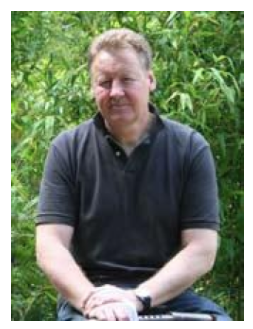
Dr. Neil Armstrong (NOT the astronaut!)
Is this an Ambitious Enterprise? Yes Indeed. As he creates his garden, Dr. Armstrong is doing what fewer and fewer people in England—or anyplace else—have the will or the means to accomplish. Dr. Armstrong is part of a select group of people, who—instead of lavishing their time and money upon yachts or sports teams—are continuing the grand, deeply civilized tradition of creating World-Class Gardens, from scratch. Such endeavors, even if they might be perceived by some as vanity projects, ultimately benefit all of us who cherish gardens.
Now, a slight Detour, with a Note: During my annual visits to England, I’ve found four other relatively-NEW, expansive, and uniquely-styled gardens, which have already achieved world-class significance. In future Armchair Diaries, which will cover more regions in England, I’ll take you on tours of the following extraordinary places:
#1: Broughton-Grange Garden, in Oxfordshire.
Land acquired in 1992, and a massive garden expansion begun in 2001.
Designer: Tom Stuart-Smith.
The Parterre, at Broughton Grange
#2: Upton Wold Garden, in Gloucestershire.
Land acquired in 1973. Initial garden plan
by designer Hal Moggridge, with continual
additions by the owners, Caroline & Ian Bond,
as well as by other designers.
Upton Wold’s Labyrinth (designed by Hall Moggridge)
#3: Wollerton Old Hall Garden, in Shropshire.
Since 1984, designed and developed by the owners,
Leslie and John Jenkins.
Wollerton Old Hall,
The Upper Rill
#4: East Ruston Old Vicarage Garden, in Norfolk.
Land acquired 40 years ago, with gardens designed
entirely by the owners, Alan Gray and Graham Robeson.
East Ruston Old Vicarage Garden, The Desert Wash
Let’s return to Tremenheere, where we’ll begin our Tour of the Site.
[Note: the Gardens are closed, from late October through mid-February.
The Kitchen Restaurant is open, year-round. Daily: 10AM—4PM;
and on Friday & Saturday, from 6PM until “late.”]
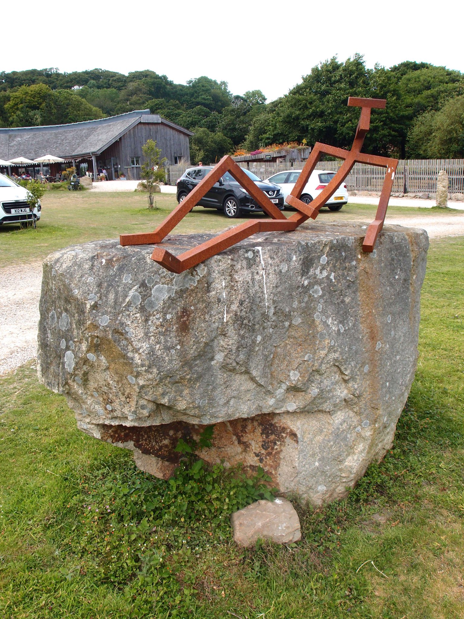
In the Car Park, a Rusty Reclining Man
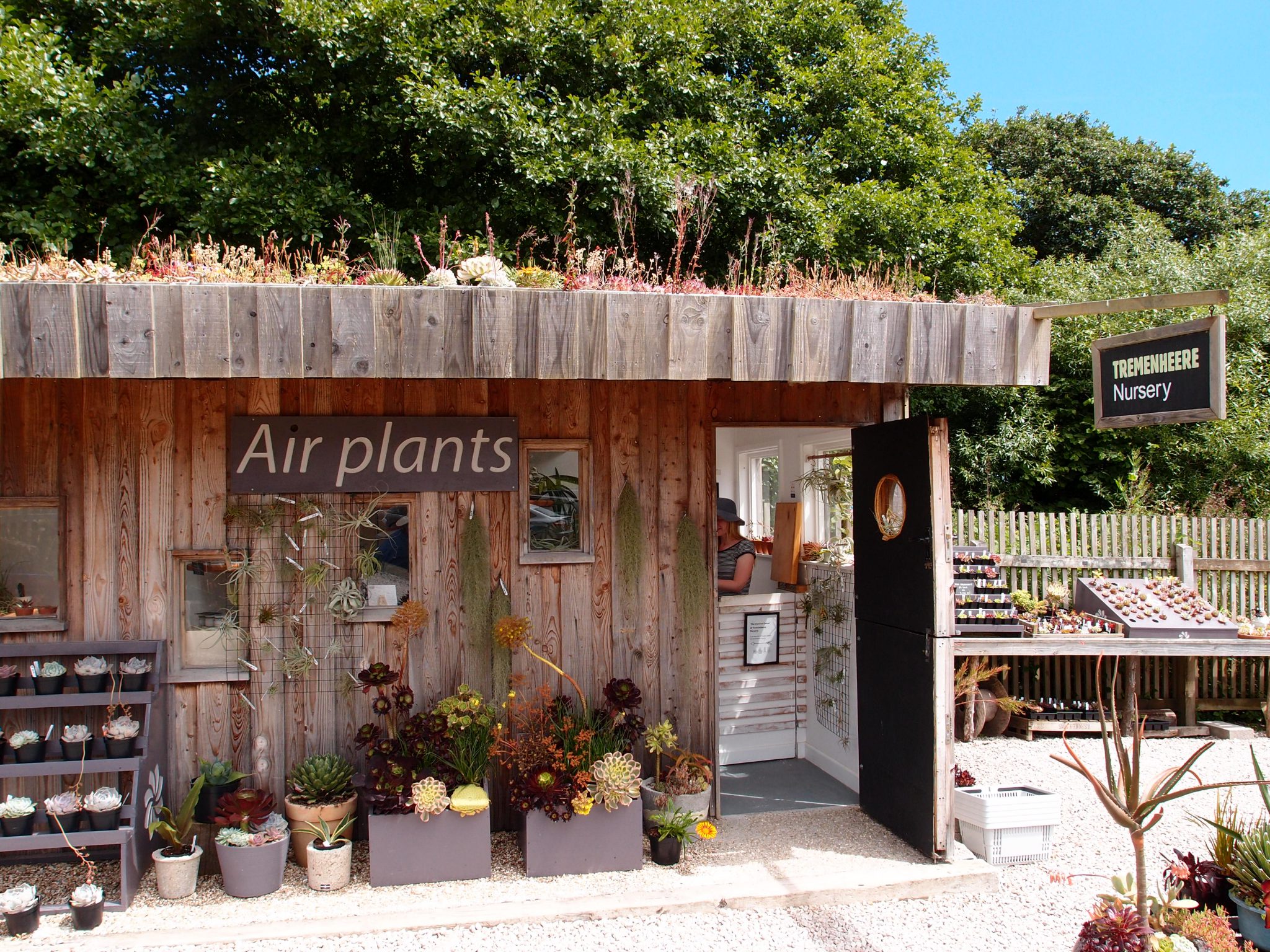
The Plant Nursery
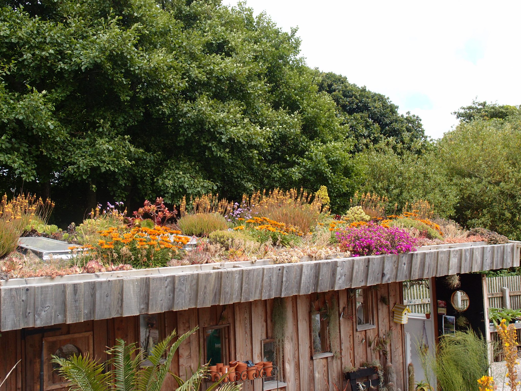
The Nursery’s Living Roof
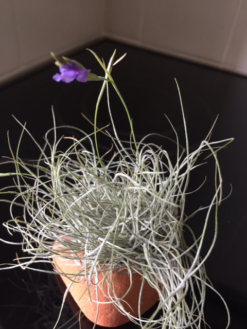
Anne & David bought this Air Plant, which they then carried for the next 2 weeks of our travels….this is when a car’s front-seat cup-holders come in handy! The unfussy plant took well to tourism, and very soon produced this blossom. Photo courtesy of Anne Guy
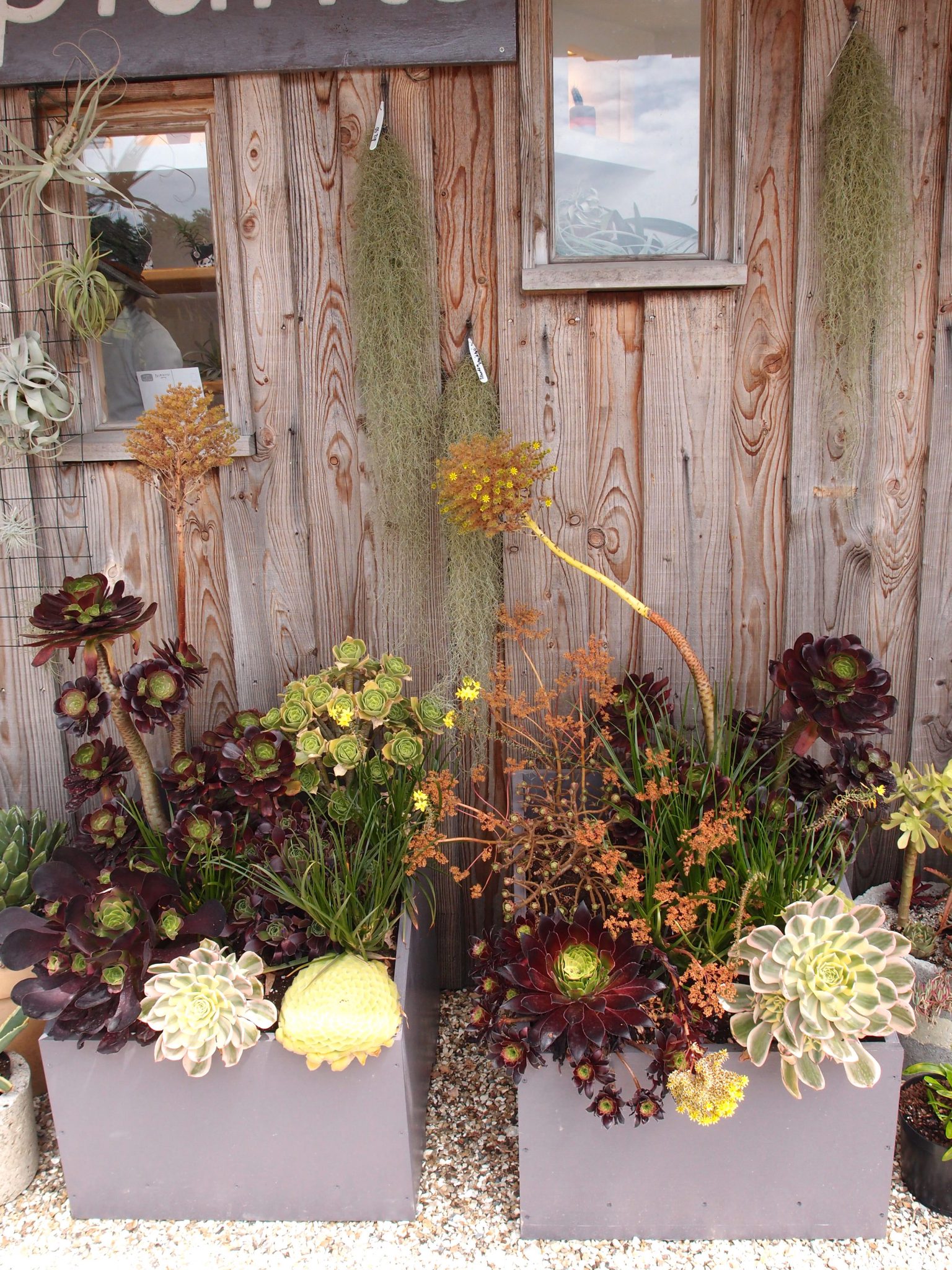
A beautifully-composed display of succulent plants, at the Nursery
Succulents
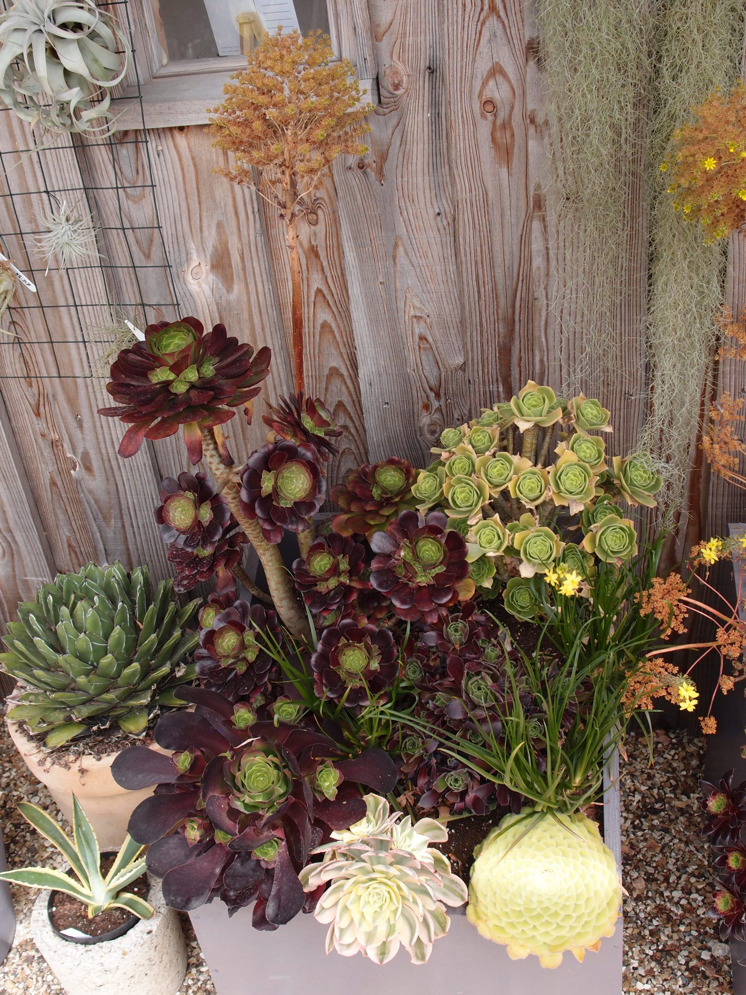
Pots and Pots of Plants, for sale at the Nursery
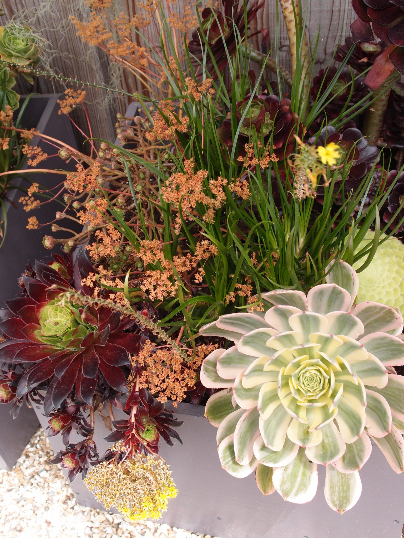
Succulents

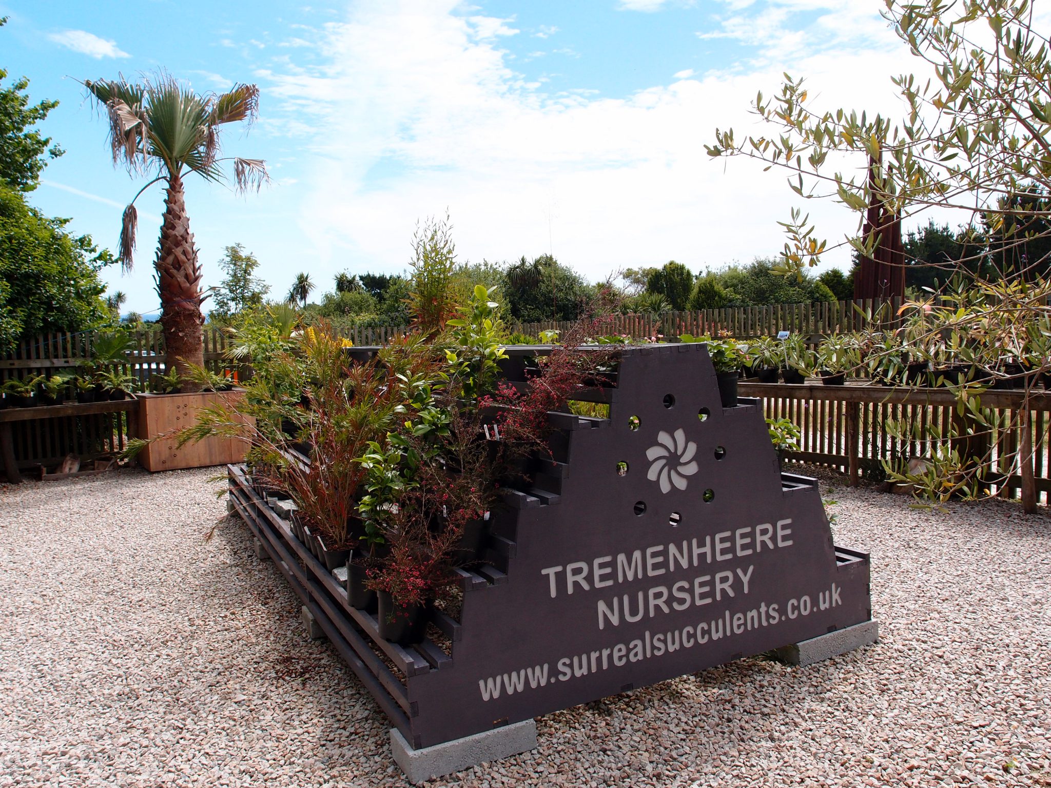
Yes! They ship….to anywhere in the World.
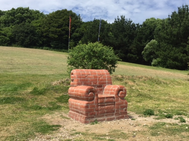
A Not-So-Comfy-Chair, near the Plant Nursery.
Photo courtesy of David Guy.
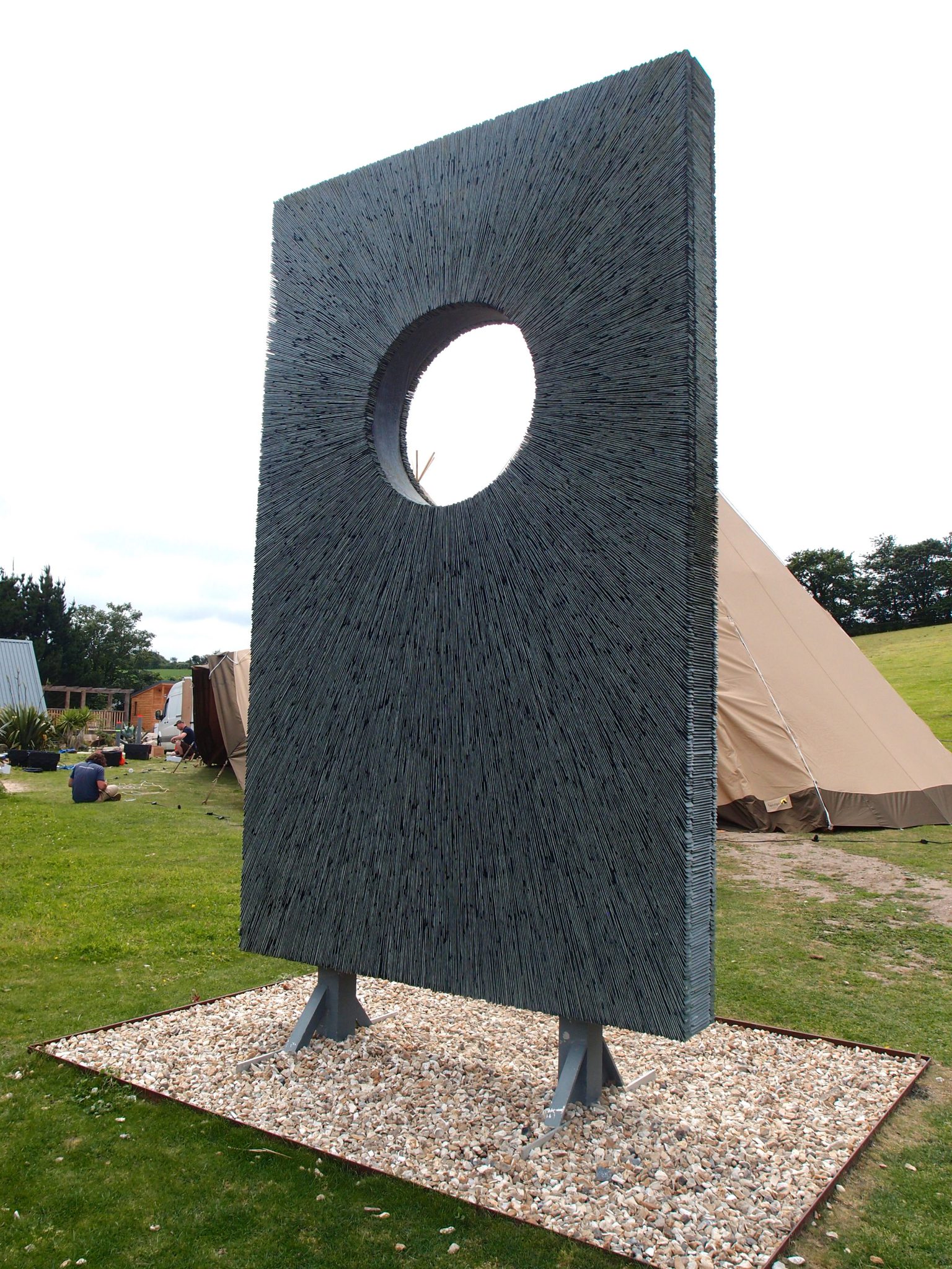
Adjacent to the Kitchen Restaurant, a Radiating Assemblage of Cornish Slate Tiles
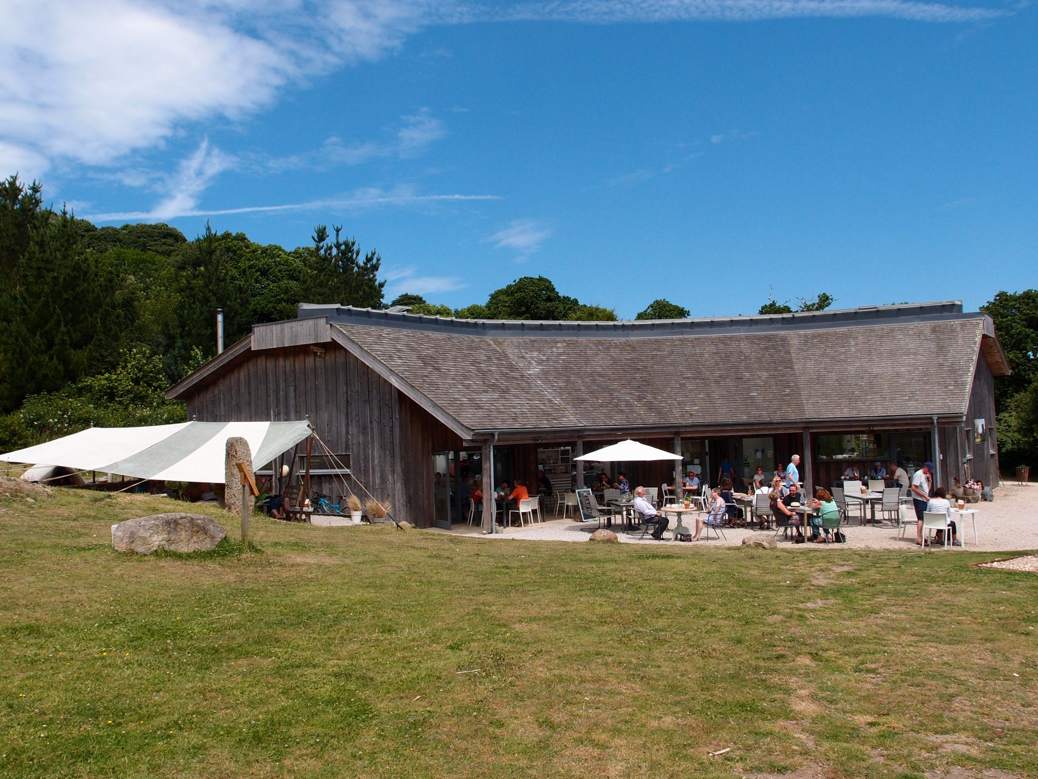
Tremenheere’s Kitchen Restaurant has both indoor and outdoor tables. I highly recommend their Tempura of Seasonal Vegetables, with sweet chili dip.
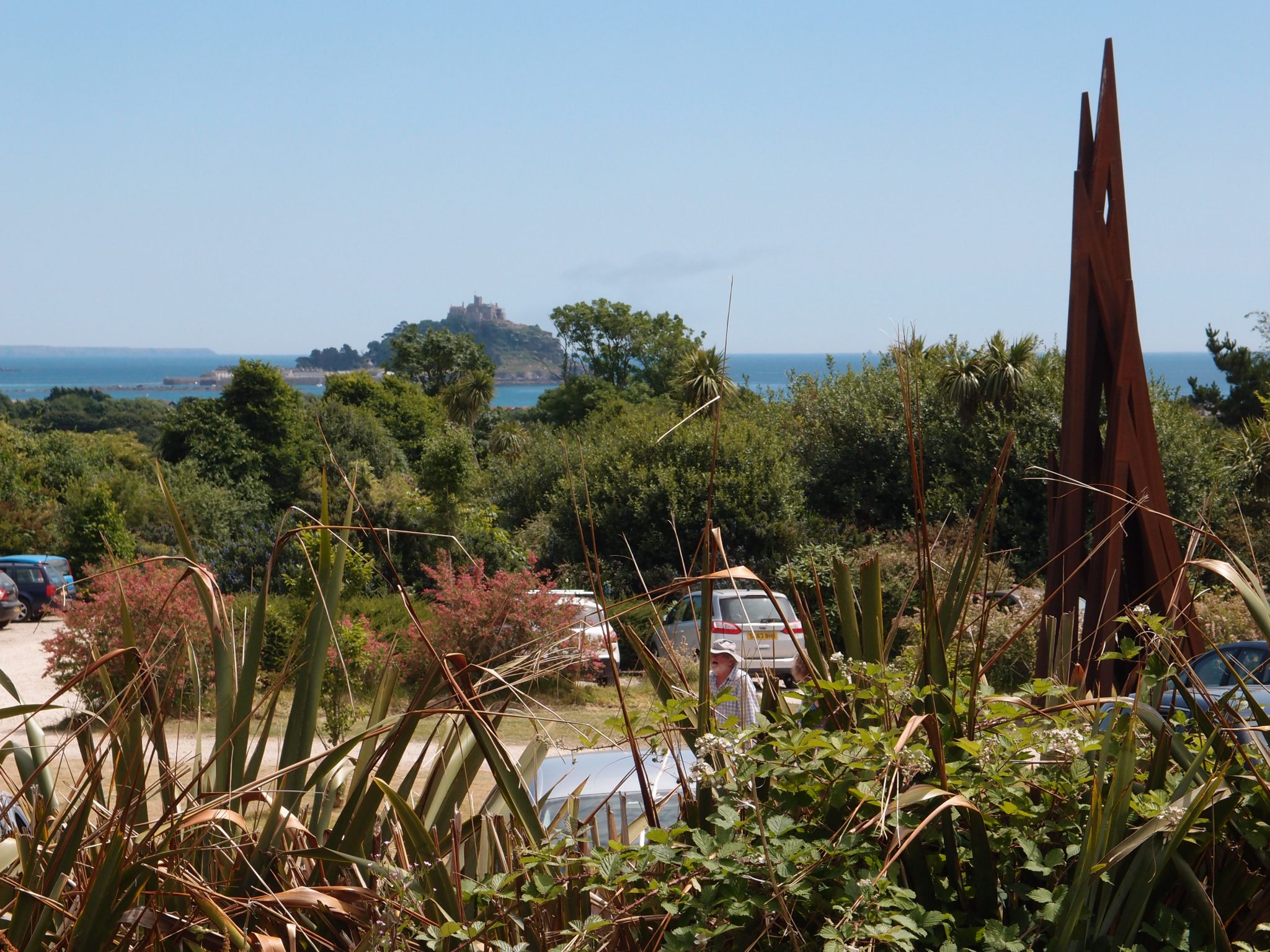
The view from our outdoor table, at the Kitchen Restaurant. St. Michael’s Mount—a tidal island in Mount’s Bay—is in the distance.
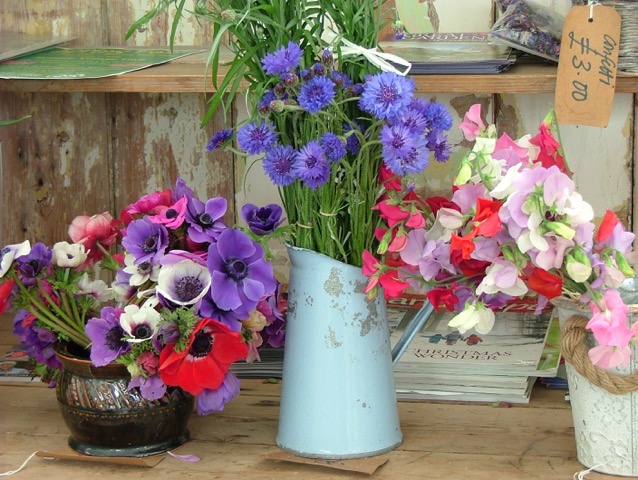
At the Gift Shop: Just-picked Posies, grown on-site. Photo courtesy of Anne Guy.
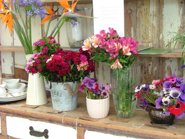
More Nosegays, in the Gift Shop. Photo courtesy of Anne Guy.
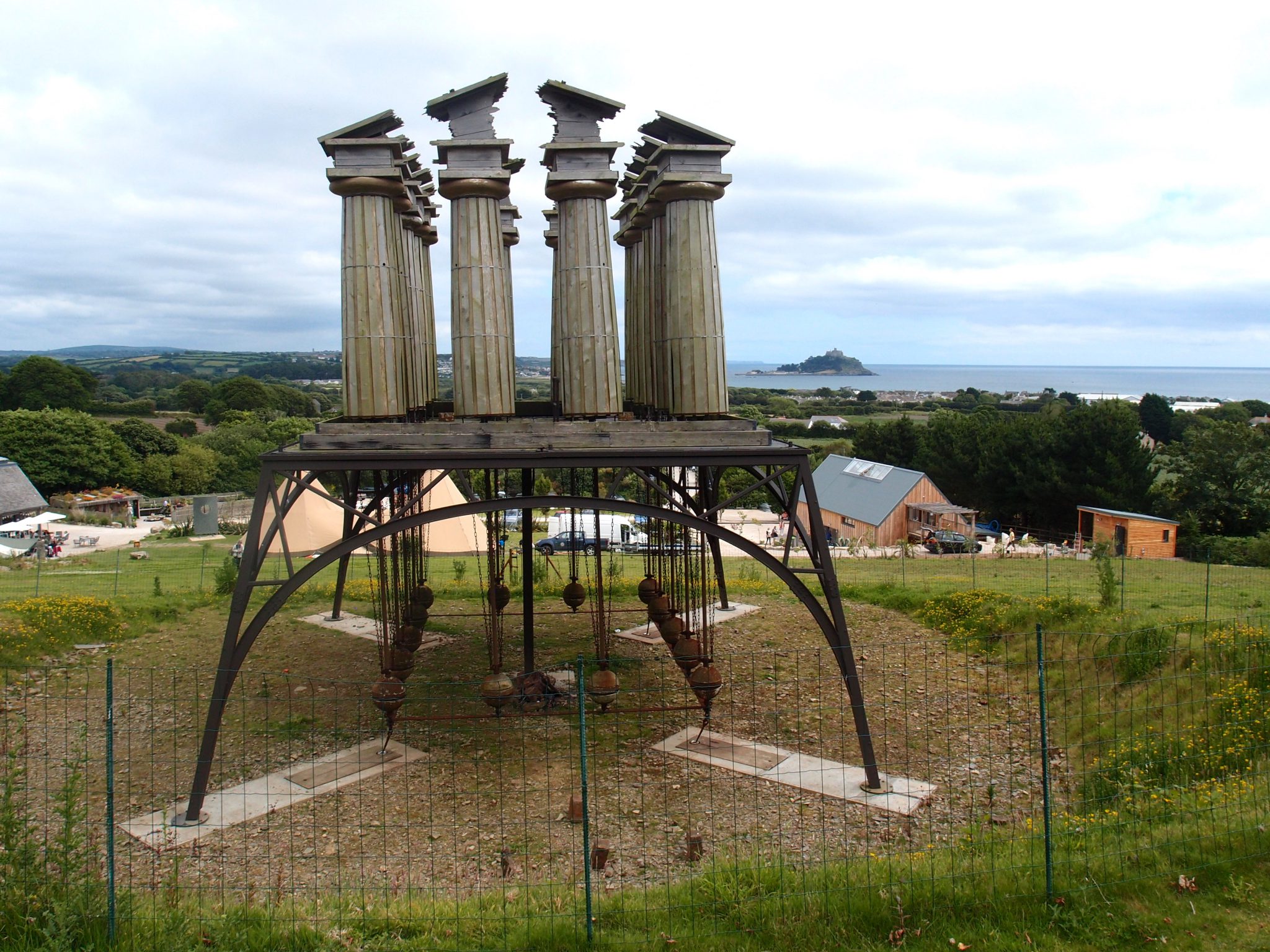
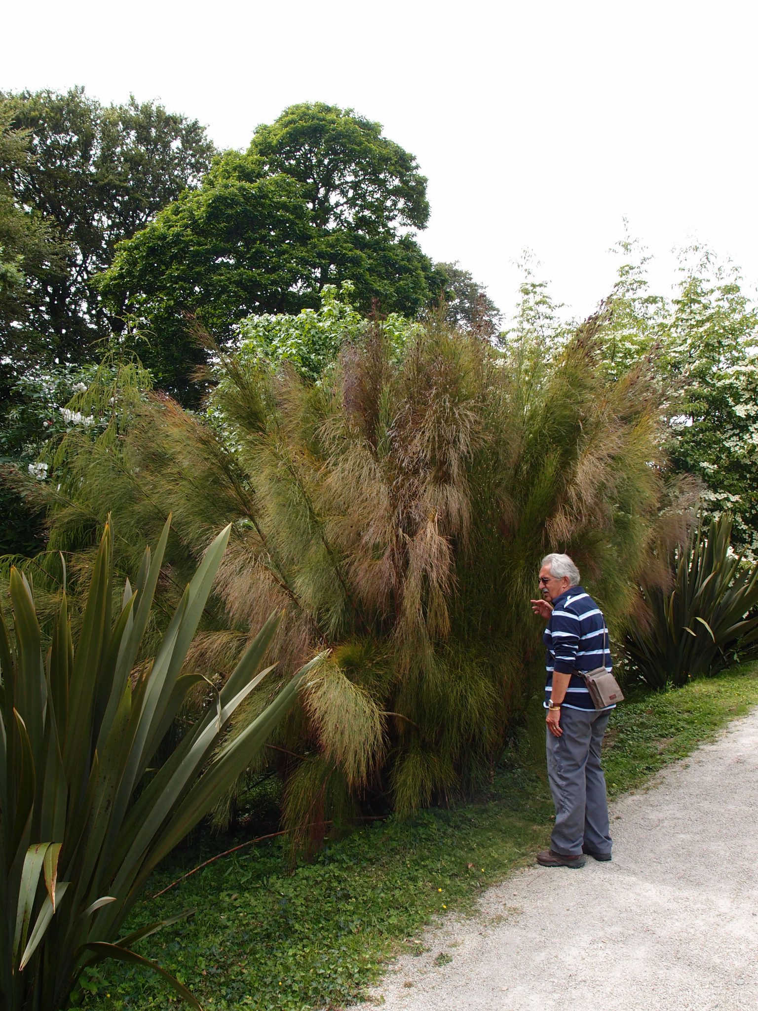
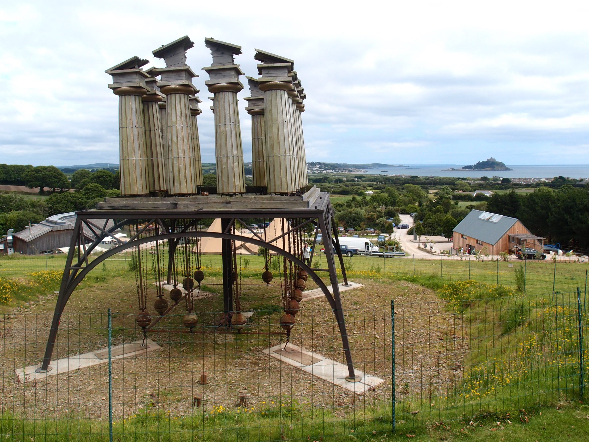
We begin to hike uphill, towards the Gardens, but are immediately distracted and then utterly waylaid by a Marvelous Contraption. A wooden temple is balanced upon an iron platform, whose black legs seem spiderish. The Temple’s dilapidated columns are quivering, or sometimes swaying every which way…their unpredictable movements prompted by the merest whispers of the ocean breezes which blow, up from Mount’s Bay. Beneath the platform, multiple pendulums are swinging slowly and purposefully. Although clearly an Architectural Thing, this Looming and Wondrous Construction feels Alive, and is the brainchild of Penny Saunders, who unveiled her RESTLESS TEMPLE at Tremenheere in 2015.
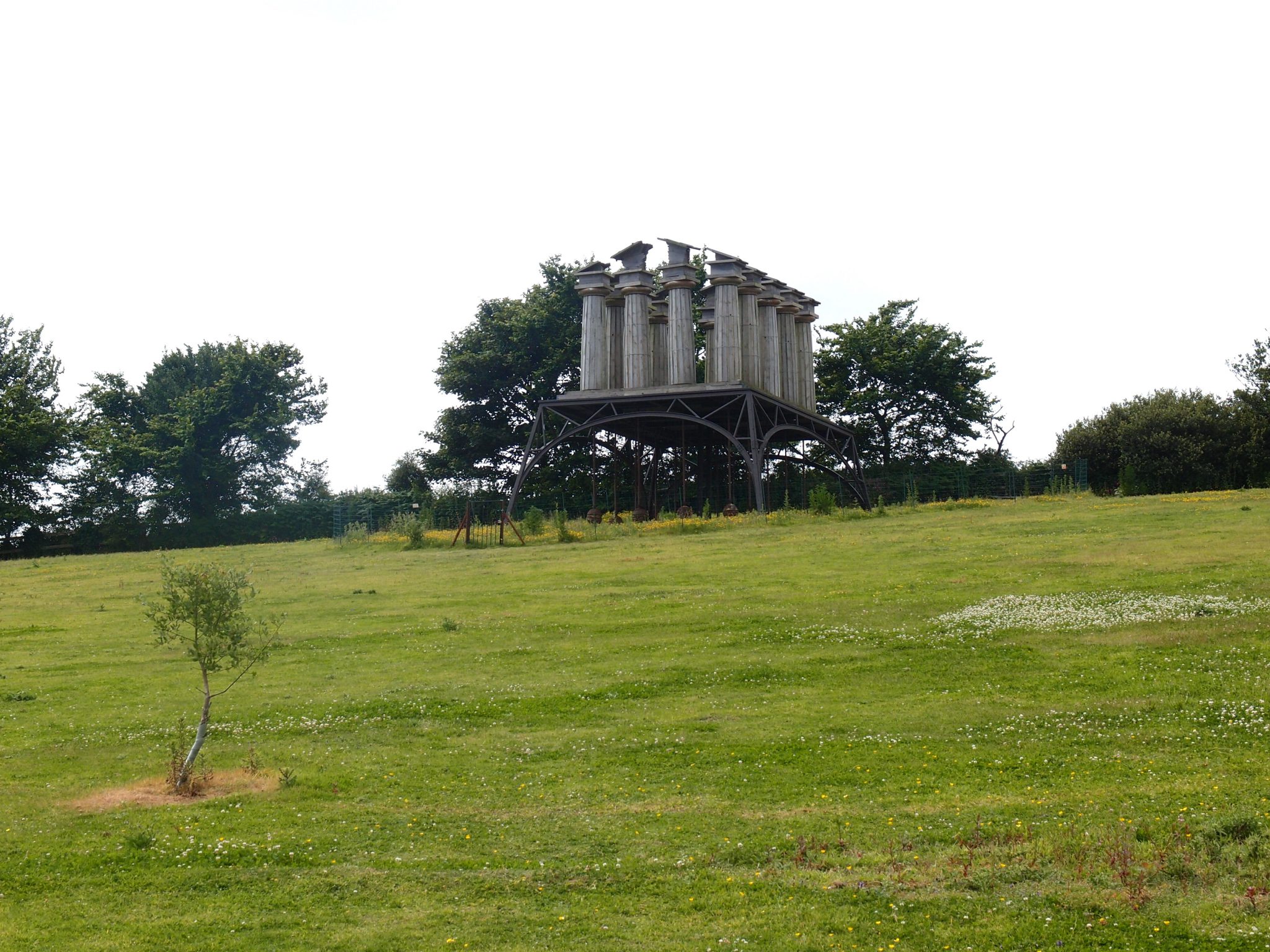
RESTLESS TEMPLE, by Penny Saunders
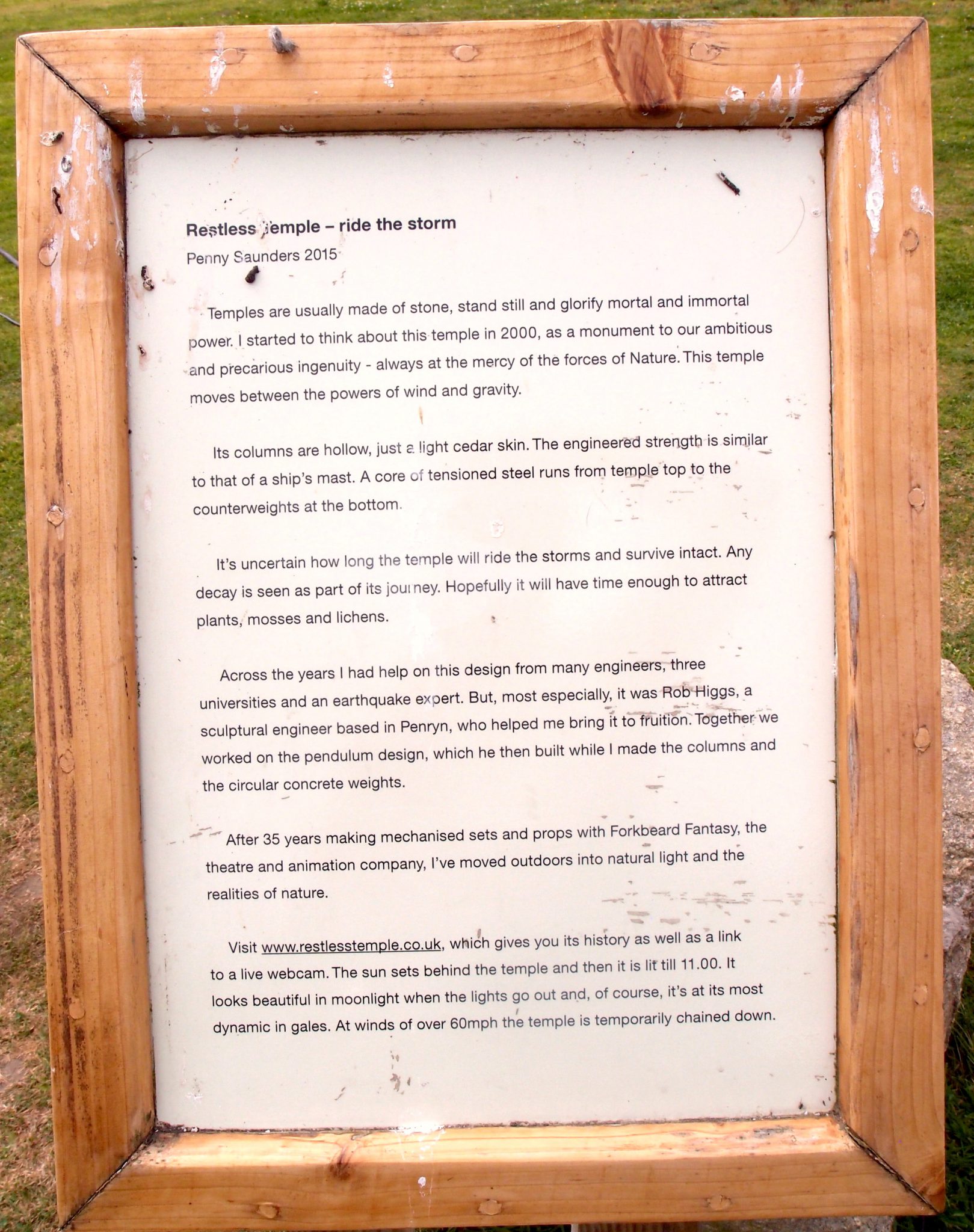
The Artist’s Statement, about RESTLESS TEMPLE
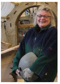
Penny Saunders. The artist worked for 35 years making mechanized sets and props with Folkbeard Fantasy, the theatre and animation company. She says that she’s now “moved outdoors into natural light and the realities of nature.”
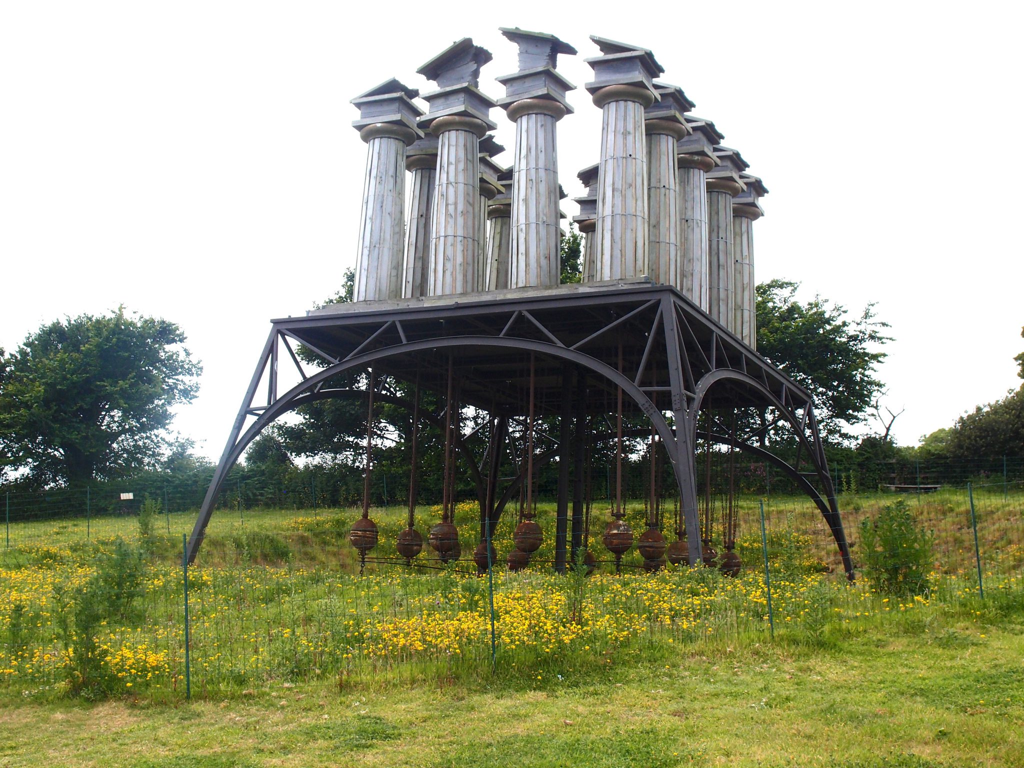
RESTLESS TEMPLE. My frozen-moment-in-time photo cannot show how this machine of wood and metal and concrete NEVER stays still. The TEMPLE actually seems to fidget; its columns seem undecided, and do not necessarily all tilt in the same direction when the wind blows.
Below-decks, the heavy pendulums, which also continually move,
seem deliberate, and almost calm.
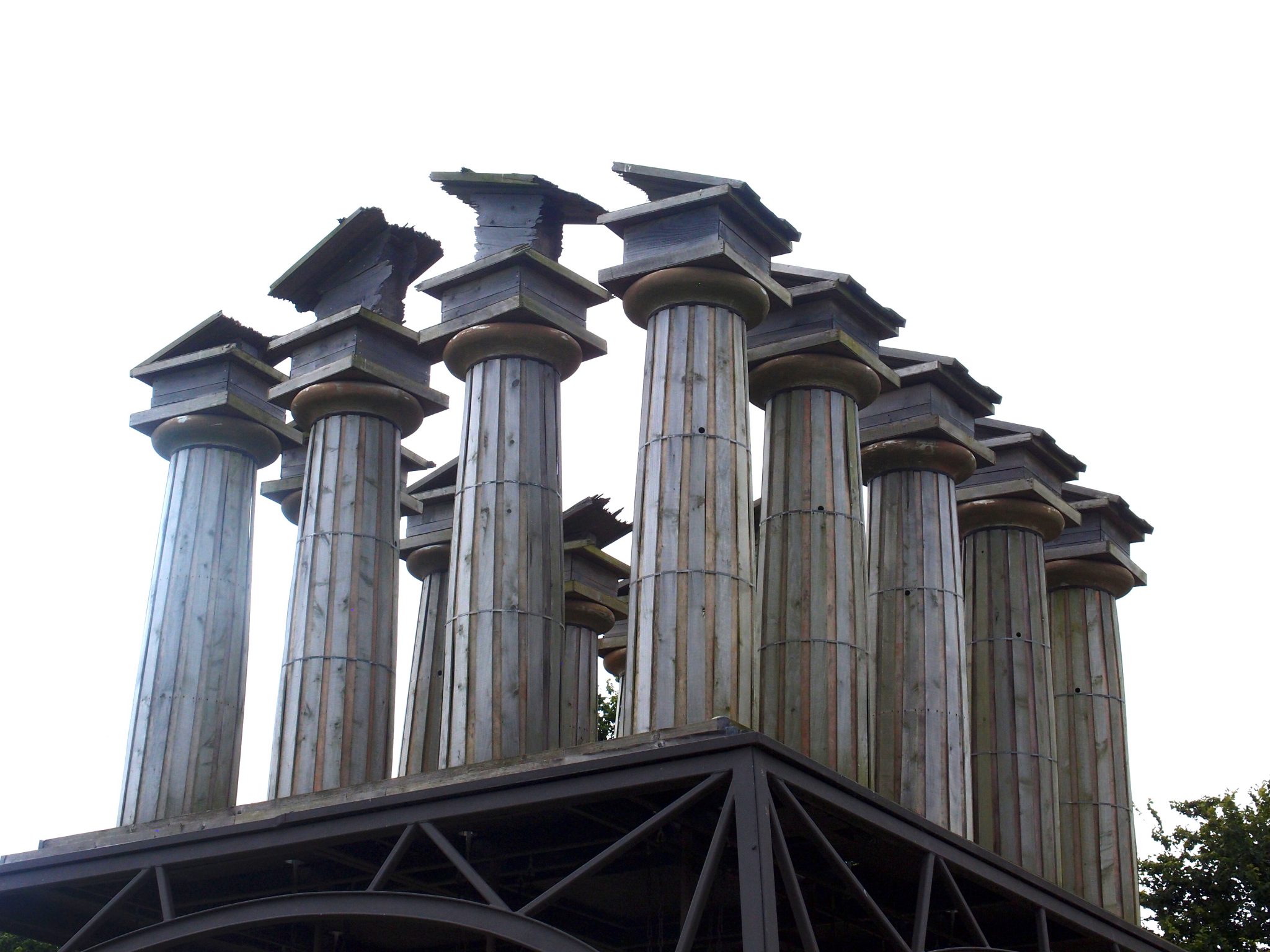
RESTLESS TEMPLE: detail of columns, which are clad with thin pieces of cedar
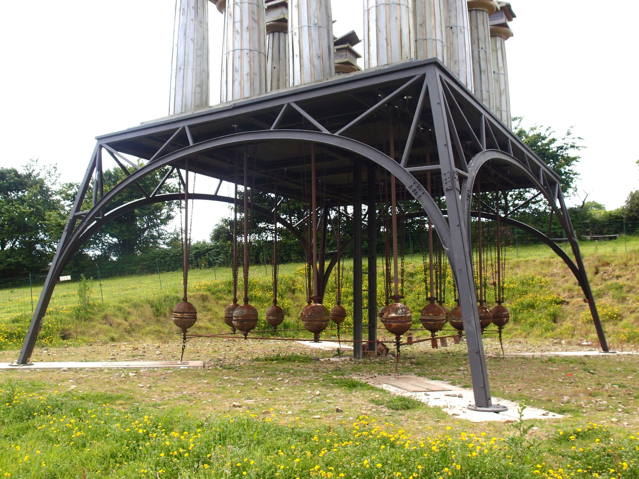
RESTLESS TEMPLE: detail of base, from which hang circular concrete pendulum-weights
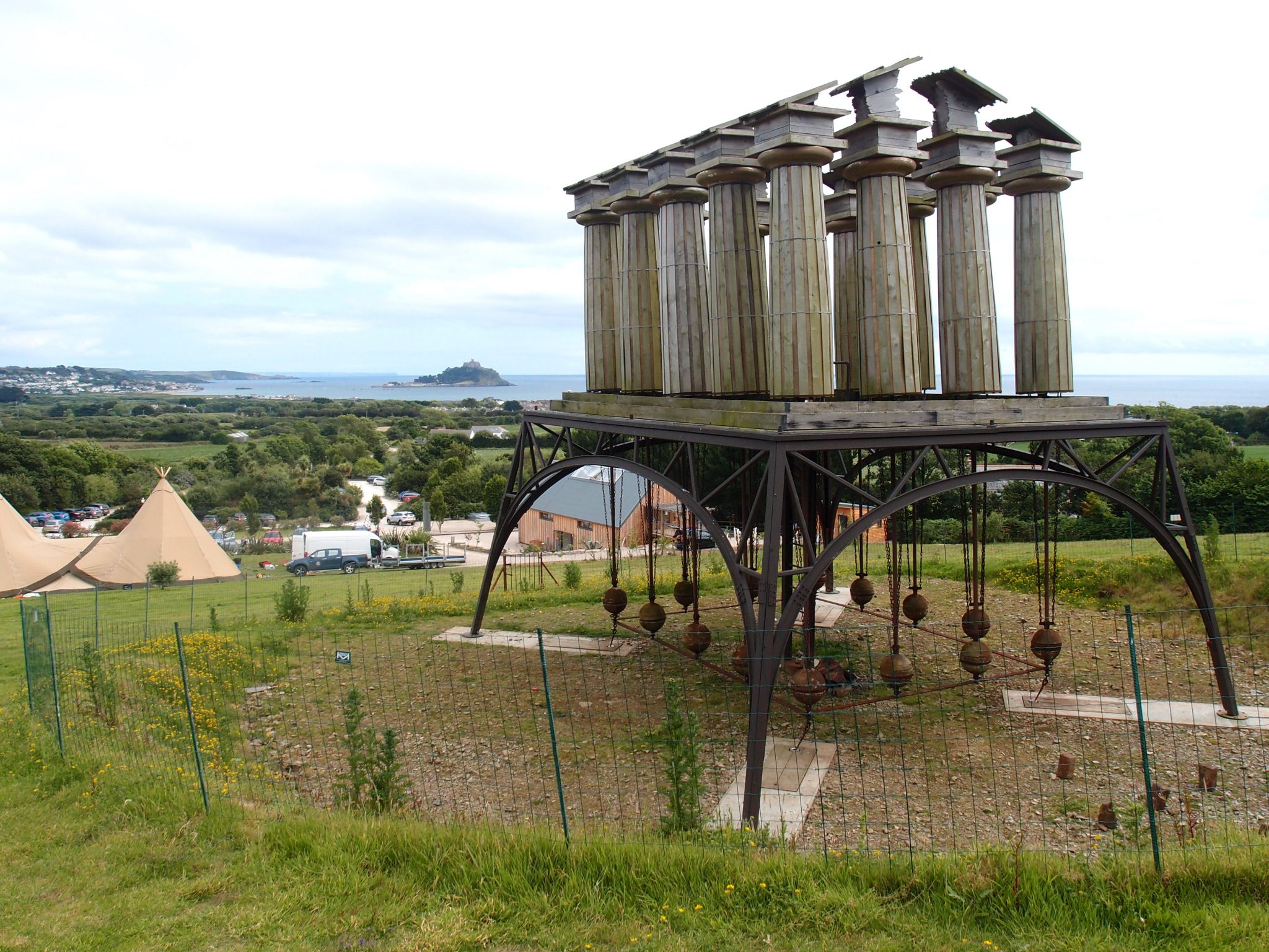
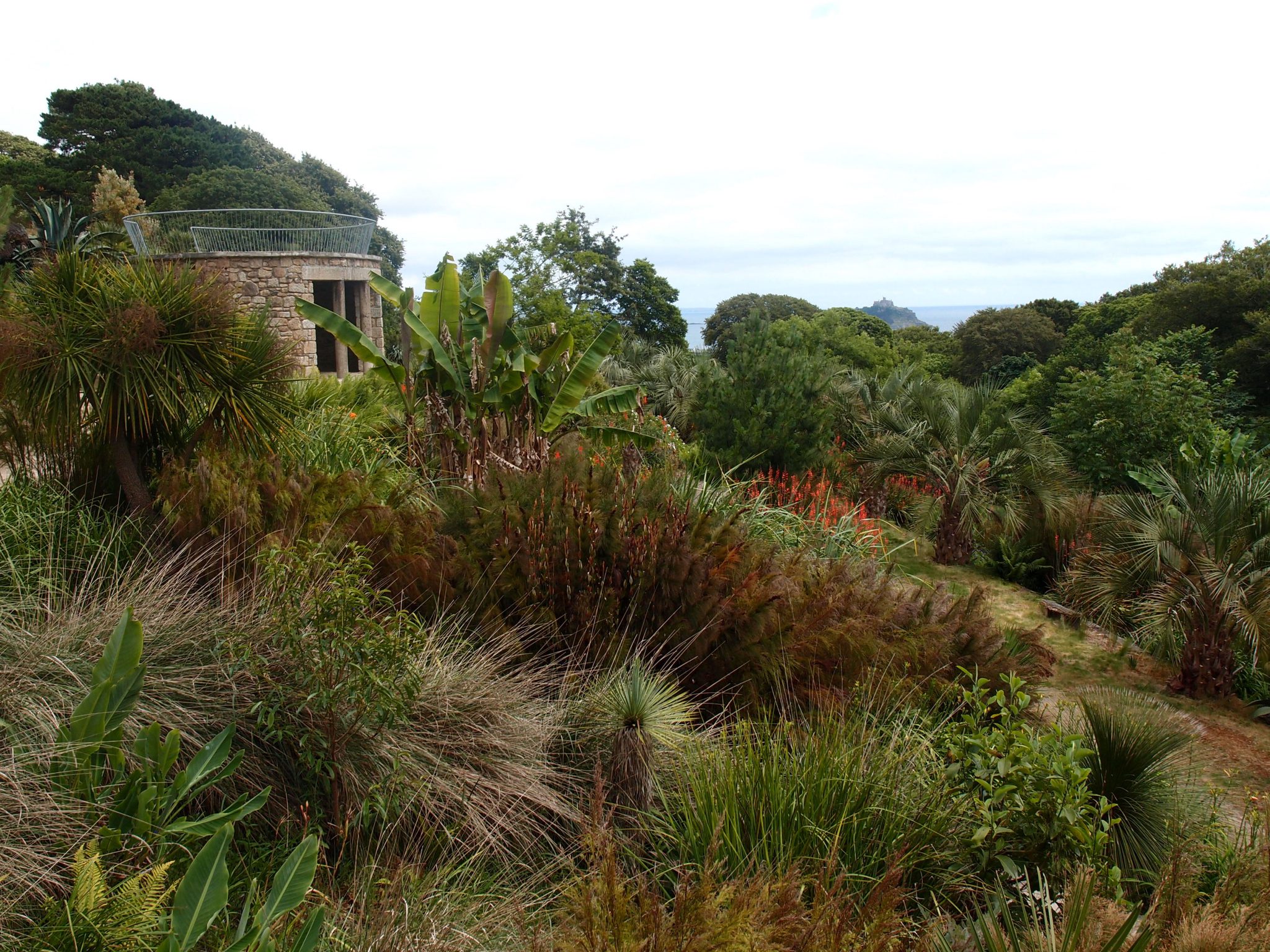
RESTLESS TEMPLE, with a distant view of St.Michael’s Mount, in Mount’s Bay. The close-by teepees are
fixtures of Tremenheere’s Marquee Site.
As the RESTLESS TEMPLE shifts, it is simultaneously familiar, unnerving, funny, thought-provoking, delightful, and hypnotic.
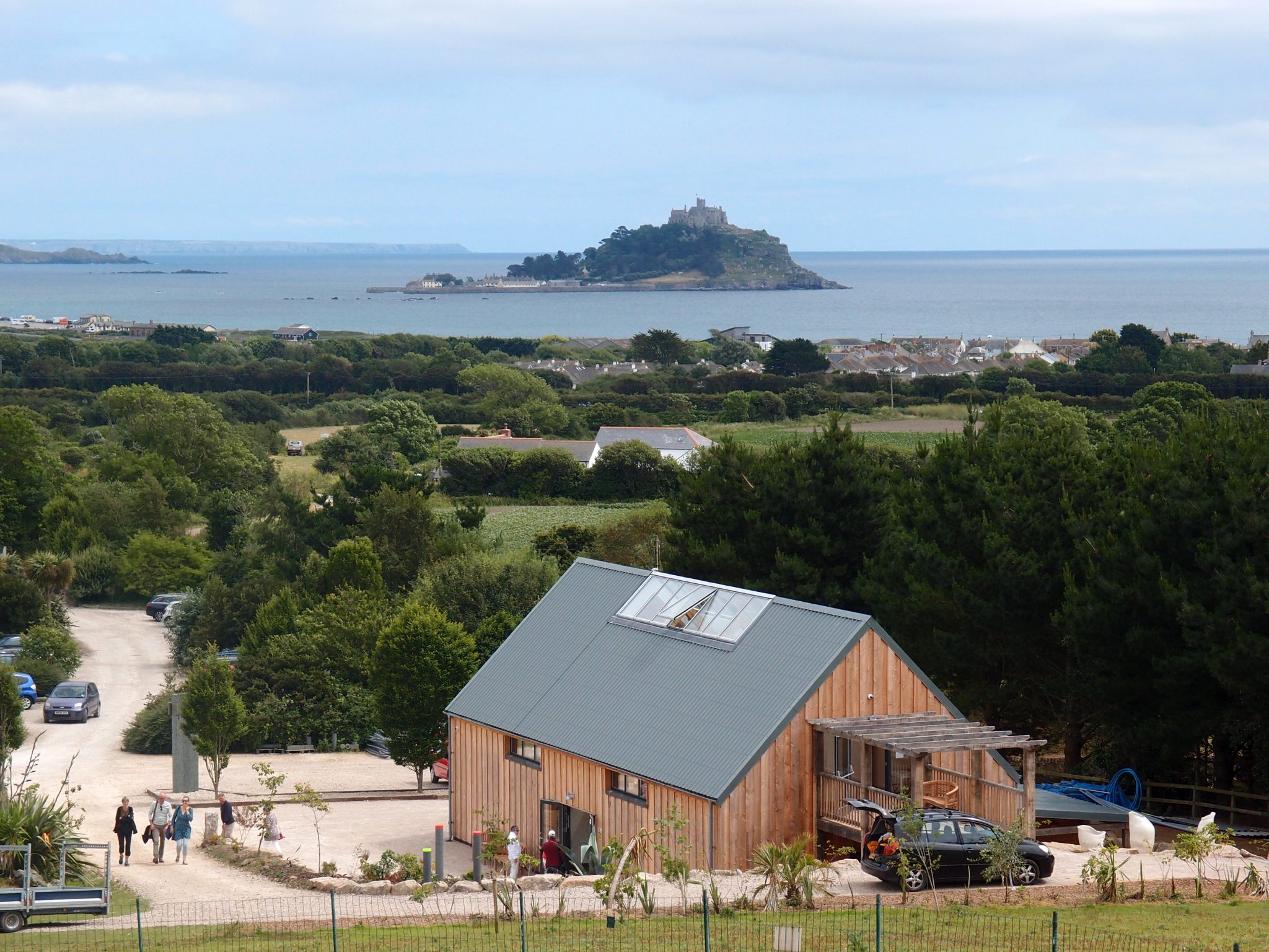
As seen from the RESTLESS TEMPLE site: Tremenheere’s Gallery building is in the foreground. In the distance, St.Michael’s Mount is in the Bay. When I took this photo, the tide was IN, and the causeway which connects The Mount to Marazion, on the mainland, was totally submerged.
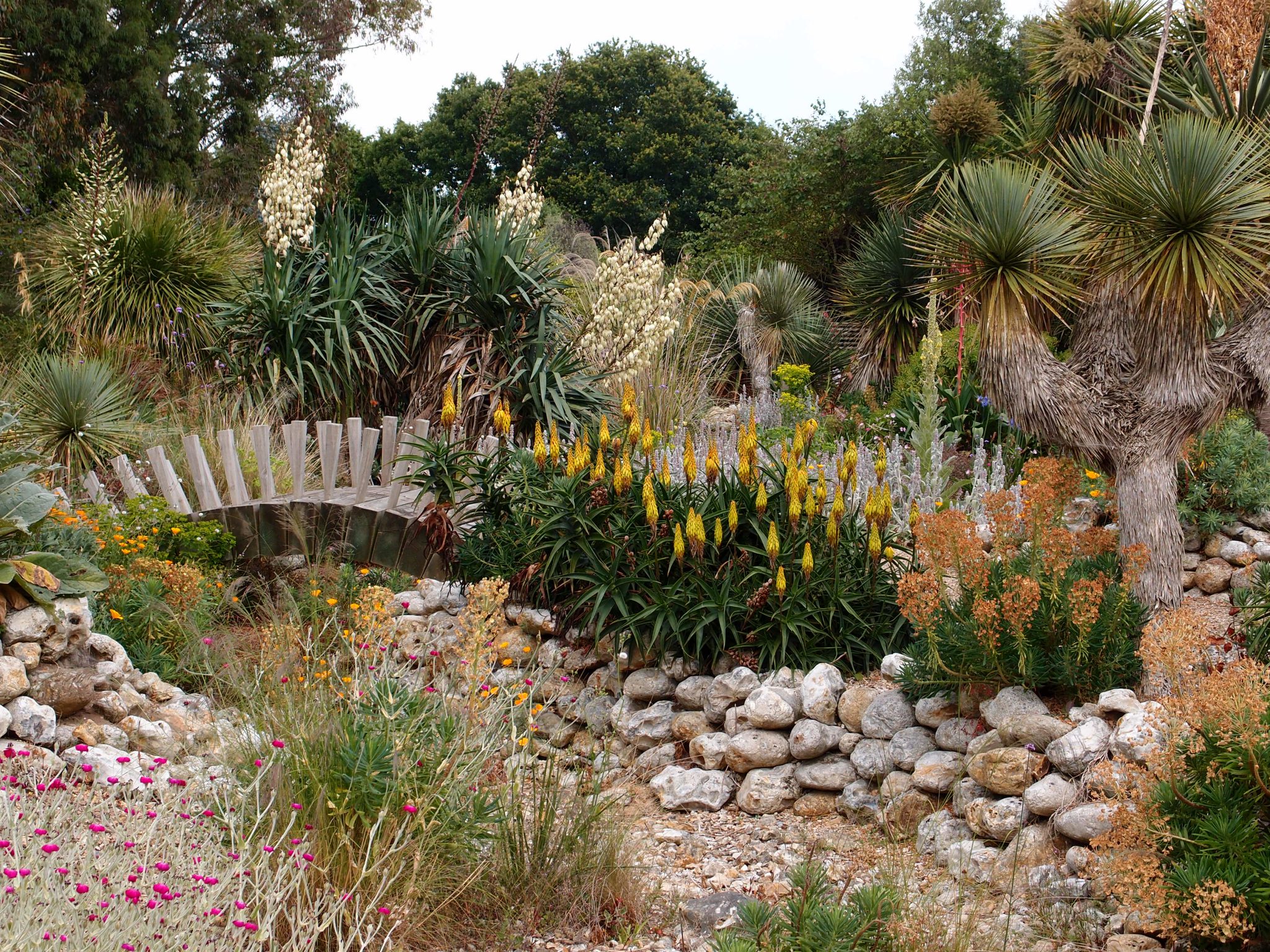
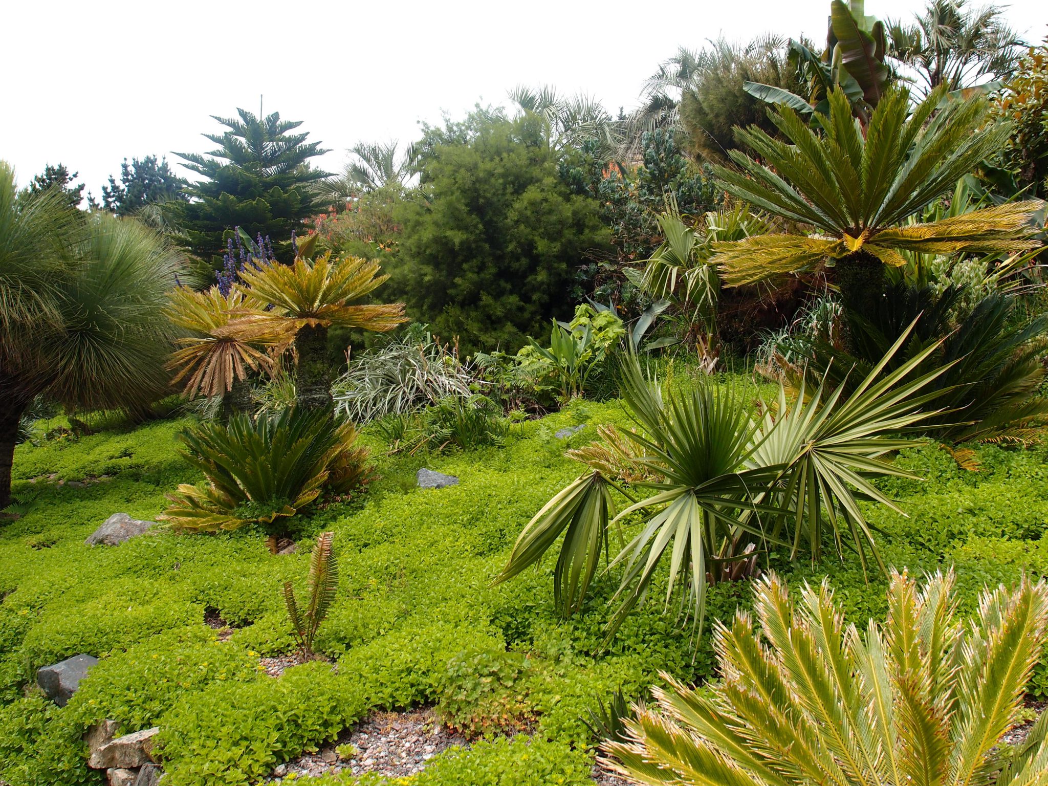
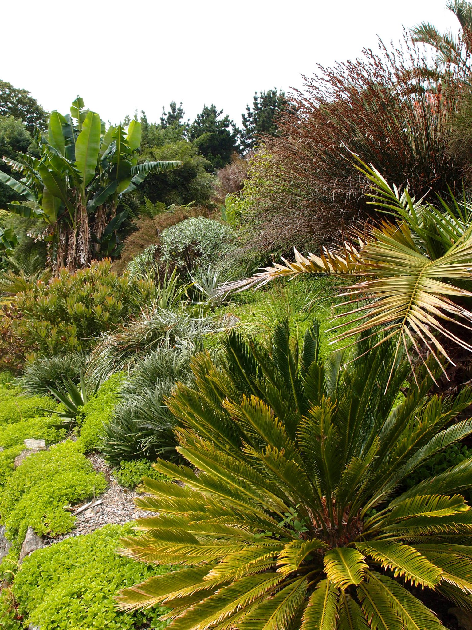
We enter the Gardens. David leads the way, up a long path which bisects the Palm Garden.
Over 50 distinct garden areas have been established at Tremenheere. Grouped within each area are perennials and trees which have been chosen to flourish in each, specific micro-climate. Tremenheere’s website includes exhaustive lists of every plant
which the gardeners have added to the site. I include the following map of the garden areas, simply to illustrate the complexity of this ambitious horticultural enterprise.
Locations of the various garden areas, at Tremenheere. [Note: for complete lists of plant species in each area, consult the Tremenheere website.] Image courtesy of Tremenheere.
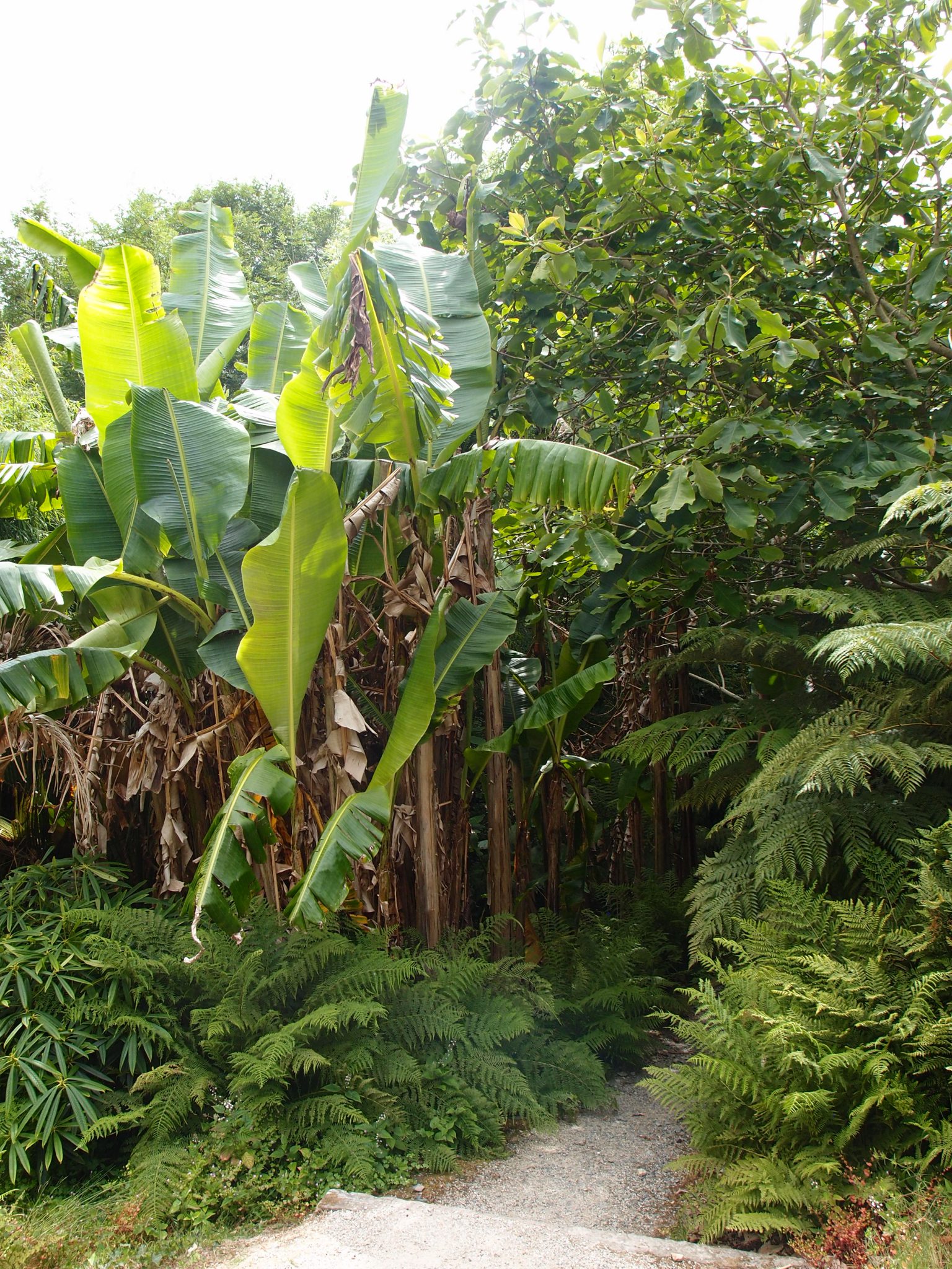
Lush, semi-tropical plantings. Yes, those are banana trees, flourishing in Cornwall. None of the thousands of non-native plants and trees which are planted the
Gardens require coddling, in Wintertime.
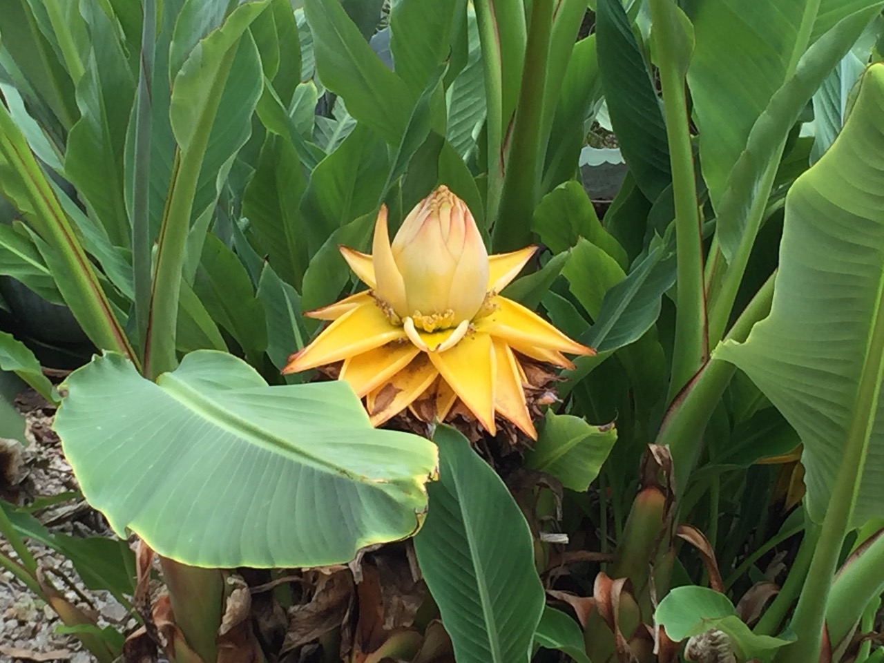
The banana plant, originating in Southeast Asia, is the World’s largest herbaceous flowering plant. This close look at a banana flower, courtesy of Anne Guy.
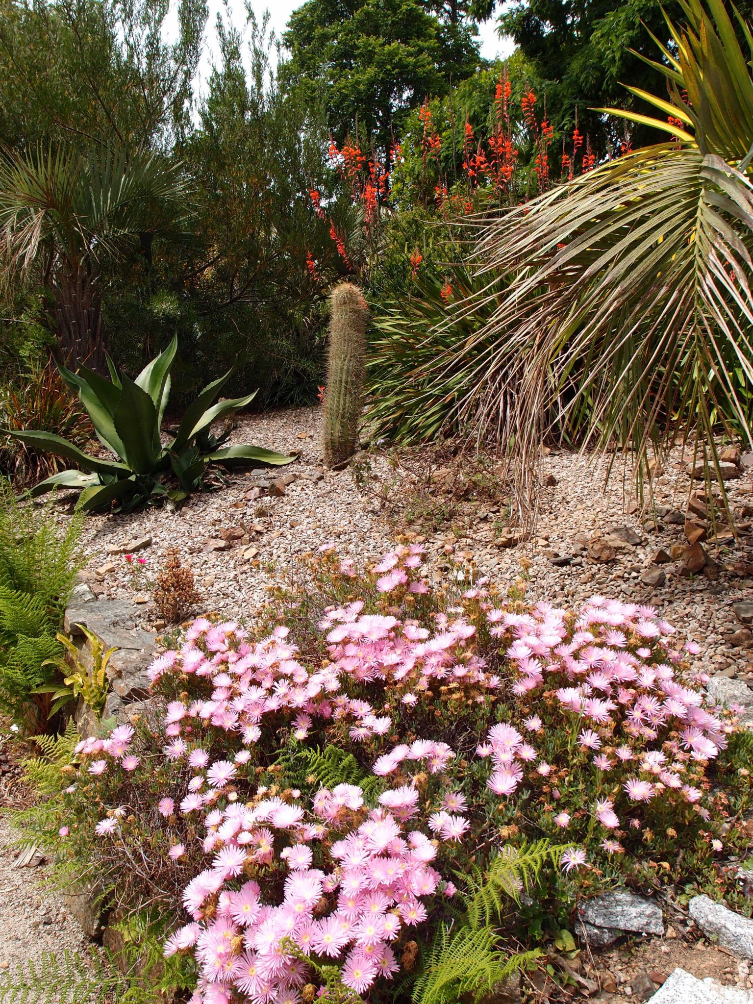
Alongside the path, more exotic gardens, with plant IDs kindly supplied by Anne Guy. Front: pink flowers are Lampranthus (from Southern Africa). Center left: Agave (from Mexico). Center: Cactus (South and Central Americas). Rear: orange flowers on tree are Isoplexis (Canary Islands).
A beautifully-balanced composition of plants. Per Anne:
Spiky tree at far left is Xanthorrhoea Grass Tree (from Australia).
Yellowish plants in foreground, middle and left are all Cycads (which have been on Earth since the Jurassic age).
Fan shaped plant is Trachycarpus Palm (from the Himalayas).
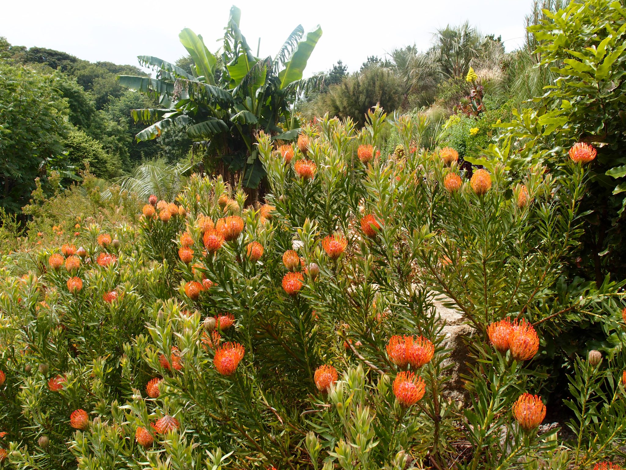
Per Anne: At the front, Protea (South Africa), with its vivid orange blossoms. A Banana is at the rear.
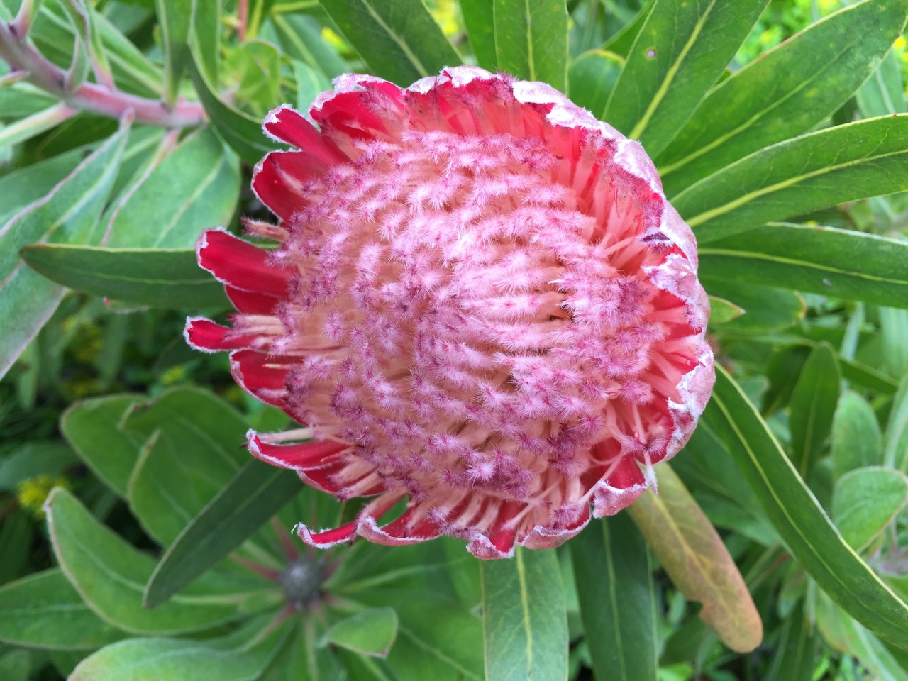
Protea blossom, close up. Photo courtesy of Anne Guy.
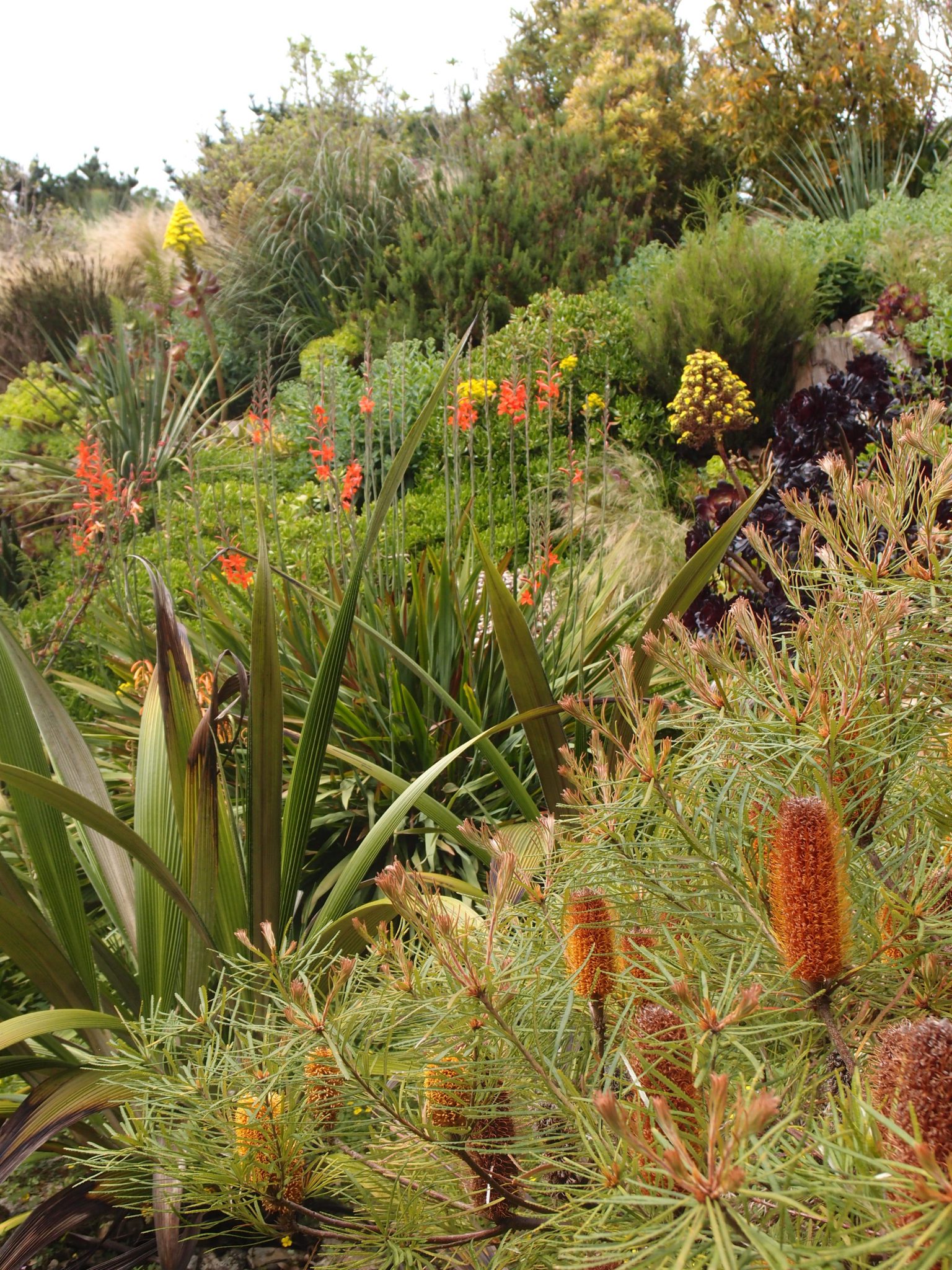
Contrasts of texture, form, and color. As identified by Anne: Yellow pyramid flowers are Tree Aeoniums (Canary Islands), with Restio grass (South Africa) behind them. Orange flower is Isoplexis. Front shrub is a variety of South African pine.
More plant IDs, courtesy of Anne: Banana at back. Bottlebrush callistemon (Australia) below. Front right Cycad. Behind that, is a tatty date palm– Phoenix species. Behind that, the wavy grass is Restio.
Now above the Palm Garden, we approach a Pavilion, which has a rooftop Observation Deck. What we haven’t yet discovered is that, through the Pavilion, we’ll soon enter an underground corridor which leads to a mysterious, elliptical Domed Chamber. In the distance, the top-most towers of
St.Michael’s Mount are JUST visible.
This Domed Chamber, which is buried under the hillside, was designed by the American artist James Turrell (born 1943, in LA, CA). On Turrell’s website he describes his medium as “pure light.”
He explains: “My work has no object, no image, and no focus….what is important to me is to create an experience of wordless thought.”
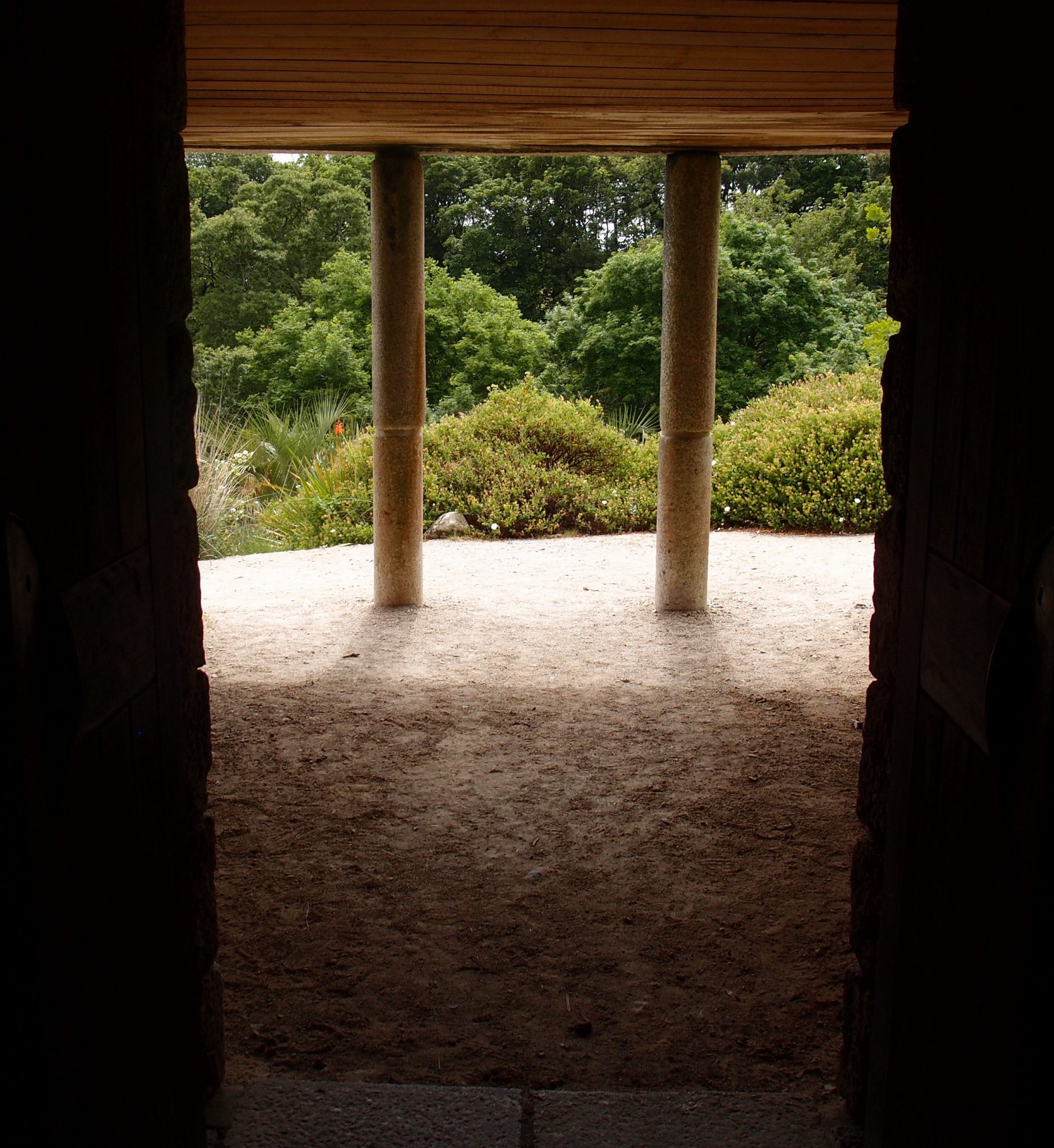
We pass between the columns of the Pavilion which is
below the Observation Deck. Looking back, I appreciate the
exquisitely-done stonework, and the lush vegetation beyond.
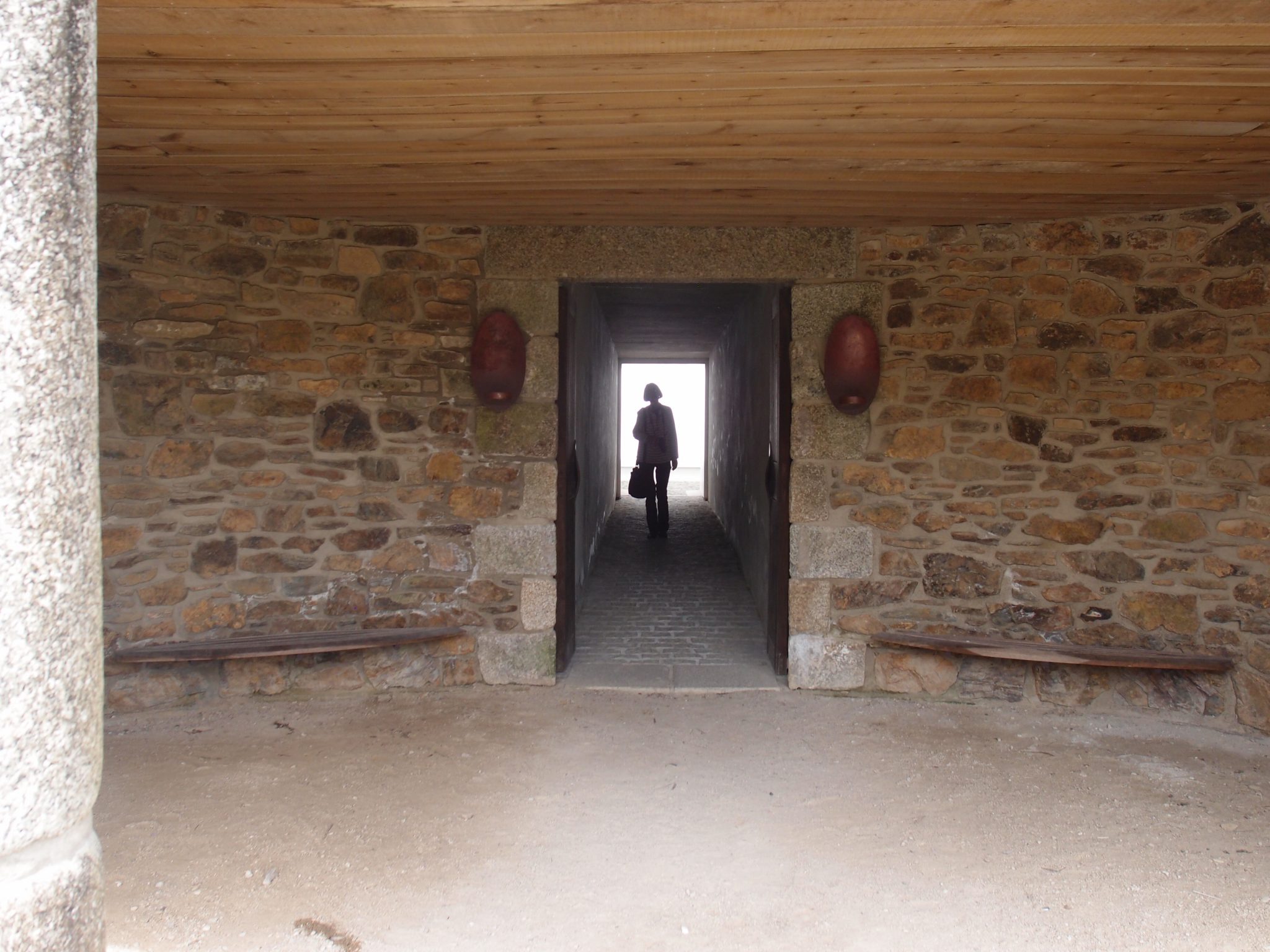
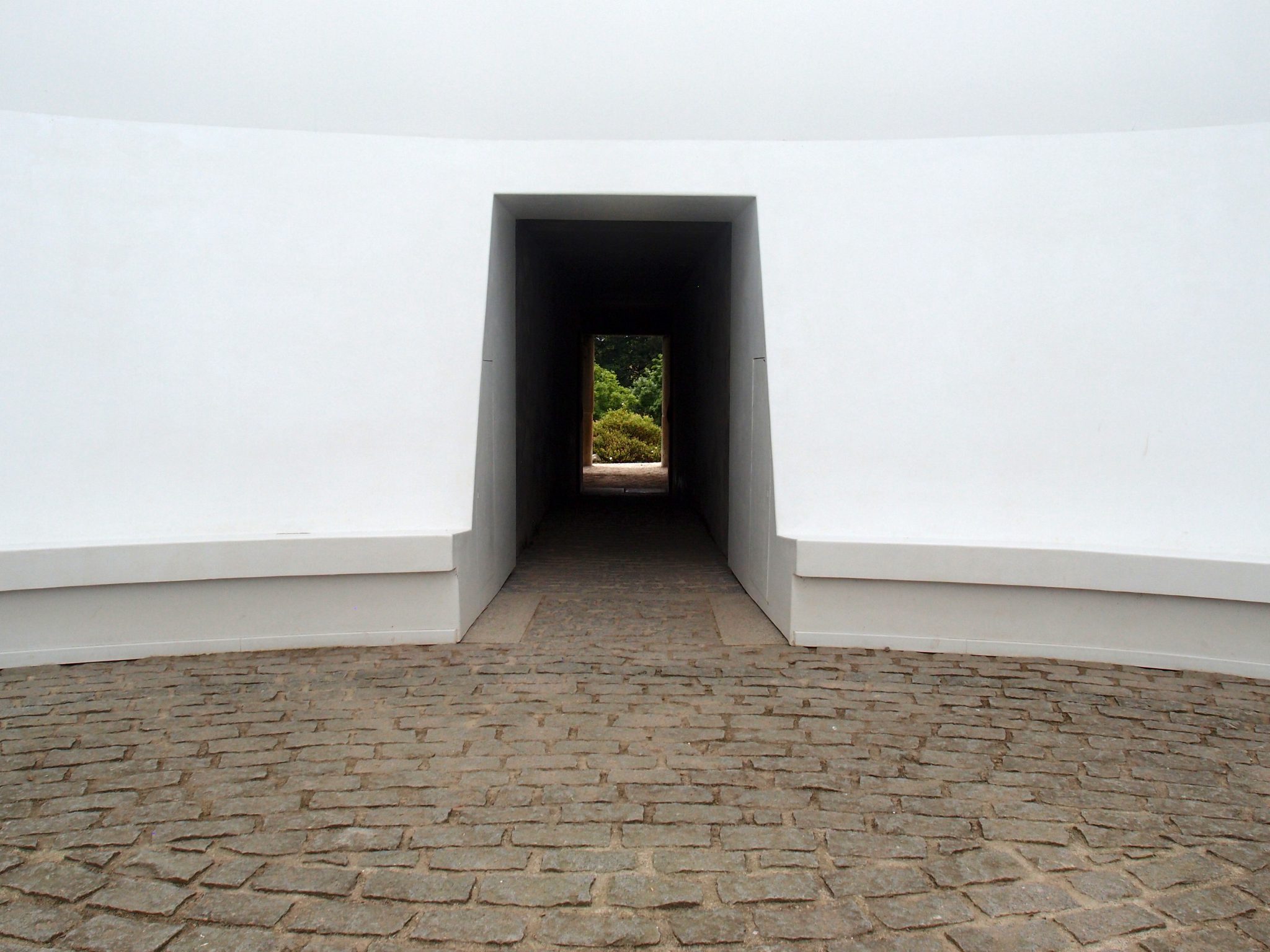
Leading us away from the entry Pavilion, along a subterranean corridor, Anne is silhouetted against the bright, white light which emanates from the Domed Chamber that’s
ahead of us.
Turrell describes this construction, which is called TEWLWOLOW KERNOW (Cornish for “Twilight in Cornwall”) as
“A temple, at the prominent site at the high point in the valley, entered from the base of the hill through an underground corridor. One is led along a rising passageway to an interior space, an elliptical chamber whose ceiling frames the sky. Discreet background illumination under-lights the ceiling of the space, and provides a telling contrast with the sky. The shifting balance between the interior and exterior light provides a hypnotic transition.”
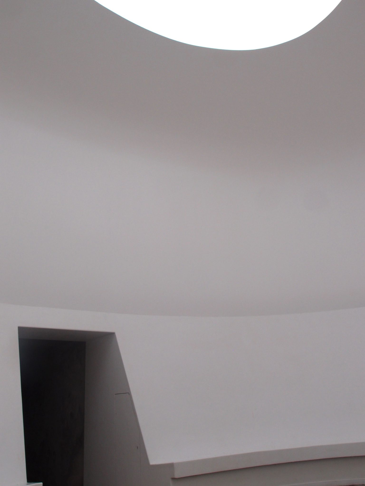
Once inside the elliptical Domed Chamber, it takes my eyes a while to adjust to the contrasts between the bright sky, and the dark access corridor, and the dim natural light that washes across the walls.
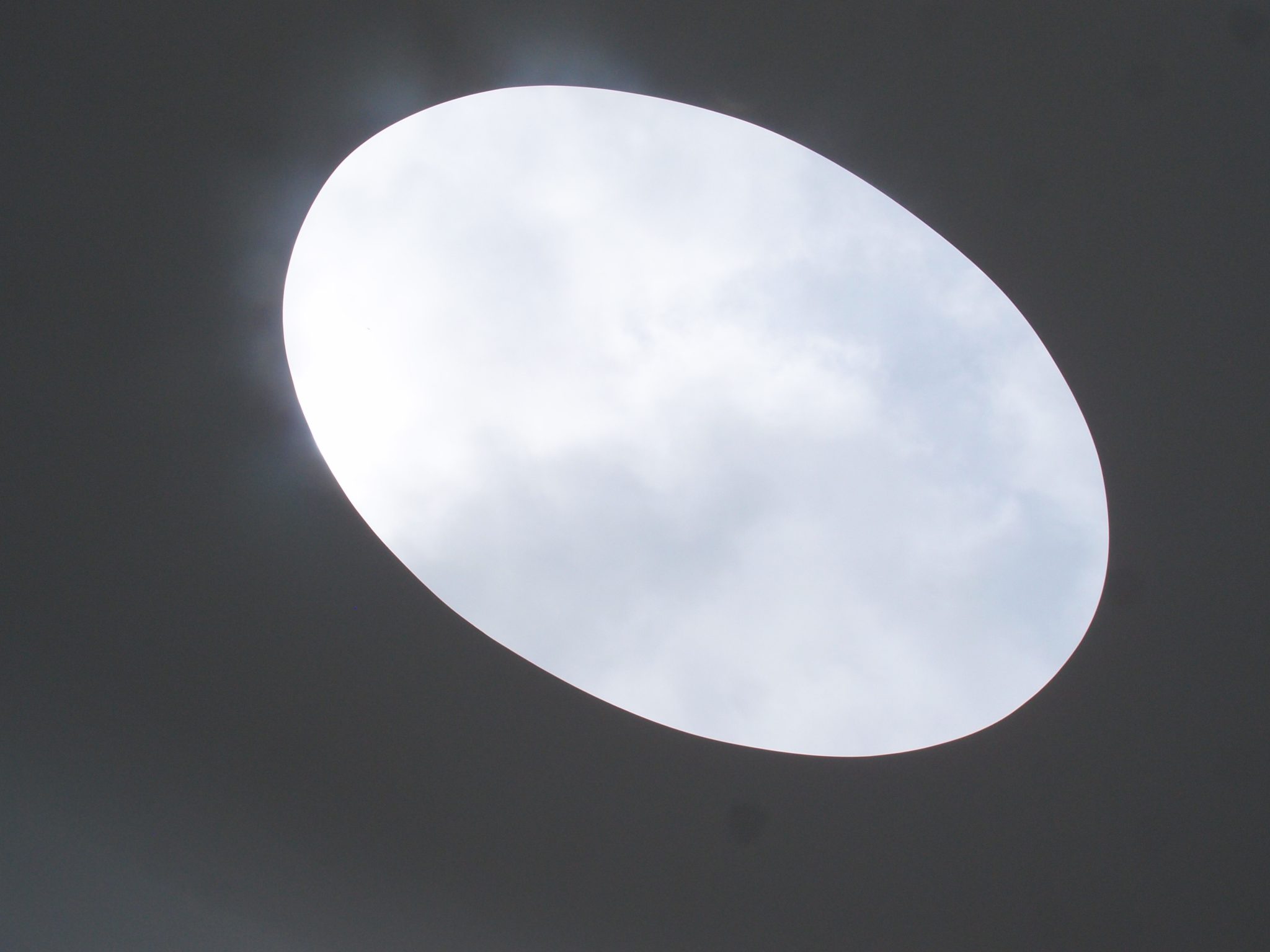
At the top of the domed Chamber: an
Oculus frames the sky
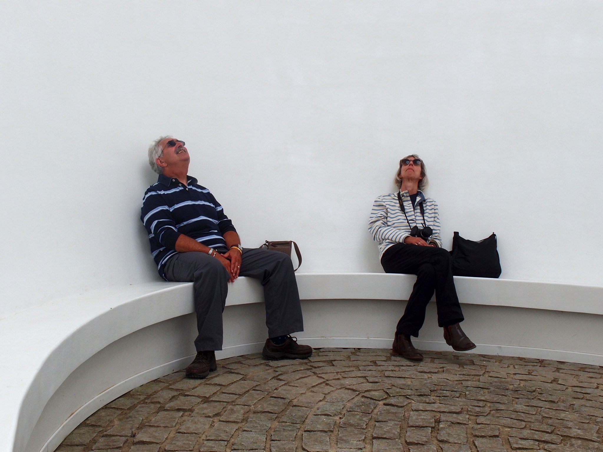
The Guys Sky-Bathe, inside the Chamber. During our summers of traveling together, I’ve taken many photos of
David and Anne. This is one of my favorite portraits of my treasured friends.
From within the Chamber: our view of the dark corridor which will lead us back outside.
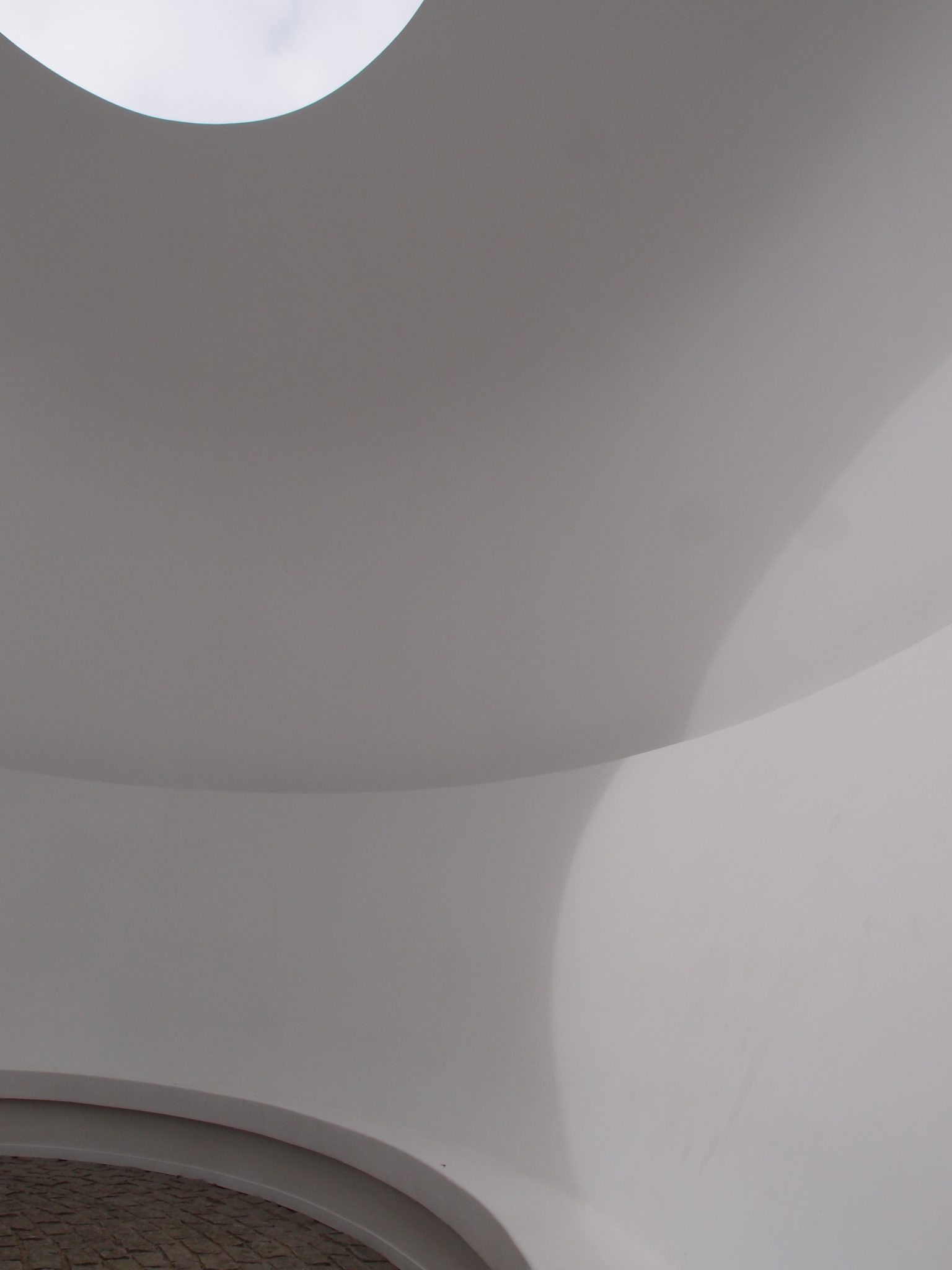
Complex forms and shadows, in the Chamber.

We’re back outside, and have climbed to the
observation deck, above the columned entry pavilion
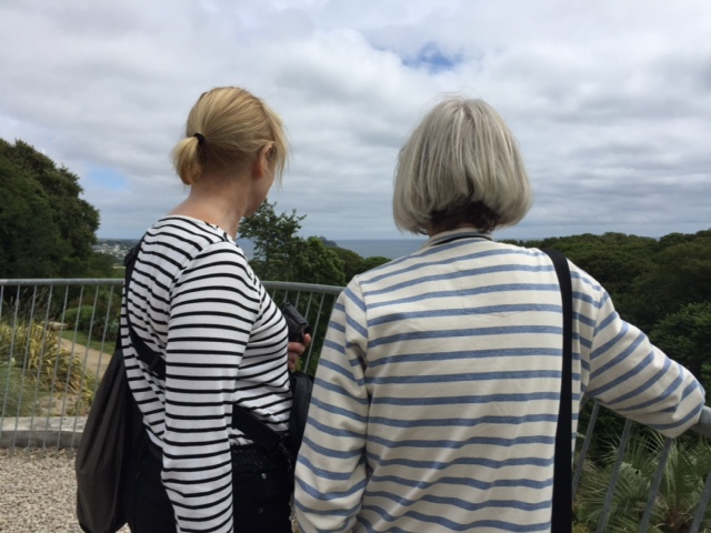
Nan and Anne, taking in the View. And NO, we don’t intentionally coordinate our outfits….it just happens, more often than not. Photo courtesy of David Guy.
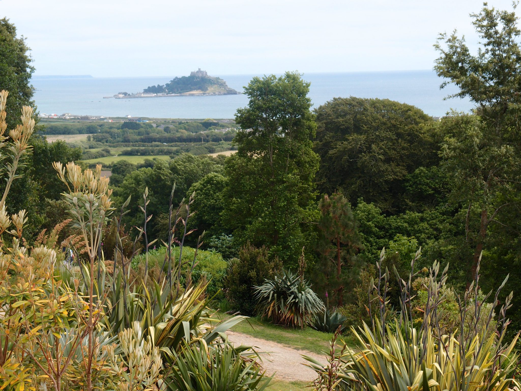
My zoom-lens view of St.Michael’s Mount,
seen from the Observation deck
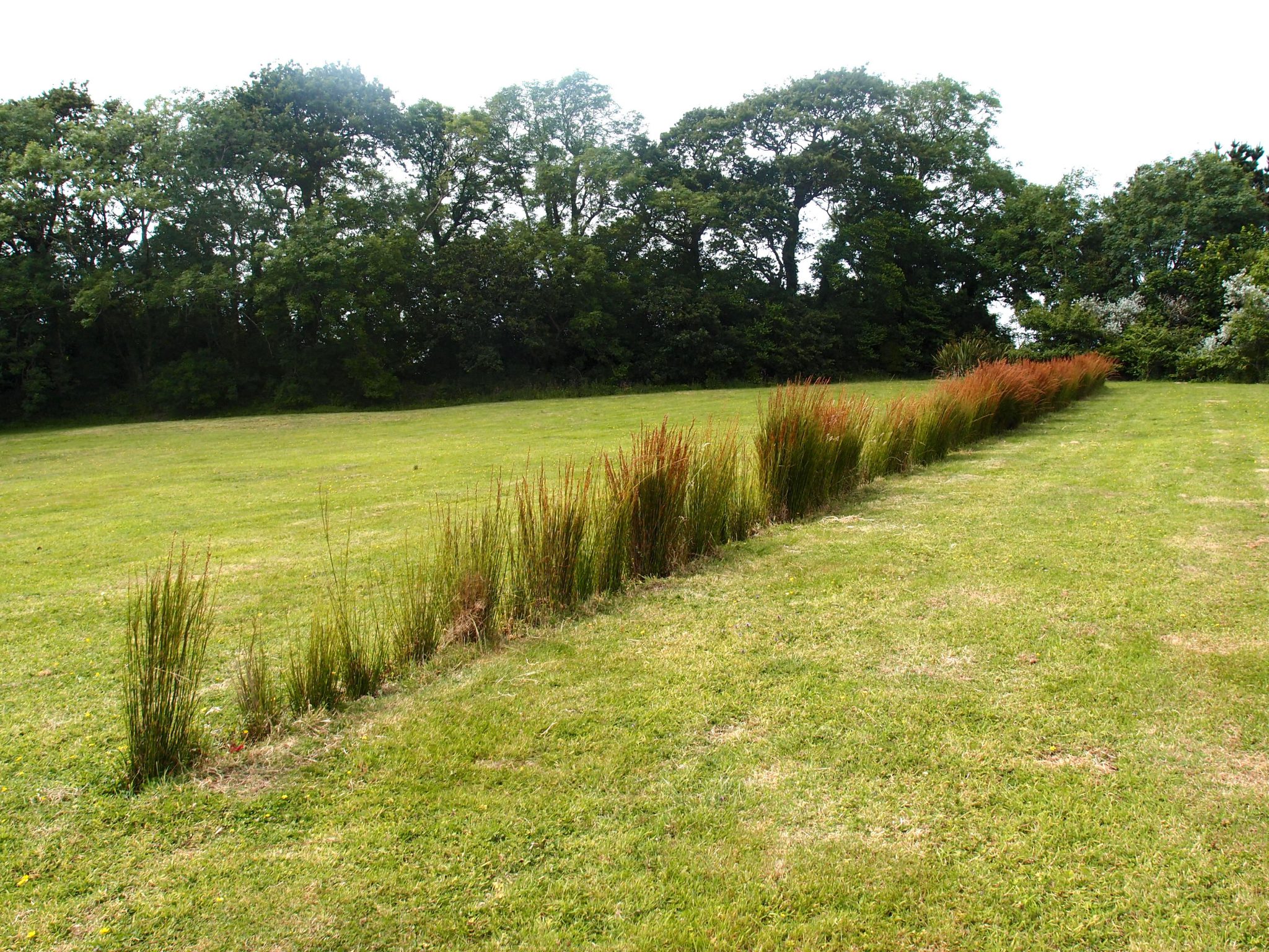
Uphill from the Domed Chamber, aligned exactly north-south, Richard Long has planted a simple line of ornamental grasses, which he calls TREMENHEERE LINE. I consider this the most UNDERwhelming art in the Gardens.
We follow a path that runs along the upper edge of the Palm Gardens. Image courtesy of Tremenheere.
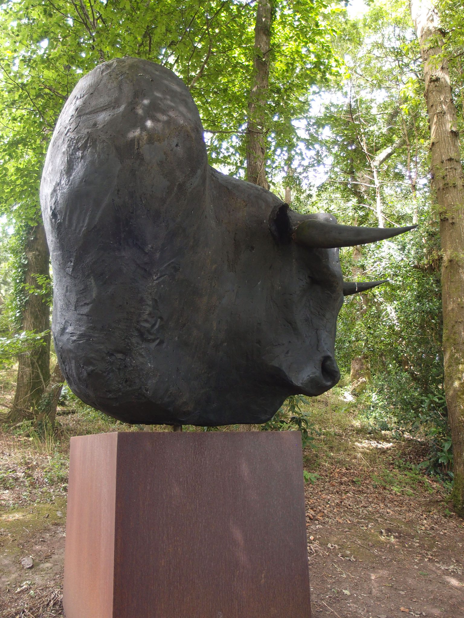
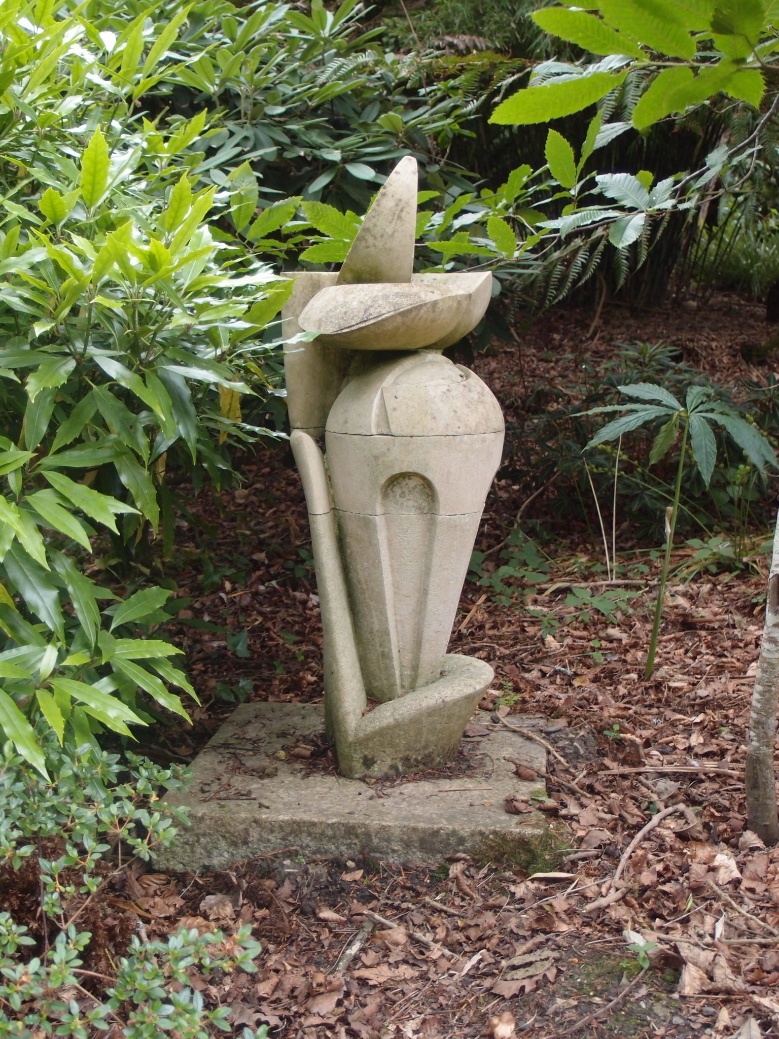
On a wooded hillside, we encounter THE MINOTAUR, by Tim Shaw
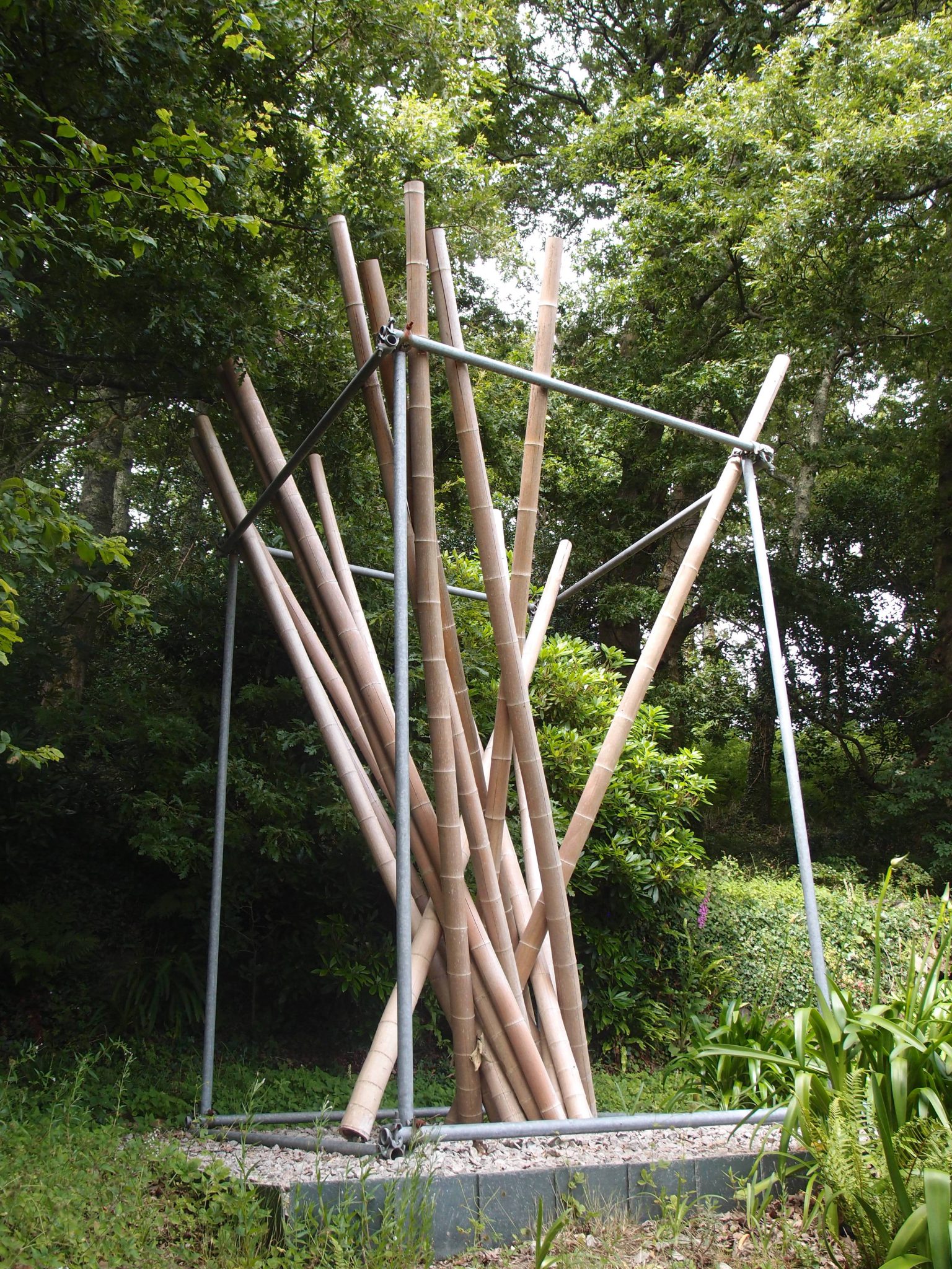
An untitled work by Kishio Suga: a large scaffolding cage encloses bamboo poles.
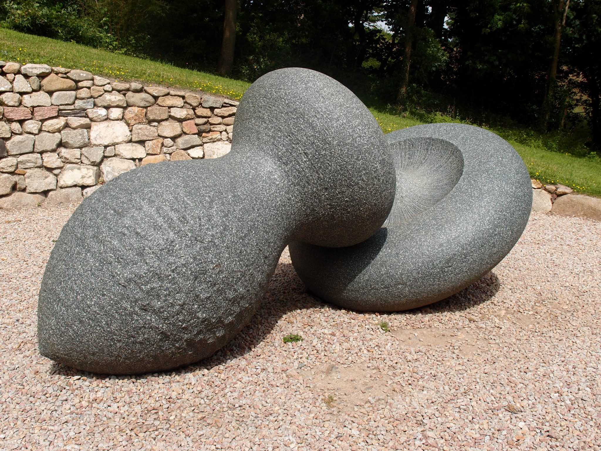
SLIP OF THE LIP, by Peter Randall-Page. An interlocking
work, in Hassan Marble.
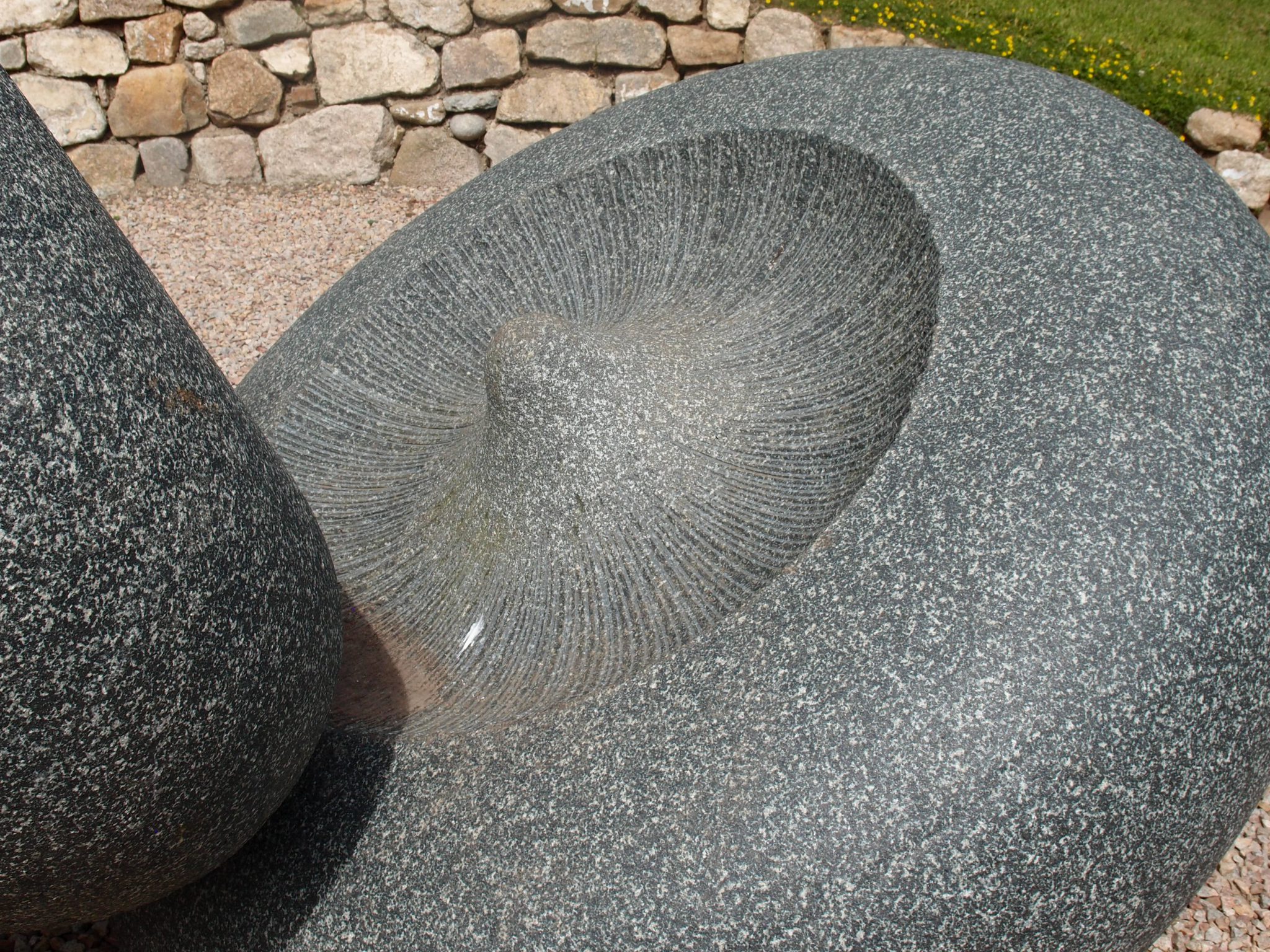
Detail: SLIP OF THE LIP. Peter Randall-Page developed
this piece from drawings of Eucalyptus seed pods.
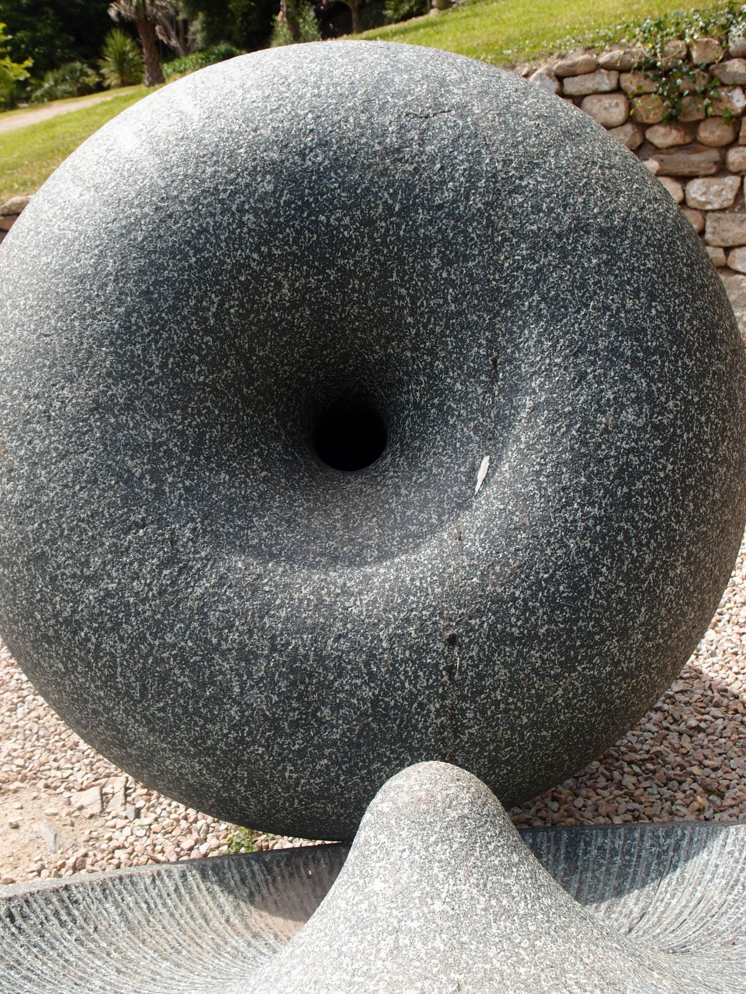
Detail: SLIP OF THE LIP. In the words of the sculptor: “The male and female forms are ambiguous and somewhat
hermaphrodite.”
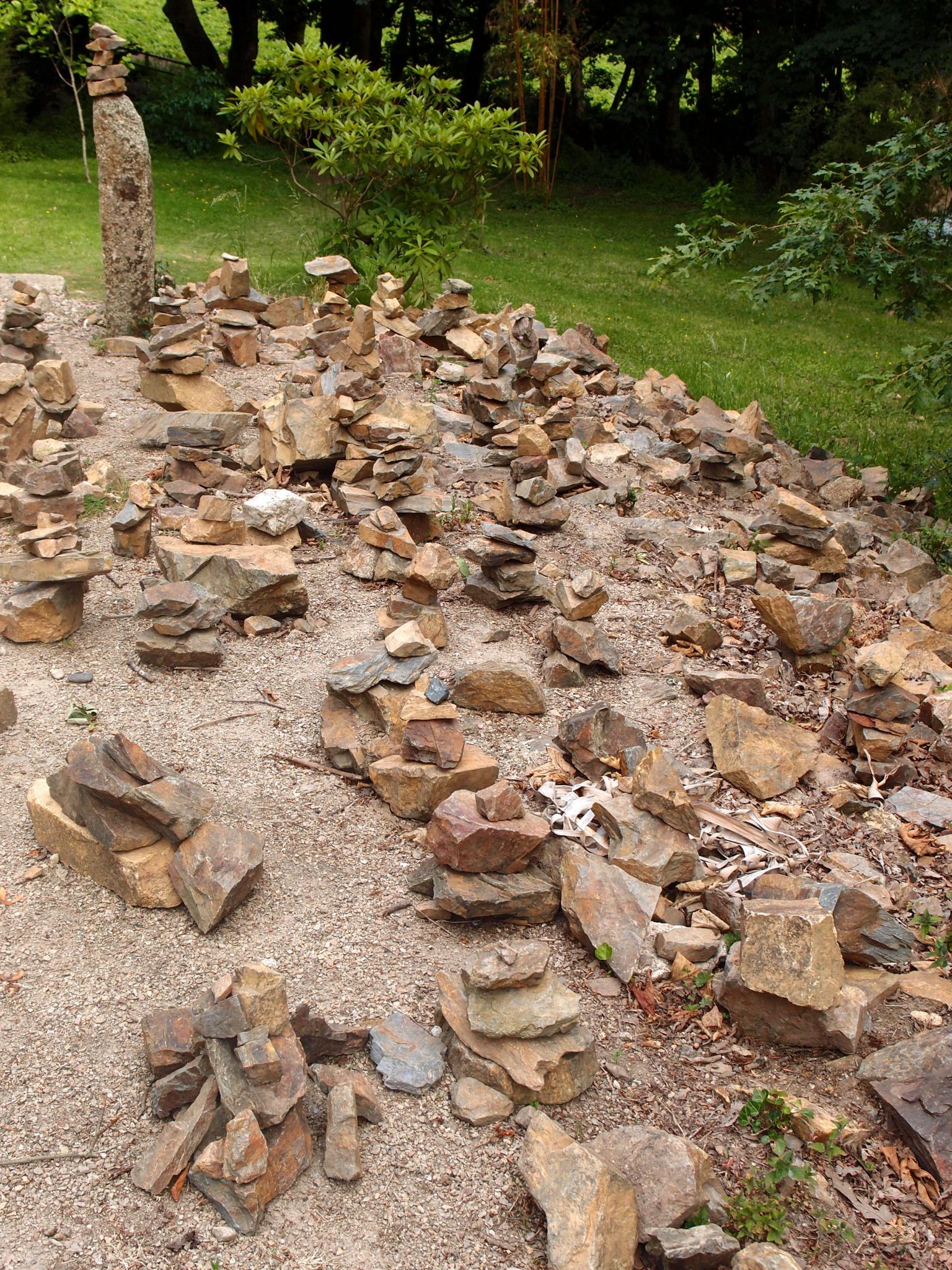
Nearby: stone shards, arranged with Intention (Arranger unknown)
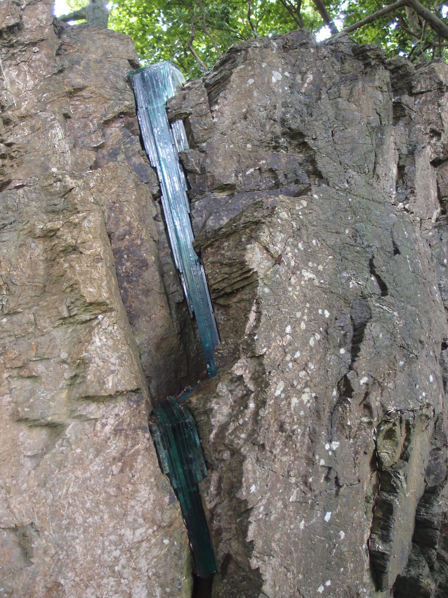
SKHIMZA, by Ken Gill: described by the artist as “an installation using glass to honor an ancient fissure in a rock face.”
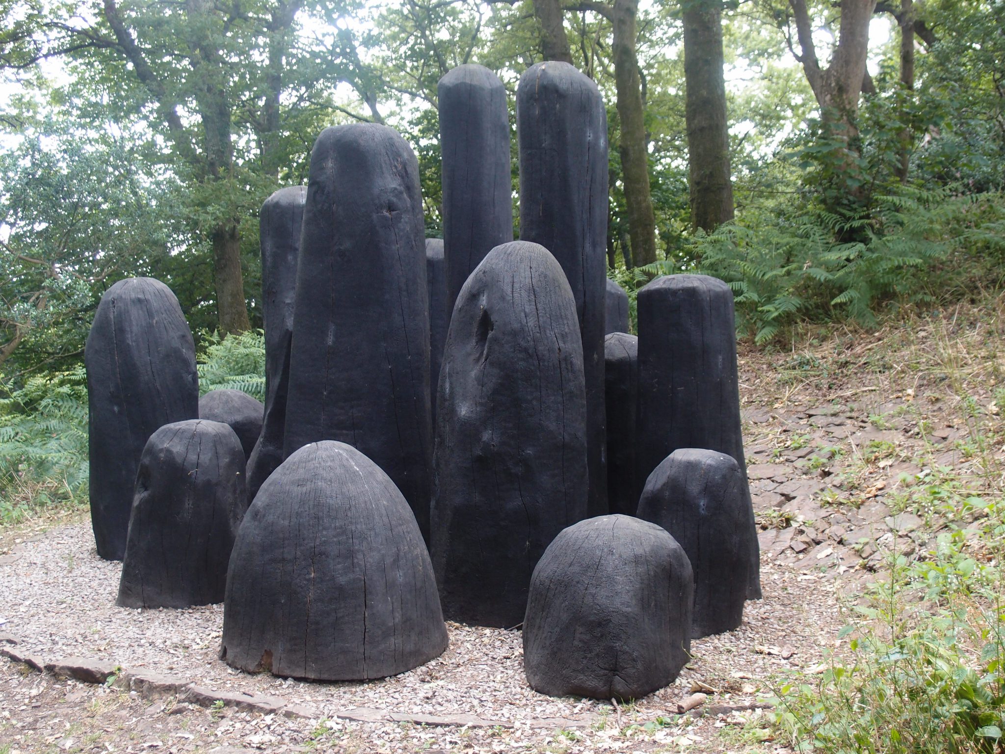
BLACK MOUND, by David Nash, who says this
“Powerful collection of charred oak shapes in a sculptured huddle is sited to resonate with the mature oak woodland and bluebells in season.”
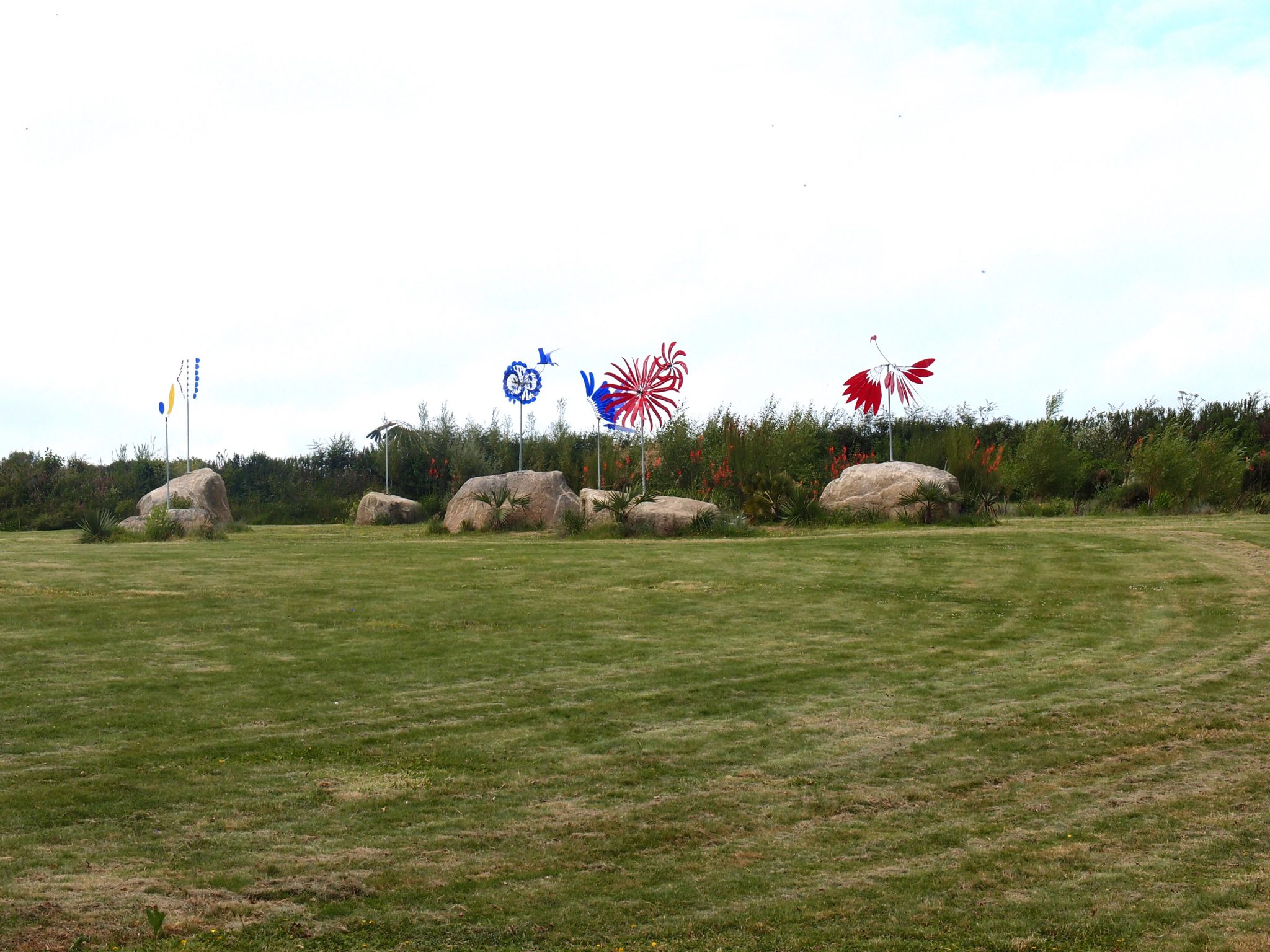
In a field, at the highest point of the Gardens, a changing collection of brightly colored kinetic artwork. On display now: PERSPEX WIND SCULPTURE, by Michaels Chaikin.
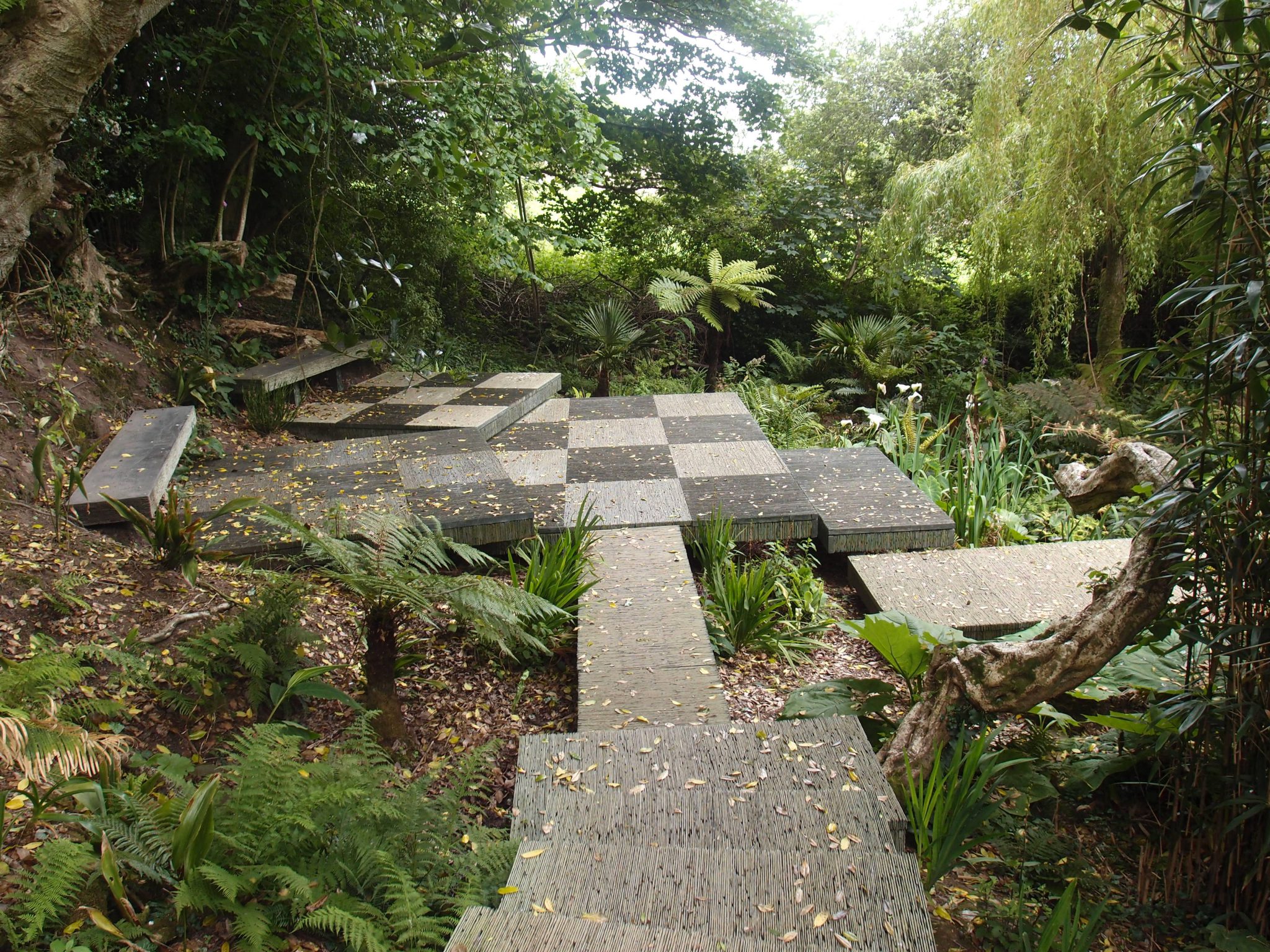
A former Chelsea Show Garden, by Darren Hawkes.
At the lowest point in the Gardens, adjacent to a pair of ponds, we find a cascade of steps and terraces—all made of Cornish slate. The original version of this Garden was designed by Darren Hawkes, for display at the 2015 Chelsea Flower Show, in London. At Chelsea, Hawkes’ entry was awarded a Gold medal by the Royal Horticultural Society. Every year, after the week-long Chelsea Flower Show, most of the massively expensive Show Gardens are then dismantled…a VERY wasteful habit indeed. Instead, in a laudable demonstration of Show-Garden-Recycling,the Designer’s Chelsea garden was moved to Tremenheeree, and reconfigured
to create this restful vantage point, near water.
A floating sculpture, near to the Cornish slate terrace.

Detail of exquisite Cornish slate stepping stones.
Afloat: a lacquered red vessel
Nearby, Cornish stone mason Richard Marsh’s
UNTITLED X3
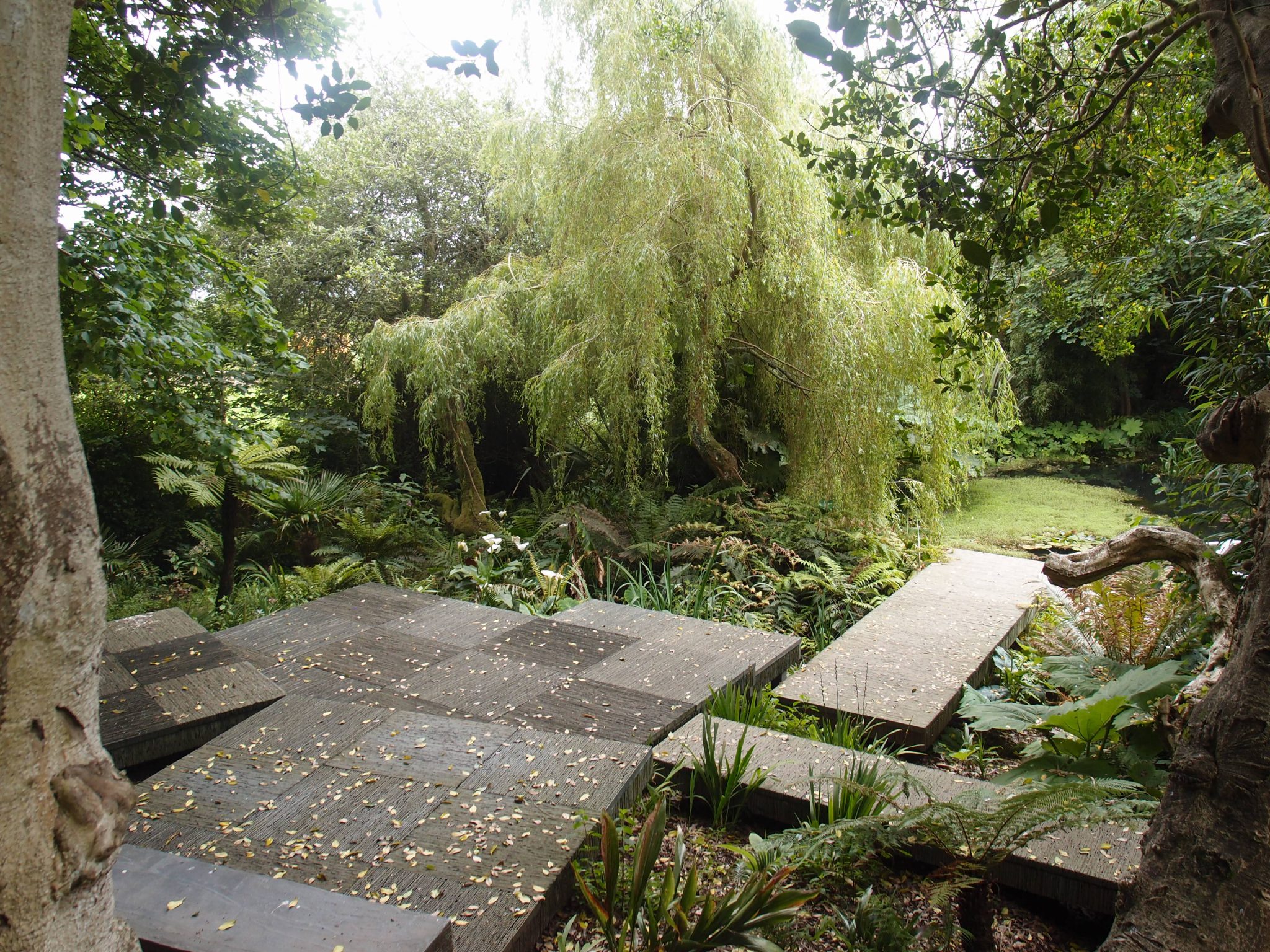
Another look at how the Chelsea Flower Show Recycled Hardscape, along with masses of newly-added plant material, have been seamlessly integrated into the natural landscape, in the Darren Hawkes garden at Tremenheere.
Our garden rambles at Tremenheere had come to an end, but, as we headed downhill, and back towards the car park, ‘twas impossible not to stop for a little bit longer, to once again admire the RESTLESS TEMPLE.
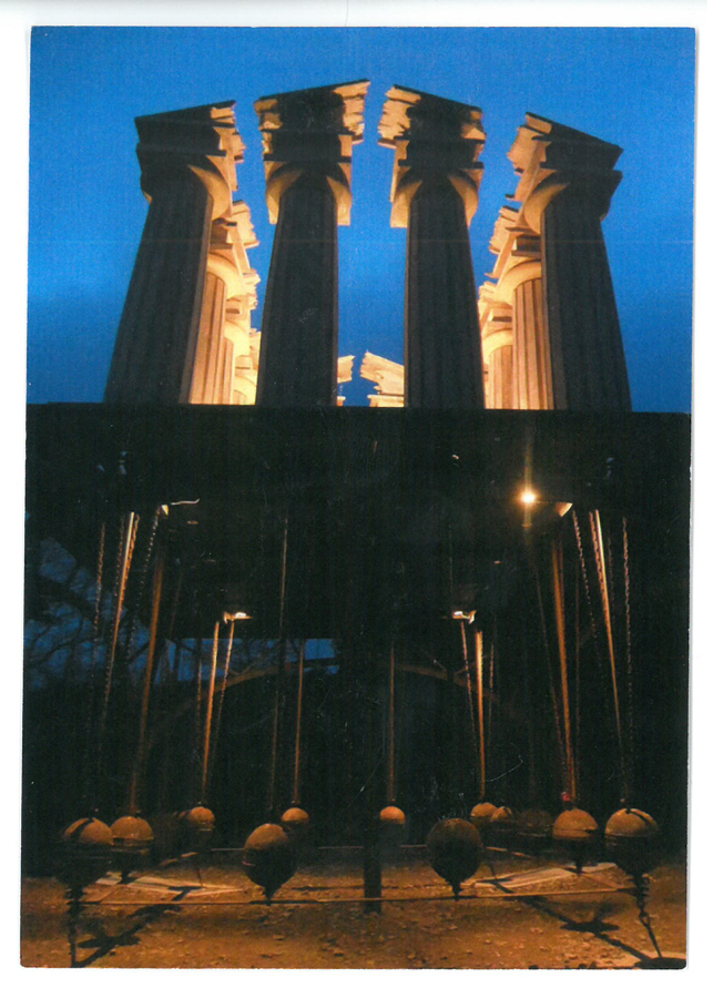
The Restless Temple, by Penny Saunders, at night. Image courtesy of Tremenheere Sculpture Gardens
As I wrap up Part One of our Cornwall explorations, consider that the wonderful places in and around Penzance which I’ve shown you here are contained within about a dozen square miles. Such abundance—of history, of culture, and, most importantly, of glorious stretches of land and of sea—and all conveniently compressed (which of course will spare a Visitor many wasted hours of driving), is typical of all of the Cornish coastal regions which we’ll visit in my forthcoming Diaries.
Here’s what I’ll be working on, so that we can continue to celebrate Cornwall’s endlessly interesting and varied seacoast:
PART TWO. Mount’s Bay, and Environs: Praa Sands, Godolphin House, Marazion, St.Michael’s Mount
PART THREE. Western-most Cornwall: Merry Maidens Stone Circle, Boscawen-un Stone Circle, Porthcurno Bay and the Telegraph Cable, Minack Theatre (& YES: there will be a Poldark-Alert, in this Diary)
PART FOUR. North-western-most Cornwall: Sennen Cove, Levant Mine & Beam Engine, St. Ives, Gwennap Pit ( with yet another Poldark-alert)
PART FIVE. England’s southern-most spit of land: Lizard Point; along with Porthleven (This part will contain the final Poldark-alert)
PART SIX. The central, southern coast, near to Helford River and Frenchman’s Creek: Trebah Garden, and Glendurgan Garden (with this Chapter we’ll begin some Daphne duMaruier-alerts)
PART SEVEN. The Roseland Peninsula: Trelissick Garden, King Harry Ferry, St.Mawes, Lamorran House Gardens, St.Just in Roseland
PART EIGHT. The eastern, southern coast, with a pinch of Bodmin Moor added to what has been a largely watery mix of locations:
Fowey, a cautionary tale about the Lost Gardens of Heligan, Pinsla Garden,Jamaica Inn, Altarnun (for our 2nd duMaurier alert)
Copyright 2018. Nan Quick—Nan Quick’s Diaries for Armchair Travelers. Unauthorized use and/or duplication of this material without express & written permission from Nan Quick is strictly prohibited.
6 Responses to Exploring Cornwall’s Seacoast, in Summertime. Part One